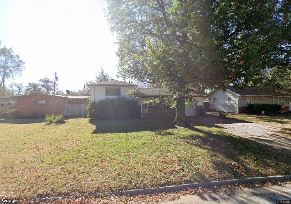
7323 W Freeman Ln Wichita, KS 67212
West Wichita NeighborhoodEstimated Value: $180,226 - $208,000
3
Beds
2
Baths
1,308
Sq Ft
$148/Sq Ft
Est. Value
About This Home
This home is located at 7323 W Freeman Ln, Wichita, KS 67212 and is currently estimated at $194,113, approximately $148 per square foot. 7323 W Freeman Ln is a home located in Sedgwick County with nearby schools including Benton Elementary School, Wilbur Middle School, and Wichita Northwest High School.
Ownership History
Date
Name
Owned For
Owner Type
Purchase Details
Closed on
Nov 9, 2011
Sold by
Secretary Of Housing & Urban Development
Bought by
Pote David and Pote Jana
Current Estimated Value
Home Financials for this Owner
Home Financials are based on the most recent Mortgage that was taken out on this home.
Original Mortgage
$57,957
Outstanding Balance
$22,985
Interest Rate
3.99%
Mortgage Type
New Conventional
Estimated Equity
$171,128
Purchase Details
Closed on
May 9, 2011
Sold by
Epperly Jeanmarie A and Epperly Carolyn S
Bought by
The Secretary Of Housing & Urban Develop
Create a Home Valuation Report for This Property
The Home Valuation Report is an in-depth analysis detailing your home's value as well as a comparison with similar homes in the area
Home Values in the Area
Average Home Value in this Area
Purchase History
| Date | Buyer | Sale Price | Title Company |
|---|---|---|---|
| Pote David | -- | Sec 1St | |
| The Secretary Of Housing & Urban Develop | $101,284 | None Available |
Source: Public Records
Mortgage History
| Date | Status | Borrower | Loan Amount |
|---|---|---|---|
| Open | Pote David | $57,957 |
Source: Public Records
Tax History Compared to Growth
Tax History
| Year | Tax Paid | Tax Assessment Tax Assessment Total Assessment is a certain percentage of the fair market value that is determined by local assessors to be the total taxable value of land and additions on the property. | Land | Improvement |
|---|---|---|---|---|
| 2025 | $1,505 | $15,859 | $3,922 | $11,937 |
| 2023 | $1,505 | $13,490 | $2,300 | $11,190 |
| 2022 | $1,359 | $12,536 | $2,174 | $10,362 |
| 2021 | $1,323 | $11,719 | $1,806 | $9,913 |
| 2020 | $1,263 | $11,156 | $1,806 | $9,350 |
| 2019 | $1,179 | $10,423 | $1,806 | $8,617 |
| 2018 | $1,137 | $10,040 | $1,668 | $8,372 |
| 2017 | $1,138 | $0 | $0 | $0 |
| 2016 | $1,102 | $0 | $0 | $0 |
| 2015 | $1,128 | $0 | $0 | $0 |
| 2014 | $1,105 | $0 | $0 | $0 |
Source: Public Records
Map
Nearby Homes
- 380 & 382 N Country Acres
- 141 N Muirfield St
- 6725 W Shade Ln
- 105 S Brownthrush Cir
- 7400 W Hale St
- 887 N Denmark Ave
- 934 N Denmark Ave
- 229 S Gleneagles Ct
- 949 N Country Acres Ave
- 960 N Denmark Ave
- 7410 W Dorsey Ave
- 7037 W School St
- 980 N Brownthrush Ln
- 8421 W Murdock St
- 705 N Arapaho St
- 1120 N Hazelwood Ln
- 300 N Wood Ave
- 1140 N Country Acres Ave
- 408 S Turquoise St
- 967 N Robin Rd
- 7315 W Freeman Ln
- 7333 W Freeman Ln
- 379 N Brunswick St
- 7401 W Freeman Ln
- 7330 W Freeman Ln
- 411 N Acadia St
- 419 N Acadia St
- 7322 W Freeman Ln
- 375 N Brunswick St
- 401 N Acadia St
- 7316 W Freeman Ln
- 7402 W Freeman Ln
- 7411 W Freeman Ln
- 433 N Acadia St
- 7410 W Freeman Ln
- 367 N Brunswick St
- 7339 W Frazier Ln
- 7333 W Frazier Ln
- 7417 W Freeman Ln
- 7325 W Frazier Ln