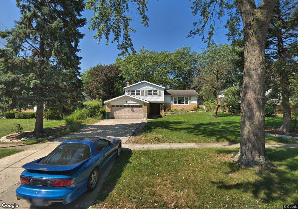
7326 Bunker Rd Darien, IL 60561
Estimated Value: $432,196 - $517,000
3
Beds
2
Baths
1,128
Sq Ft
$413/Sq Ft
Est. Value
About This Home
This home is located at 7326 Bunker Rd, Darien, IL 60561 and is currently estimated at $466,299, approximately $413 per square foot. 7326 Bunker Rd is a home located in DuPage County with nearby schools including Mark Delay School, Lace Elementary School, and Eisenhower Jr High School.
Ownership History
Date
Name
Owned For
Owner Type
Purchase Details
Closed on
Aug 25, 2009
Sold by
Conforti Edward and Conforti Michelle
Bought by
Salberg Sherry L
Current Estimated Value
Home Financials for this Owner
Home Financials are based on the most recent Mortgage that was taken out on this home.
Original Mortgage
$160,000
Outstanding Balance
$104,746
Interest Rate
5.21%
Mortgage Type
New Conventional
Estimated Equity
$361,553
Purchase Details
Closed on
Jul 15, 2003
Sold by
Martello Ramon A and Martello Barbara J
Bought by
Conforti Edward and Conforti Michelle
Home Financials for this Owner
Home Financials are based on the most recent Mortgage that was taken out on this home.
Original Mortgage
$227,447
Interest Rate
5.62%
Mortgage Type
Purchase Money Mortgage
Purchase Details
Closed on
Jan 15, 2002
Sold by
Fifth Third Bank
Bought by
Martello Ramon A and Martello Barbara J
Create a Home Valuation Report for This Property
The Home Valuation Report is an in-depth analysis detailing your home's value as well as a comparison with similar homes in the area
Home Values in the Area
Average Home Value in this Area
Purchase History
| Date | Buyer | Sale Price | Title Company |
|---|---|---|---|
| Salberg Sherry L | $320,000 | Regent Title Ins Agency Llc | |
| Conforti Edward | $253,000 | Pntn | |
| Martello Ramon A | -- | -- |
Source: Public Records
Mortgage History
| Date | Status | Borrower | Loan Amount |
|---|---|---|---|
| Open | Salberg Sherry L | $160,000 | |
| Previous Owner | Conforti Edward | $227,447 |
Source: Public Records
Tax History Compared to Growth
Tax History
| Year | Tax Paid | Tax Assessment Tax Assessment Total Assessment is a certain percentage of the fair market value that is determined by local assessors to be the total taxable value of land and additions on the property. | Land | Improvement |
|---|---|---|---|---|
| 2024 | $6,773 | $113,121 | $44,959 | $68,162 |
| 2023 | $6,515 | $103,990 | $41,330 | $62,660 |
| 2022 | $6,417 | $101,850 | $40,480 | $61,370 |
| 2021 | $6,172 | $100,690 | $40,020 | $60,670 |
| 2020 | $6,088 | $98,700 | $39,230 | $59,470 |
| 2019 | $5,882 | $94,700 | $37,640 | $57,060 |
| 2018 | $5,504 | $89,670 | $37,370 | $52,300 |
| 2017 | $5,447 | $86,290 | $35,960 | $50,330 |
| 2016 | $5,302 | $82,350 | $34,320 | $48,030 |
| 2015 | $5,222 | $77,480 | $32,290 | $45,190 |
| 2014 | $4,954 | $72,840 | $31,390 | $41,450 |
| 2013 | $4,788 | $72,500 | $31,240 | $41,260 |
Source: Public Records
Map
Nearby Homes
- 7216 Leonard Dr
- 7525 Nantucket Dr Unit 210
- 7510 Farmingdale Dr Unit 208
- 7515 Nantucket Dr Unit 404
- 7715 Sussex Creek Dr Unit 1D
- 7713 Brookhaven Ave
- 716 Somerset Ln
- 320 Sheridan Dr Unit 2C
- 7817 Mayfair Ln
- 1145 Lacebark Ct
- 709 79th St Unit 103
- 709 79th St Unit 307
- 709 79th St Unit 403
- 801 79th St Unit 105
- Lot 1, 2, 3, 4 & 5 Nantucket Dr
- 1121 Lodgepole Ct
- 7801 Pine Pkwy
- 1116 Bristlecone Ct
- 17W455 Concord Place
- 1526 Shelley Ct
- 7322 Bunker Rd
- 7330 Bunker Rd
- 7311 Seminole Ct
- 7318 Bunker Rd
- 7313 Seminole Ct
- 7336 Bunker Rd
- 7309 Seminole Ct
- 7314 Bunker Rd
- 7325 Bunker Rd
- 7329 Bunker Rd
- 7321 Bunker Rd
- 7325 Seminole Dr
- 7321 Seminole Dr
- 7333 Bunker Rd
- 7317 Bunker Rd
- 7342 Bunker Rd
- 7307 Seminole Ct Unit 1
- 7337 Bunker Rd
- 7310 Bunker Rd
- 7315 Seminole Dr