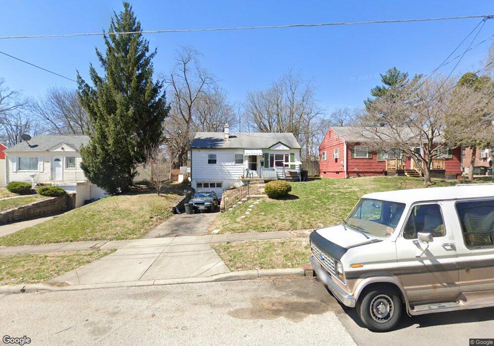
7337 Bernard Ave Cincinnati, OH 45231
Estimated Value: $130,000 - $200,000
3
Beds
1
Bath
800
Sq Ft
$209/Sq Ft
Est. Value
About This Home
This home is located at 7337 Bernard Ave, Cincinnati, OH 45231 and is currently estimated at $166,956, approximately $208 per square foot. 7337 Bernard Ave is a home located in Hamilton County with nearby schools including Mt Healthy High School, John Paul II Catholic School, and St. Vivian School.
Ownership History
Date
Name
Owned For
Owner Type
Purchase Details
Closed on
Oct 26, 2004
Sold by
Lagdameo Christopher J and Lagdameo Joy M
Bought by
Bryant Richard and Byrd Holly
Current Estimated Value
Home Financials for this Owner
Home Financials are based on the most recent Mortgage that was taken out on this home.
Original Mortgage
$97,200
Interest Rate
8.74%
Mortgage Type
Fannie Mae Freddie Mac
Purchase Details
Closed on
Mar 6, 2001
Sold by
Wilson Michael J and Wilson Michelle
Bought by
Lagdameo Christopher J and Yeary Joy M
Home Financials for this Owner
Home Financials are based on the most recent Mortgage that was taken out on this home.
Original Mortgage
$84,671
Interest Rate
7.18%
Mortgage Type
FHA
Purchase Details
Closed on
Jun 29, 1998
Sold by
Wissing Arthur W
Bought by
Wilson Michael J and Wilson Michelle
Home Financials for this Owner
Home Financials are based on the most recent Mortgage that was taken out on this home.
Original Mortgage
$77,250
Interest Rate
7.17%
Mortgage Type
FHA
Create a Home Valuation Report for This Property
The Home Valuation Report is an in-depth analysis detailing your home's value as well as a comparison with similar homes in the area
Home Values in the Area
Average Home Value in this Area
Purchase History
| Date | Buyer | Sale Price | Title Company |
|---|---|---|---|
| Bryant Richard | $97,200 | -- | |
| Lagdameo Christopher J | $86,000 | -- | |
| Wilson Michael J | $78,000 | -- |
Source: Public Records
Mortgage History
| Date | Status | Borrower | Loan Amount |
|---|---|---|---|
| Previous Owner | Bryant Richard | $97,200 | |
| Previous Owner | Lagdameo Christopher J | $84,671 | |
| Previous Owner | Wilson Michael J | $77,250 |
Source: Public Records
Tax History
| Year | Tax Paid | Tax Assessment Tax Assessment Total Assessment is a certain percentage of the fair market value that is determined by local assessors to be the total taxable value of land and additions on the property. | Land | Improvement |
|---|---|---|---|---|
| 2025 | $1,523 | $29,061 | $7,350 | $21,711 |
| 2023 | $1,527 | $29,061 | $7,350 | $21,711 |
| 2022 | $1,513 | $20,609 | $5,933 | $14,676 |
| 2021 | $1,476 | $20,609 | $5,933 | $14,676 |
| 2020 | $1,515 | $20,609 | $5,933 | $14,676 |
| 2019 | $1,272 | $18,239 | $5,250 | $12,989 |
| 2018 | $1,280 | $18,239 | $5,250 | $12,989 |
| 2017 | $1,207 | $18,239 | $5,250 | $12,989 |
| 2016 | $1,449 | $21,613 | $6,615 | $14,998 |
| 2015 | $1,458 | $21,613 | $6,615 | $14,998 |
| 2014 | $1,611 | $21,613 | $6,615 | $14,998 |
| 2013 | $1,708 | $25,729 | $7,875 | $17,854 |
Source: Public Records
Map
Nearby Homes
- 7352 Clovernook Ave
- 1458 Van Fleet Ave
- 1461 Kinney Ave
- 8771 Desoto Dr
- 7508 Elizabeth St
- 1500 Madison Ave
- 1481 Saint Clair Ave
- 7274 Elizabeth St
- 7227 Bernard Ave
- 7404 Joseph St
- 8719 Hood Ct
- 1297 Landis Ln
- 1545 Mcmakin Ave
- 1476 Foxwood Dr
- 1478 Foxwood Dr
- 7849 Seward Ave
- 1457 Adams Rd
- 1378 Adams Rd
- 7918 Southampton Ct
- 8943 Monsanto Dr
- 7335 Bernard Ave
- 7339 Bernard Ave
- 7333 Bernard Ave
- 7365 Bernard Ave
- 7367 Bernard Ave
- 7331 Bernard Ave
- 7329 Bernard Ave
- 7340 Bernard Ave
- 7401 Bernard Ave
- 7344 Bernard Ave
- 1420 Van Fleet Ave
- 7336 Bernard Ave
- 7334 Bernard Ave
- 7364 Bernard Ave
- 1413 Van Fleet Ave
- 7332 Bernard Ave
- 7368 Bernard Ave
- 7325 Bernard Ave
- 7405 Bernard Ave
- 1421 Van Fleet Ave
Your Personal Tour Guide
Ask me questions while you tour the home.