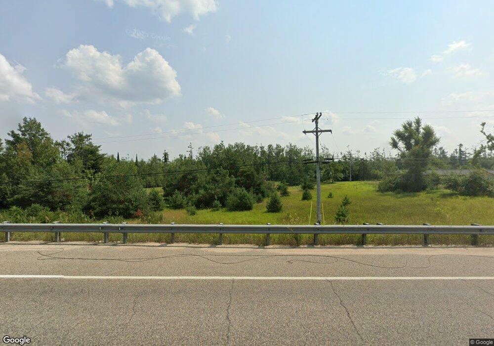
7339 Airport Rd N Vanderbilt, MI 49795
Estimated Value: $283,000 - $456,000
--
Bed
--
Bath
--
Sq Ft
4.39
Acres
About This Home
This home is located at 7339 Airport Rd N, Vanderbilt, MI 49795 and is currently estimated at $373,259. 7339 Airport Rd N is a home with nearby schools including Vanderbilt Area School.
Ownership History
Date
Name
Owned For
Owner Type
Purchase Details
Closed on
Dec 21, 2018
Sold by
James Schenden Llc
Bought by
Gordon Hoyem Llc
Current Estimated Value
Home Financials for this Owner
Home Financials are based on the most recent Mortgage that was taken out on this home.
Original Mortgage
$172,250
Outstanding Balance
$151,140
Interest Rate
4.6%
Mortgage Type
New Conventional
Estimated Equity
$222,119
Purchase Details
Closed on
Mar 13, 2013
Sold by
Guess Robb
Bought by
James Schenden Llc
Purchase Details
Closed on
Jan 31, 2011
Sold by
First Federal Of Northern Michigan
Bought by
Guess Robb
Home Financials for this Owner
Home Financials are based on the most recent Mortgage that was taken out on this home.
Original Mortgage
$94,000
Interest Rate
10%
Purchase Details
Closed on
Oct 23, 2008
Sold by
Otsego County
Bought by
First Federal Of Northern Michigan
Create a Home Valuation Report for This Property
The Home Valuation Report is an in-depth analysis detailing your home's value as well as a comparison with similar homes in the area
Home Values in the Area
Average Home Value in this Area
Purchase History
| Date | Buyer | Sale Price | Title Company |
|---|---|---|---|
| Gordon Hoyem Llc | $180,000 | Alpine Title & Escrow | |
| James Schenden Llc | -- | -- | |
| Guess Robb | $25,000 | -- | |
| First Federal Of Northern Michigan | $96,387 | -- |
Source: Public Records
Mortgage History
| Date | Status | Borrower | Loan Amount |
|---|---|---|---|
| Open | Gordon Hoyem Llc | $172,250 | |
| Previous Owner | Guess Robb | $94,000 |
Source: Public Records
Tax History Compared to Growth
Tax History
| Year | Tax Paid | Tax Assessment Tax Assessment Total Assessment is a certain percentage of the fair market value that is determined by local assessors to be the total taxable value of land and additions on the property. | Land | Improvement |
|---|---|---|---|---|
| 2025 | $4,570 | $245,400 | $0 | $0 |
| 2024 | $4,361 | $181,300 | $0 | $0 |
| 2023 | $4,371 | $167,800 | $0 | $0 |
| 2022 | $4,116 | $154,900 | $0 | $0 |
| 2021 | $3,220 | $147,900 | $0 | $0 |
| 2020 | $4,300 | $136,100 | $0 | $0 |
| 2019 | $4,238 | $135,800 | $0 | $0 |
| 2018 | -- | $105,700 | $105,700 | $0 |
| 2017 | -- | $106,400 | $0 | $0 |
| 2016 | -- | $107,100 | $0 | $0 |
| 2013 | -- | $112,800 | $0 | $0 |
Source: Public Records
Map
Nearby Homes
- 7207 Airport Rd
- 7948 Elm St
- 373 Garfield St
- 6433 Old 27 Hwy N
- 765 Mcgregor Rd
- 6802 Mt Vernon Hills Dr
- 10 Mount Vernon Hills Dr
- Lot 10 Mount Vernon Hills Dr
- 6494 Mount Vernon Hills Dr
- 3300 Tree Tops Ln
- 0 E Alexander Rd Unit 20251041446
- 2359 Watson Hills Trail
- Unit #9 Bear Paw Trail
- Lot 21 Hlywa Dr
- V/L 1.23AC Hlywa Dr
- 1818 Martindale Rd
- 3995 Old Vanderbilt Rd
- 1601 Bear Paw Trail
- 1800 Bear's Paw Trail
- 1133 W Thumb Lake Rd
- 7339 Old 27 Hwy N
- 7313 Old 27 Hwy N
- 7313 Airport Rd N
- 7273 Old 27 Hwy N
- 0 Old 27 N Unit 317622
- 0 Old 27 N Unit 290966
- 0 Old 27 N Unit 248376
- 0 Old 27 N Unit 278801
- 0 Old 27 N Unit 266804
- 0 Old 27 N Unit 253351
- 0 Old 27 N Unit 201813122
- 0 Old 27 N Unit 313088
- 0 Old 27 N Unit .89 acres 304387
- 0 Old 27 N Unit 30 +/- Acres 300691
- 0 Old 27 N Unit (S 125' OF NW/4)
- 0 Old 27 N Unit 78080039279
- 0 Old 27 N Unit 78080038078
- 0 Old 27 N Unit 78080024533
- 0 Old 27 N Unit 78080034809
- 0 Old 27 N Unit 78080034921
