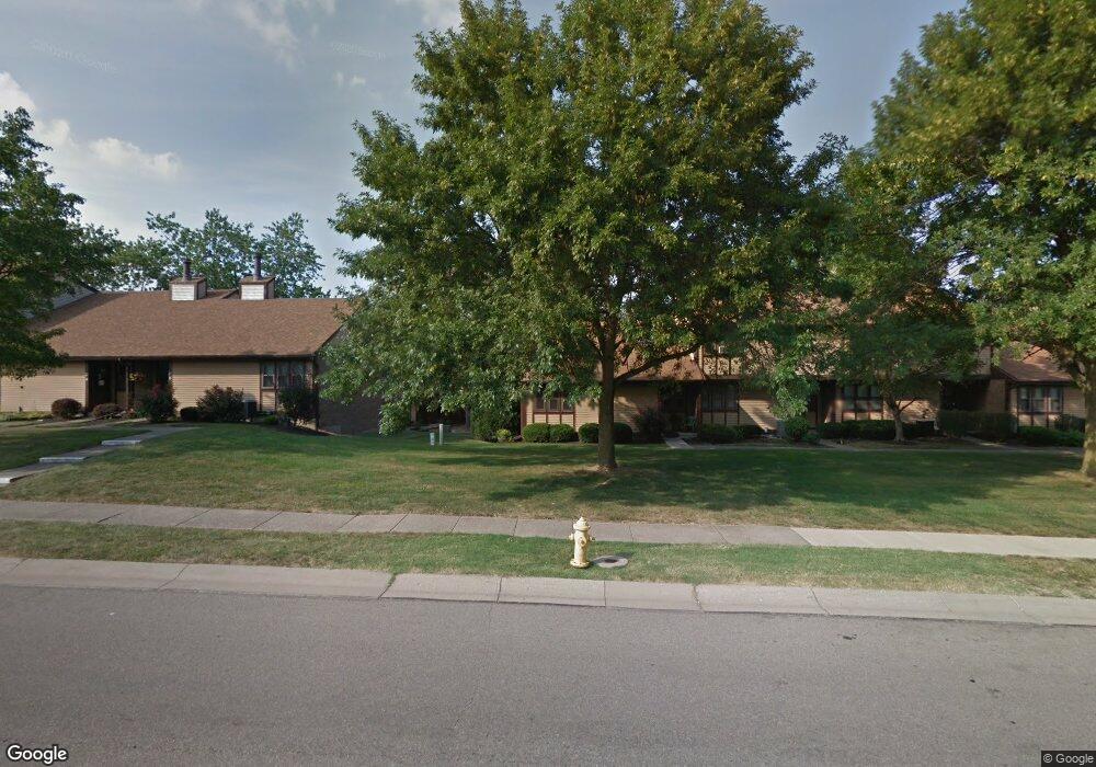
7339 William Hensley Dr Fairfield, OH 45014
Estimated Value: $362,000 - $382,000
4
Beds
3
Baths
1,984
Sq Ft
$188/Sq Ft
Est. Value
About This Home
This home is located at 7339 William Hensley Dr, Fairfield, OH 45014 and is currently estimated at $373,386, approximately $188 per square foot. 7339 William Hensley Dr is a home located in Butler County with nearby schools including Compass Elementary School, Creekside Middle School, and Fairfield Senior High School.
Ownership History
Date
Name
Owned For
Owner Type
Purchase Details
Closed on
Apr 2, 2014
Sold by
Wilder Robert E and Wilder Tysha
Bought by
Wilder Robert E and Wilder Tysha
Current Estimated Value
Home Financials for this Owner
Home Financials are based on the most recent Mortgage that was taken out on this home.
Original Mortgage
$126,036
Outstanding Balance
$95,703
Interest Rate
4.31%
Mortgage Type
FHA
Estimated Equity
$277,683
Purchase Details
Closed on
May 13, 2005
Sold by
Dallis Homes Llc
Bought by
Wilder Robert E and Southall Tysha
Home Financials for this Owner
Home Financials are based on the most recent Mortgage that was taken out on this home.
Original Mortgage
$159,900
Interest Rate
6.25%
Mortgage Type
Fannie Mae Freddie Mac
Create a Home Valuation Report for This Property
The Home Valuation Report is an in-depth analysis detailing your home's value as well as a comparison with similar homes in the area
Home Values in the Area
Average Home Value in this Area
Purchase History
| Date | Buyer | Sale Price | Title Company |
|---|---|---|---|
| Wilder Robert E | -- | None Available | |
| Wilder Robert E | $199,900 | Prodigy Title Agency Llc |
Source: Public Records
Mortgage History
| Date | Status | Borrower | Loan Amount |
|---|---|---|---|
| Open | Wilder Robert E | $126,036 | |
| Closed | Wilder Robert E | $159,900 | |
| Closed | Wilder Robert E | $40,000 |
Source: Public Records
Tax History Compared to Growth
Tax History
| Year | Tax Paid | Tax Assessment Tax Assessment Total Assessment is a certain percentage of the fair market value that is determined by local assessors to be the total taxable value of land and additions on the property. | Land | Improvement |
|---|---|---|---|---|
| 2024 | $4,042 | $109,740 | $13,160 | $96,580 |
| 2023 | $4,022 | $109,750 | $13,160 | $96,590 |
| 2022 | $3,574 | $74,820 | $13,160 | $61,660 |
| 2021 | $3,087 | $73,620 | $13,160 | $60,460 |
| 2020 | $3,211 | $73,620 | $13,160 | $60,460 |
| 2019 | $2,910 | $57,640 | $13,090 | $44,550 |
| 2018 | $2,856 | $57,640 | $13,090 | $44,550 |
| 2017 | $2,885 | $57,640 | $13,090 | $44,550 |
| 2016 | $2,782 | $52,920 | $13,090 | $39,830 |
| 2015 | $2,649 | $52,920 | $13,090 | $39,830 |
| 2014 | $2,662 | $52,920 | $13,090 | $39,830 |
| 2013 | $2,662 | $55,810 | $13,090 | $42,720 |
Source: Public Records
Map
Nearby Homes
- 3745 Mack Rd
- 3690 Mack Rd
- 992 Olde Station Ct
- 17 Springbok Dr
- 19 Caribou Ct
- 38 Providence Dr
- 5890 Kay Dr
- 3323 Devonian Dr
- 3491 Danbury Rd
- 12189 Kenn Rd
- 12069 Cantrell Dr
- 40 Applewood Dr Unit 40
- 74 Applewood Dr
- 48 Applewood Dr Unit 48
- 20 N Applewood Ct Unit 151
- 867 Yorkhaven Rd
- 4 Old Duxbury Ct
- 4351 Whitmore Ln
- 0 Seward Rd Unit 1833613
- 7 Darby Ct Unit 67
- 7347 William Hensley Dr
- 7331 William Hensley Dr
- 7331 Wm Hensley Dr
- 7323 Wm Hensley Dr
- 7355 William Hensley Dr
- 7355 Wm Hensley Dr
- 7323 William Hensley Dr
- 2444 Chloe Dr
- 3547 Spruce Hill Dr
- 7363 William Hensley Dr
- 7363 Wm Hensley Dr
- 7315 William Hensley Dr
- 7315 Wm Hensley Dr
- 2436 Chloe Dr
- 7310 William Hensley Dr
- 7371 William Hensley Dr
- 7371 Wm Hensley Dr
- 3539 Spruce Hill Dr
- 7307 William Hensley Dr
- 7307 Wm Hensley Dr