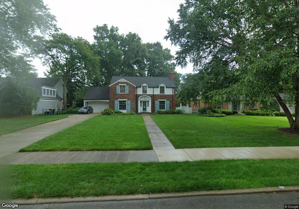
734 Middlesex Rd Grosse Pointe Park, MI 48230
Estimated Value: $709,000 - $795,000
4
Beds
5
Baths
2,727
Sq Ft
$273/Sq Ft
Est. Value
About This Home
This home is located at 734 Middlesex Rd, Grosse Pointe Park, MI 48230 and is currently estimated at $745,608, approximately $273 per square foot. 734 Middlesex Rd is a home located in Wayne County with nearby schools including Pierce Middle School, Grosse Pointe South High School, and Detroit Merit Charter Academy.
Ownership History
Date
Name
Owned For
Owner Type
Purchase Details
Closed on
Apr 30, 2003
Sold by
Bacon Amy B
Bought by
Kulie Ellen K
Current Estimated Value
Purchase Details
Closed on
Aug 3, 2001
Sold by
Bacon Alexander J
Bought by
Bacon Amy B
Purchase Details
Closed on
May 27, 1998
Sold by
Ro Bacon R and Ro Helen Sally
Bought by
Bacon J J and Bacon B
Purchase Details
Closed on
Jun 10, 1995
Sold by
Sally Read Bacon Trust
Bought by
Bacon Alexander J
Create a Home Valuation Report for This Property
The Home Valuation Report is an in-depth analysis detailing your home's value as well as a comparison with similar homes in the area
Home Values in the Area
Average Home Value in this Area
Purchase History
| Date | Buyer | Sale Price | Title Company |
|---|---|---|---|
| Kulie Ellen K | $500,000 | Lawyers Title Insurance Co | |
| Bacon Amy B | -- | -- | |
| Bacon J J | $270,347 | -- | |
| Bacon Alexander J | $270,347 | -- |
Source: Public Records
Tax History
| Year | Tax Paid | Tax Assessment Tax Assessment Total Assessment is a certain percentage of the fair market value that is determined by local assessors to be the total taxable value of land and additions on the property. | Land | Improvement |
|---|---|---|---|---|
| 2025 | $5,887 | $348,000 | $0 | $0 |
| 2024 | $5,666 | $327,000 | $0 | $0 |
| 2023 | $5,411 | $310,200 | $0 | $0 |
| 2022 | $5,141 | $246,100 | $0 | $0 |
| 2021 | $10,137 | $226,000 | $0 | $0 |
| 2019 | $10,431 | $217,500 | $0 | $0 |
| 2018 | $4,902 | $193,600 | $0 | $0 |
| 2017 | $10,913 | $139,500 | $0 | $0 |
| 2016 | $10,214 | $208,400 | $0 | $0 |
| 2015 | $18,343 | $200,800 | $0 | $0 |
| 2013 | $17,770 | $180,800 | $0 | $0 |
| 2012 | $4,974 | $190,200 | $68,900 | $121,300 |
Source: Public Records
Map
Nearby Homes
- 784 Barrington Rd
- 785 Barrington Rd
- 504 Alter Rd
- 552 Middlesex Rd
- 815 Harcourt Rd Unit 2
- 796 Harcourt Rd Unit 98
- 814 Harcourt Rd Unit 816
- 709 Ashland St
- 487 Philip St
- 225 Ashland St
- 943 Harcourt Rd Unit 45
- 178 Ashland St
- 74 Pointe Park Place Unit 311
- 32 Pointe Park Place Unit 31
- 175 Ashland St
- 26 Pointe Park Place Unit 303
- 877 Manistique St
- 908 Manistique St
- 204 Philip St
- 14511 Harbor Island St
- 726 Middlesex Rd
- 742 Middlesex Rd
- 750 Middlesex Rd
- 718 Middlesex Rd
- 733 Westchester Rd
- 725 Westchester Rd
- 741 Westchester Rd
- 710 Middlesex Rd
- 758 Middlesex Rd
- 717 Westchester Rd
- 749 Westchester Rd
- 733 Middlesex Rd
- 741 Middlesex Rd
- 709 Westchester Rd
- 725 Middlesex Rd
- 757 Westchester Rd
- 706 Middlesex Rd
- 766 Middlesex Rd
- 749 Middlesex Rd
- 705 Westchester Rd
Your Personal Tour Guide
Ask me questions while you tour the home.