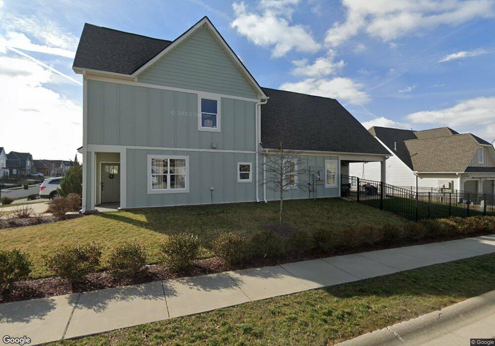
734 Plowson Rd Unit 507 Mount Juliet, TN 37122
Estimated Value: $581,598 - $646,000
--
Bed
3
Baths
2,100
Sq Ft
$294/Sq Ft
Est. Value
About This Home
This home is located at 734 Plowson Rd Unit 507, Mount Juliet, TN 37122 and is currently estimated at $617,650, approximately $294 per square foot. 734 Plowson Rd Unit 507 is a home located in Wilson County with nearby schools including Stoner Creek Elementary School, West Wilson Middle School, and Mt. Juliet High School.
Ownership History
Date
Name
Owned For
Owner Type
Purchase Details
Closed on
Jul 17, 2024
Sold by
Johnson Jennifer and Johnson Daniel Clayton
Bought by
Bates Scott William and Bates Mary Katherine
Current Estimated Value
Home Financials for this Owner
Home Financials are based on the most recent Mortgage that was taken out on this home.
Original Mortgage
$314,183
Outstanding Balance
$310,430
Interest Rate
6.99%
Mortgage Type
New Conventional
Estimated Equity
$307,220
Purchase Details
Closed on
Mar 27, 2019
Sold by
Jackson Hills Partners Ll
Bought by
Johnson Jennifer and Johnson Daniel Clayton
Home Financials for this Owner
Home Financials are based on the most recent Mortgage that was taken out on this home.
Original Mortgage
$282,400
Interest Rate
4.3%
Mortgage Type
New Conventional
Purchase Details
Closed on
Aug 16, 2018
Sold by
Propst Realty Nashville Llc
Bought by
Jackson Hills Partners Llc
Create a Home Valuation Report for This Property
The Home Valuation Report is an in-depth analysis detailing your home's value as well as a comparison with similar homes in the area
Home Values in the Area
Average Home Value in this Area
Purchase History
| Date | Buyer | Sale Price | Title Company |
|---|---|---|---|
| Bates Scott William | $575,000 | Greenvue Title & Escrow | |
| Johnson Jennifer | $353,000 | Windmill Title Llc | |
| Jackson Hills Partners Llc | $427,500 | Windmill Tilte Llc |
Source: Public Records
Mortgage History
| Date | Status | Borrower | Loan Amount |
|---|---|---|---|
| Open | Bates Scott William | $314,183 | |
| Previous Owner | Johnson Jennifer | $282,400 |
Source: Public Records
Tax History Compared to Growth
Tax History
| Year | Tax Paid | Tax Assessment Tax Assessment Total Assessment is a certain percentage of the fair market value that is determined by local assessors to be the total taxable value of land and additions on the property. | Land | Improvement |
|---|---|---|---|---|
| 2024 | $1,795 | $94,050 | $20,000 | $74,050 |
| 2022 | $1,795 | $94,050 | $20,000 | $74,050 |
| 2021 | $1,899 | $94,050 | $20,000 | $74,050 |
| 2020 | $2,015 | $94,050 | $20,000 | $74,050 |
| 2019 | $409 | $75,025 | $16,250 | $58,775 |
| 2018 | $409 | $16,250 | $16,250 | $0 |
Source: Public Records
Map
Nearby Homes
- 247 Croft Way
- 243 Croft Way
- 270 Croft Way
- 701 Plowson Rd
- 1012 Zane Dr
- 1010 Zane Dr
- 1019 Zane Dr
- Weston Plan at Bradshaw Farms - Estates
- Ansley Plan at Bradshaw Farms - Estates
- Buchanan Plan at Bradshaw Farms - Estates
- Kingston Plan at Bradshaw Farms - Estates
- Ashford Plan at Bradshaw Farms - Estates
- 27 Yearling Way
- 1015 Zane Dr
- 1101 Codah Dr
- 1014 Zane Dr
- 1018 Zane Dr
- 1107 Codah Dr
- 1022 Zane Dr
- 1109 Codah Dr
- 734 Plowson Rd
- 734 Plowson Rd
- 736 Plowson Rd
- 736 Plowson Rd Unit 506
- 736 Plowson Rd
- 738 Plowson Rd
- 738 Plowson Rd Unit 505
- 738 Plowson Rd
- 735 Plowson Rd
- 735 Plowson Rd
- 735 Plowson Rd Unit 537
- 733 Plowson Rd
- 733 Plowson Rd
- 733 Plowson Rd Unit 536
- 673 Sire Ave
- 673 Sire Ave
- 673 Sire Ave Unit 508
- 673 Sire Ave
- 737 Plowson Rd
- 737 Plowson Rd