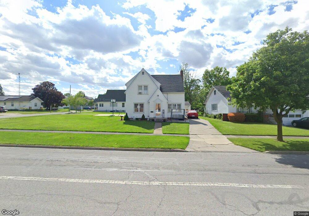
734 S Myrtle Ave Willard, OH 44890
Estimated Value: $131,000 - $161,000
3
Beds
2
Baths
1,200
Sq Ft
$120/Sq Ft
Est. Value
About This Home
This home is located at 734 S Myrtle Ave, Willard, OH 44890 and is currently estimated at $144,061, approximately $120 per square foot. 734 S Myrtle Ave is a home located in Huron County with nearby schools including Willard Middle/High School, Celeryville Christian School, and St Francis Xavier School.
Ownership History
Date
Name
Owned For
Owner Type
Purchase Details
Closed on
Mar 5, 2025
Sold by
Bays Ray
Bought by
Schmidt Terri Lynn
Current Estimated Value
Purchase Details
Closed on
Nov 7, 2008
Bought by
Ray Bays
Purchase Details
Closed on
Mar 23, 2007
Bought by
Kousma John H
Purchase Details
Closed on
May 20, 2005
Bought by
Snyder Darrell P
Purchase Details
Closed on
Sep 2, 2004
Bought by
Kousma John H
Purchase Details
Closed on
Aug 13, 2004
Bought by
Kousma John H and Kousma Donna R
Purchase Details
Closed on
Nov 20, 1997
Bought by
Baugh Sharlene
Purchase Details
Closed on
Oct 18, 1996
Bought by
Hicks Ellis Ray
Purchase Details
Closed on
Mar 25, 1994
Bought by
Hicks Ellis Ray
Create a Home Valuation Report for This Property
The Home Valuation Report is an in-depth analysis detailing your home's value as well as a comparison with similar homes in the area
Home Values in the Area
Average Home Value in this Area
Purchase History
| Date | Buyer | Sale Price | Title Company |
|---|---|---|---|
| Schmidt Terri Lynn | -- | None Listed On Document | |
| Ray Bays | $88,000 | -- | |
| Kousma John H | $90,000 | -- | |
| Snyder Darrell P | $112,000 | -- | |
| Kousma John H | -- | -- | |
| Kousma John H | $67,000 | -- | |
| Baugh Sharlene | -- | -- | |
| Hicks Ellis Ray | -- | -- | |
| Hicks Ellis Ray | $65,500 | -- |
Source: Public Records
Tax History Compared to Growth
Tax History
| Year | Tax Paid | Tax Assessment Tax Assessment Total Assessment is a certain percentage of the fair market value that is determined by local assessors to be the total taxable value of land and additions on the property. | Land | Improvement |
|---|---|---|---|---|
| 2024 | $1,277 | $36,980 | $3,710 | $33,270 |
| 2023 | $1,277 | $26,530 | $2,700 | $23,830 |
| 2022 | $1,009 | $26,530 | $2,700 | $23,830 |
| 2021 | $1,009 | $26,530 | $2,700 | $23,830 |
| 2020 | $908 | $23,130 | $2,700 | $20,430 |
| 2019 | $931 | $23,130 | $2,700 | $20,430 |
| 2018 | $941 | $23,130 | $2,700 | $20,430 |
| 2017 | $845 | $20,800 | $2,700 | $18,100 |
| 2016 | $840 | $20,800 | $2,700 | $18,100 |
| 2015 | $831 | $20,800 | $2,700 | $18,100 |
| 2014 | $946 | $23,350 | $2,980 | $20,370 |
| 2013 | $905 | $23,350 | $2,980 | $20,370 |
Source: Public Records
Map
Nearby Homes
- 620 S Myrtle Ave
- 620 Dale Ave
- 211 W Howard St
- 606 Park St
- 528 Maplewood St
- 539 Euclid St
- 514 Clark St
- 14 E Laurel St
- 534 Spangler St
- 66 Hillcrest Dr
- 607 Linden Ln
- 618 Linden Ln
- 29 Wedgewood Dr
- 402 W Pearl St
- 1531 S Conwell Ave
- 590 W Emerald St
- 108 Spring St
- 809 Kennedy Dr
- 33 Spring St
- 104 S West Ave
- 12 W Howard St
- 730 S Myrtle Ave
- 804 S Myrtle Ave
- 726 S Myrtle Ave
- 737 Dale Ave
- 735 Dale Ave
- 801 Dale Ave
- 722 1/2 S Myrtle Ave
- 729 Dale Ave
- 722 S Myrtle Ave
- 722 S Myrtle Ave Unit AVE
- 805 S Myrtle Ave
- 725 S Myrtle Ave
- 807 Dale Ave
- 725 Dale Ave
- 814 S Myrtle Ave
- 721 S Myrtle Ave
- 811 Dale Ave
- 723 Dale Ave
- 811 S Myrtle Ave