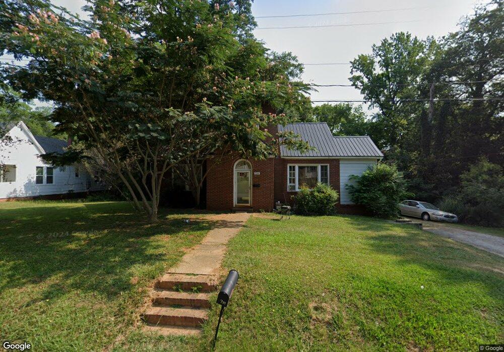
734 W Brooklyn Ave Lancaster, SC 29720
Estimated Value: $120,854 - $213,000
Studio
1
Bath
1,216
Sq Ft
$134/Sq Ft
Est. Value
About This Home
This home is located at 734 W Brooklyn Ave, Lancaster, SC 29720 and is currently estimated at $162,964, approximately $134 per square foot. 734 W Brooklyn Ave is a home located in Lancaster County with nearby schools including Brooklyn Springs Elementary School, South Middle School, and Lancaster High School.
Ownership History
Date
Name
Owned For
Owner Type
Purchase Details
Closed on
May 19, 2014
Sold by
Founders Federal Credit Union
Bought by
Twitty Delia D
Current Estimated Value
Purchase Details
Closed on
Feb 5, 2014
Sold by
Hatfield Rachel and Hatfield Ralph
Bought by
Founders Federal Credit Union
Purchase Details
Closed on
Nov 10, 2003
Sold by
Hatfield Rachel
Bought by
Hatfield Ralph
Create a Home Valuation Report for This Property
The Home Valuation Report is an in-depth analysis detailing your home's value as well as a comparison with similar homes in the area
Home Values in the Area
Average Home Value in this Area
Purchase History
| Date | Buyer | Sale Price | Title Company |
|---|---|---|---|
| Twitty Delia D | $21,600 | -- | |
| Founders Federal Credit Union | $5,000 | -- | |
| Hatfield Ralph | -- | -- |
Source: Public Records
Tax History
| Year | Tax Paid | Tax Assessment Tax Assessment Total Assessment is a certain percentage of the fair market value that is determined by local assessors to be the total taxable value of land and additions on the property. | Land | Improvement |
|---|---|---|---|---|
| 2024 | $1,675 | $3,834 | $786 | $3,048 |
| 2023 | $1,268 | $3,834 | $786 | $3,048 |
| 2022 | $1,263 | $3,834 | $786 | $3,048 |
| 2021 | $1,244 | $3,834 | $786 | $3,048 |
| 2020 | $1,095 | $3,378 | $786 | $2,592 |
| 2019 | $1,143 | $3,378 | $786 | $2,592 |
| 2018 | $1,100 | $3,378 | $786 | $2,592 |
| 2017 | $1,032 | $0 | $0 | $0 |
| 2016 | $1,019 | $0 | $0 | $0 |
| 2015 | $223 | $0 | $0 | $0 |
| 2014 | $223 | $0 | $0 | $0 |
| 2013 | $223 | $0 | $0 | $0 |
Source: Public Records
Map
Nearby Homes
- 1334 Williams Estate Dr
- TBD Williams Estate Dr
- 1453 Old Landsford Rd
- 1257 Springdale Rd
- TBD Old Landsford Rd
- 1451 Kings Cir
- 5.45 acres Memorial Park Rd
- 3.04 acres Memorial Park Rd
- TBD Summit Ave
- 707 W Barr St
- 1613 Small St
- 962 13th St
- 1501 Victoria St Unit 11
- 1841 Grace Ave
- 1500 Victoria St Unit 4
- 1503 Victoria St
- 439 South Ave
- 1817 Grace Ave
- 1509 Victoria St Unit 13
- 1801 Grace Ave
- 738 W Brooklyn Ave
- 746 W Brooklyn Ave
- 731 W Brooklyn Ave
- 735 W Brooklyn Ave
- 1328 Williams Estate Dr
- 1356 Williams Estate Dr
- 729 W Brooklyn Ave
- 741 W Brooklyn Ave
- 1322 Williams Estate Dr
- 0 W Brooklyn Ave Unit 11111955
- 1368 Williams Estate Dr
- 1345 Williams Estate Dr
- 760 W Brooklyn Ave
- 1335 Williams Estate Dr
- 1357 Williams Estate Dr
- 759 W Brooklyn Ave
- 721 W Brooklyn Ave
- 766 W Brooklyn Ave
- 1323 Williams Estate Dr
- 1279 Elmwood Ave