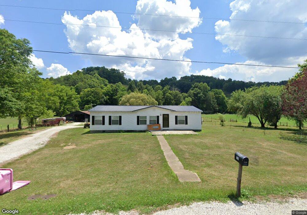
735 Murphy Fork Rd Hazel Green, KY 41332
Estimated Value: $159,000 - $325,000
3
Beds
2
Baths
1,792
Sq Ft
$128/Sq Ft
Est. Value
About This Home
This home is located at 735 Murphy Fork Rd, Hazel Green, KY 41332 and is currently estimated at $229,365, approximately $127 per square foot. 735 Murphy Fork Rd is a home located in Morgan County with nearby schools including Morgan County High School.
Ownership History
Date
Name
Owned For
Owner Type
Purchase Details
Closed on
Apr 5, 2019
Sold by
Roberts Nathan and Roberts Crissy
Bought by
Mccarty Branden Leslie and Dewey Heather Nicole
Current Estimated Value
Home Financials for this Owner
Home Financials are based on the most recent Mortgage that was taken out on this home.
Original Mortgage
$93,279
Outstanding Balance
$82,174
Interest Rate
4.4%
Mortgage Type
FHA
Estimated Equity
$147,191
Purchase Details
Closed on
Oct 13, 2016
Sold by
Keaton Nathan and Keaton Andrea
Bought by
Roberts Nathan and Roberts Crissy
Purchase Details
Closed on
May 7, 2009
Sold by
Rose Staci C and Rose Stacie C
Bought by
Keaton Nathan and Keaton Andrea
Home Financials for this Owner
Home Financials are based on the most recent Mortgage that was taken out on this home.
Original Mortgage
$86,097
Interest Rate
4.89%
Mortgage Type
FHA
Create a Home Valuation Report for This Property
The Home Valuation Report is an in-depth analysis detailing your home's value as well as a comparison with similar homes in the area
Home Values in the Area
Average Home Value in this Area
Purchase History
| Date | Buyer | Sale Price | Title Company |
|---|---|---|---|
| Mccarty Branden Leslie | $9,500 | Bluegrass Land Title Llc | |
| Mccarty Branden Leslie | $95,000 | Bluegrass Land Title Llc | |
| Roberts Nathan | $120,000 | None Available | |
| Roberts Nathan | $120,000 | None Available | |
| Keaton Nathan | $105,000 | None Available |
Source: Public Records
Mortgage History
| Date | Status | Borrower | Loan Amount |
|---|---|---|---|
| Open | Mccarty Branden Leslie | $93,279 | |
| Closed | Mccarty Branden Leslie | $6,000 | |
| Previous Owner | Keaton Nathan | $86,097 |
Source: Public Records
Tax History Compared to Growth
Tax History
| Year | Tax Paid | Tax Assessment Tax Assessment Total Assessment is a certain percentage of the fair market value that is determined by local assessors to be the total taxable value of land and additions on the property. | Land | Improvement |
|---|---|---|---|---|
| 2024 | $1,162 | $95,000 | $0 | $0 |
| 2023 | $1,180 | $95,000 | $0 | $0 |
| 2022 | $1,144 | $95,000 | $0 | $0 |
| 2021 | $1,187 | $95,000 | $0 | $0 |
| 2020 | $1,191 | $95,000 | $0 | $0 |
| 2019 | $924 | $73,000 | $0 | $0 |
| 2018 | $919 | $73,000 | $0 | $0 |
| 2017 | $1,498 | $120,000 | $0 | $0 |
| 2016 | $1,260 | $105,000 | $0 | $0 |
| 2015 | -- | $105,000 | $0 | $0 |
| 2013 | -- | $105,000 | $0 | $0 |
Source: Public Records
Map
Nearby Homes
- 1912 Bryant Fork Rd
- 569 Bushrod Rd
- 210 TBD Meadow Ln
- 10 Robinson Branch Rd
- 2500 Highway 772
- 1285 TBD Halsey Fork Rd
- 740 Kentucky 203
- 64 Spring St
- 272 Liberty Rd
- 2009 New Cummer Rd
- 48 Nipper Dr
- 33 Day St
- 4413 Kentucky 1010
- 8582 Highway 844
- 0000 Glen Lawson Rd
- 2500 State Highway 772
- 1375 Kentucky 882
- 1482
- 14 Vic Elam Rd
- 4 Grassy Hill Rd E
- 128 Murphy Fork Rd
- 9829 Highway 460 W
- 9677 Highway 460 W
- 1392 Murphy Fork Rd
- 9808 Highway 460 W
- 9898 Highway 460 W
- 9898 Highway 460 W Unit TRACT 2
- 9898 Highway 460 W
- 9808 Highway 460 W
- 9637 Highway 460 W
- 9654 Highway 460 W
- 9619 Highway 460 W
- 9585 Highway 460 W
- 10168 Highway 460 W
- 9537 Highway 460 W
- 9694 U S 460
- 9528 Highway 460 W
- 9546 Highway 460 W
- 9528 Highway 460 W
- 9528 Highway 460 W
