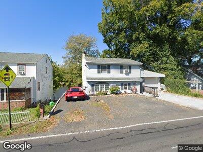
735 Newportville Rd Croydon, PA 19021
Bristol Township NeighborhoodEstimated Value: $287,000 - $359,000
3
Beds
1
Bath
1,344
Sq Ft
$241/Sq Ft
Est. Value
About This Home
This home is located at 735 Newportville Rd, Croydon, PA 19021 and is currently estimated at $324,109, approximately $241 per square foot. 735 Newportville Rd is a home located in Bucks County with nearby schools including Truman Senior High School, School Lane Charter School, and De La Salle Vocational School.
Ownership History
Date
Name
Owned For
Owner Type
Purchase Details
Closed on
May 25, 2007
Sold by
Cembruch Edward M
Bought by
Macauley Michael
Current Estimated Value
Home Financials for this Owner
Home Financials are based on the most recent Mortgage that was taken out on this home.
Original Mortgage
$153,200
Interest Rate
6.19%
Mortgage Type
Purchase Money Mortgage
Purchase Details
Closed on
Jun 5, 1990
Bought by
Cembruch Edward M
Create a Home Valuation Report for This Property
The Home Valuation Report is an in-depth analysis detailing your home's value as well as a comparison with similar homes in the area
Home Values in the Area
Average Home Value in this Area
Purchase History
| Date | Buyer | Sale Price | Title Company |
|---|---|---|---|
| Macauley Michael | $191,500 | Lawyers Title Ins | |
| Cembruch Edward M | -- | -- |
Source: Public Records
Mortgage History
| Date | Status | Borrower | Loan Amount |
|---|---|---|---|
| Open | Macauley Michael | $164,000 | |
| Closed | Macauley Michael | $156,000 | |
| Closed | Macauley Michael | $153,200 | |
| Previous Owner | Cembruch Edward M | $50,000 |
Source: Public Records
Tax History Compared to Growth
Tax History
| Year | Tax Paid | Tax Assessment Tax Assessment Total Assessment is a certain percentage of the fair market value that is determined by local assessors to be the total taxable value of land and additions on the property. | Land | Improvement |
|---|---|---|---|---|
| 2024 | $3,816 | $14,050 | $2,640 | $11,410 |
| 2023 | $3,787 | $14,050 | $2,640 | $11,410 |
| 2022 | $3,787 | $14,050 | $2,640 | $11,410 |
| 2021 | $3,787 | $14,050 | $2,640 | $11,410 |
| 2020 | $3,787 | $14,050 | $2,640 | $11,410 |
| 2019 | $3,773 | $14,050 | $2,640 | $11,410 |
| 2018 | $3,713 | $14,050 | $2,640 | $11,410 |
| 2017 | $3,656 | $14,050 | $2,640 | $11,410 |
| 2016 | $3,656 | $14,050 | $2,640 | $11,410 |
| 2015 | $2,562 | $14,050 | $2,640 | $11,410 |
| 2014 | $2,562 | $14,050 | $2,640 | $11,410 |
Source: Public Records
Map
Nearby Homes
- 0 Newportville Rd Unit PABU487252
- 0 Newportville Rd Unit PABU2091858
- 307 Louise Ave
- L:15 Dunston Rd
- 1000 Stephen Ave
- 1102 Dolores Ln
- 910 Magnolia Ave
- 1712 Dixon Ave
- 1719 Dixon Ave
- 1717 Spencer Dr
- 1719 Susan Ave
- 1902 Spencer Dr
- 883 Jordan Dr
- 649 Yale Ct Unit 649
- 302 Spring Ave
- 0 Neshaminy St Unit PABU2089046
- 1315 Pennsylvania Ave
- 311 Dartmouth Ct Unit 311
- 4033 Branch St
- 393 Rutgers Ct Unit 393
- 735 Newportville Rd
- 731 Newportville Rd
- 741 Newportville Rd
- 741 Newportville Rd
- 747 Newportville Rd
- 719 Newportville Rd
- 801 Hilary Ave
- 0 Newportville Rd Unit 1006576178
- 0 Newportville Rd Unit 5538548
- 0 Newportville Rd Unit 6022198
- 0 Newportville Rd Unit 6791853
- 728 Newportville Rd
- 715 Newportville Rd
- 730 Newportville Rd
- 803 Hilary Ave
- 711 Newportville Rd
- 900 Dixon Ave
- 511 Louise Ave
- 901 Hilary Ave
- 703 Newportville Rd