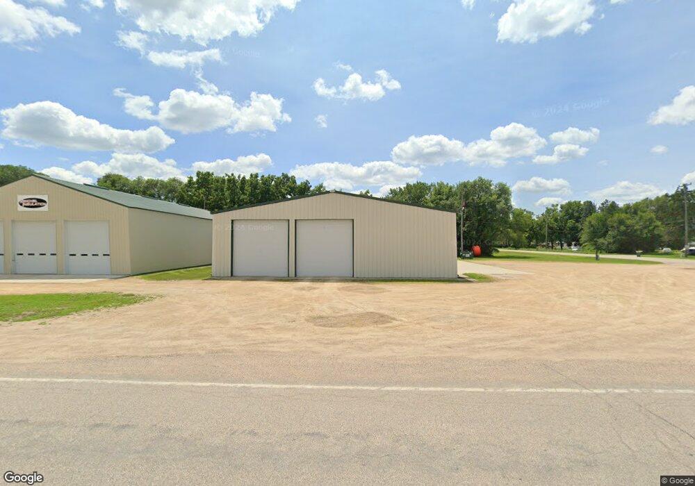
735 Southbend Ave Mankato, MN 56001
--
Bed
--
Bath
6,000
Sq Ft
0.63
Acres
About This Home
This home is located at 735 Southbend Ave, Mankato, MN 56001. 735 Southbend Ave is a home located in Blue Earth County with nearby schools including Roosevelt Elementary School, Dakota Meadows Middle School, and Mankato West Senior High School.
Ownership History
Date
Name
Owned For
Owner Type
Purchase Details
Closed on
May 28, 2015
Sold by
S & K Group Of Mn Llc
Bought by
Cc Holdings Llc
Home Financials for this Owner
Home Financials are based on the most recent Mortgage that was taken out on this home.
Original Mortgage
$214,500
Outstanding Balance
$165,541
Interest Rate
3.65%
Mortgage Type
Commercial
Purchase Details
Closed on
Jan 12, 2015
Sold by
Tousignant Steven A and Tousignant Sharon M
Bought by
S & K Group Mn Llc
Purchase Details
Closed on
Jan 25, 2012
Sold by
Hatpield William J and Hatpield Judith A
Bought by
Tousignant Steven A and Sevcik Kenneth J
Create a Home Valuation Report for This Property
The Home Valuation Report is an in-depth analysis detailing your home's value as well as a comparison with similar homes in the area
Home Values in the Area
Average Home Value in this Area
Purchase History
| Date | Buyer | Sale Price | Title Company |
|---|---|---|---|
| Cc Holdings Llc | -- | North American Title | |
| S & K Group Mn Llc | -- | -- | |
| Tousignant Steven A | $30,000 | -- |
Source: Public Records
Mortgage History
| Date | Status | Borrower | Loan Amount |
|---|---|---|---|
| Open | Cc Holdings Llc | $214,500 |
Source: Public Records
Tax History Compared to Growth
Tax History
| Year | Tax Paid | Tax Assessment Tax Assessment Total Assessment is a certain percentage of the fair market value that is determined by local assessors to be the total taxable value of land and additions on the property. | Land | Improvement |
|---|---|---|---|---|
| 2025 | $5,546 | $275,800 | $40,800 | $235,000 |
| 2024 | $5,546 | $276,000 | $40,800 | $235,200 |
| 2023 | $3,812 | $224,000 | $40,800 | $183,200 |
| 2022 | $4,578 | $204,500 | $40,800 | $163,700 |
| 2021 | $4,486 | $205,800 | $40,800 | $165,000 |
| 2020 | $4,506 | $203,100 | $40,800 | $162,300 |
| 2019 | $4,120 | $203,100 | $40,800 | $162,300 |
| 2018 | $3,948 | $202,000 | $40,800 | $161,200 |
| 2017 | $4,522 | $202,000 | $40,800 | $161,200 |
| 2016 | $4,108 | $202,000 | $40,800 | $161,200 |
| 2015 | $41 | $182,400 | $40,800 | $141,600 |
| 2014 | $4,234 | $182,400 | $40,800 | $141,600 |
Source: Public Records
Map
Nearby Homes
- 210 Bird St S
- 204 Sturgis St N
- 204 204 N Sturgis St
- 1614 Le Sueur Ave
- 50 50 Skyline Dr
- 237 W Skyline Ct
- 237 237 W Skyline Ct
- 607 Blue Earth St
- 19 19 Skyline Dr
- 1030 Oak Terrace Dr
- 1030 1030 Oak Terrace Dr
- 627 Park Ln
- 602 Park Ln
- 201 Tile St
- 407 407 W 8th St
- 426 426 W 6th St
- 233 Allan Ave
- 513 513 W 3rd St
- 407 407 W 6 St Unit sixth
- 1002 Dr
- 114 Spartan St
- 726 Beaver Ave
- 114 Hemlock Rd
- 126 Hemlock Rd
- 815 Southbend Ave
- 822 Beaver Ave
- 823 Southbend Ave
- 127 Spartan St Unit 3
- 127 Spartan St
- 115 Spartan St Unit 1
- 816 Southbend Ave
- 636 Beaver Ave
- 819 Beaver Ave
- 829 Southbend Ave
- 831 Beaver Ave
- 628 Beaver Ave
- 837 Beaver Ave
- 641 Beaver Ave
- 618 Beaver Ave
- 232 Hemlock Rd