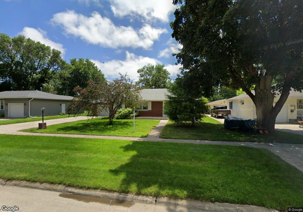
735 W 6th St Garner, IA 50438
Estimated Value: $162,000 - $186,000
2
Beds
2
Baths
1,053
Sq Ft
$166/Sq Ft
Est. Value
About This Home
This home is located at 735 W 6th St, Garner, IA 50438 and is currently estimated at $175,010, approximately $166 per square foot. 735 W 6th St is a home located in Hancock County with nearby schools including Garner-Hayfield-Ventura Elementary School and Garner-Hayfield-Ventura High School.
Ownership History
Date
Name
Owned For
Owner Type
Purchase Details
Closed on
Aug 1, 2022
Sold by
Peters Kathleen M
Bought by
Kadrlik Riannan Rae
Current Estimated Value
Home Financials for this Owner
Home Financials are based on the most recent Mortgage that was taken out on this home.
Original Mortgage
$107,500
Outstanding Balance
$103,015
Interest Rate
5.81%
Mortgage Type
New Conventional
Estimated Equity
$71,995
Purchase Details
Closed on
May 31, 2006
Sold by
Nimmer Leatrice P
Bought by
Peters Merrill J and Peters Kathleen M
Home Financials for this Owner
Home Financials are based on the most recent Mortgage that was taken out on this home.
Original Mortgage
$85,000
Interest Rate
6.62%
Mortgage Type
New Conventional
Create a Home Valuation Report for This Property
The Home Valuation Report is an in-depth analysis detailing your home's value as well as a comparison with similar homes in the area
Home Values in the Area
Average Home Value in this Area
Purchase History
| Date | Buyer | Sale Price | Title Company |
|---|---|---|---|
| Kadrlik Riannan Rae | $143,500 | None Listed On Document | |
| Peters Merrill J | $130,000 | None Available |
Source: Public Records
Mortgage History
| Date | Status | Borrower | Loan Amount |
|---|---|---|---|
| Open | Kadrlik Riannan Rae | $107,500 | |
| Previous Owner | Peters Merrill J | $85,000 |
Source: Public Records
Tax History Compared to Growth
Tax History
| Year | Tax Paid | Tax Assessment Tax Assessment Total Assessment is a certain percentage of the fair market value that is determined by local assessors to be the total taxable value of land and additions on the property. | Land | Improvement |
|---|---|---|---|---|
| 2025 | $2,032 | $165,760 | $22,500 | $143,260 |
| 2024 | $2,032 | $147,570 | $13,130 | $134,440 |
| 2023 | $2,038 | $147,570 | $13,130 | $134,440 |
| 2022 | $1,814 | $134,240 | $13,130 | $121,110 |
| 2021 | $1,708 | $118,140 | $13,130 | $105,010 |
| 2020 | $1,708 | $105,260 | $13,130 | $92,130 |
| 2019 | $1,562 | $105,260 | $13,130 | $92,130 |
| 2018 | $1,436 | $96,300 | $13,130 | $83,170 |
| 2017 | $1,362 | $90,470 | $0 | $0 |
| 2016 | $1,306 | $90,470 | $0 | $0 |
| 2015 | $1,306 | $87,990 | $0 | $0 |
| 2014 | $1,242 | $87,990 | $0 | $0 |
Source: Public Records
Map
Nearby Homes
- 760 W 7th St
- 780 W 5th St
- 750 Pebblestone Ln
- 965 Cobblestone Ln
- 495 W 5th St
- 970 Cobblestone Ln
- 390 W 5th St
- 320 W 8th St
- 490 Allen Ave
- 490 W 11th St
- 1065 Center Ave
- 340 Bush Ave
- 1044 Bush Ave
- 1050 Bush Ave
- 645 Maben Ave
- 640 W Lyons St
- 1145 State St
- 1330 Bush Ave
- 1440 State St Unit 1450
- 335 E Lyons St