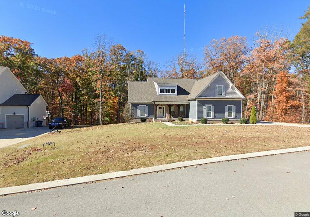
7355 Blackstone Dr Signal Mountain, TN 37377
Estimated Value: $572,449 - $698,000
--
Bed
1
Bath
2,192
Sq Ft
$292/Sq Ft
Est. Value
About This Home
This home is located at 7355 Blackstone Dr, Signal Mountain, TN 37377 and is currently estimated at $640,862, approximately $292 per square foot. 7355 Blackstone Dr is a home with nearby schools including Nolan Elementary School and Signal Mountain Middle/High School.
Ownership History
Date
Name
Owned For
Owner Type
Purchase Details
Closed on
Dec 13, 2018
Sold by
Pratt Homebuildes Llc
Bought by
Woerner Carl H
Current Estimated Value
Home Financials for this Owner
Home Financials are based on the most recent Mortgage that was taken out on this home.
Original Mortgage
$288,900
Outstanding Balance
$237,775
Interest Rate
4.8%
Mortgage Type
New Conventional
Estimated Equity
$403,087
Purchase Details
Closed on
May 8, 2018
Sold by
Eagle S Crest Llc
Bought by
Pratt Homebuilders Ii Llc
Home Financials for this Owner
Home Financials are based on the most recent Mortgage that was taken out on this home.
Original Mortgage
$3,000,000
Interest Rate
4.44%
Mortgage Type
Construction
Create a Home Valuation Report for This Property
The Home Valuation Report is an in-depth analysis detailing your home's value as well as a comparison with similar homes in the area
Home Values in the Area
Average Home Value in this Area
Purchase History
| Date | Buyer | Sale Price | Title Company |
|---|---|---|---|
| Woerner Carl H | $358,809 | Jones Title Ins Agency Inc | |
| Pratt Homebuilders Ii Llc | $165,000 | Jones Raulston Title Ins Age |
Source: Public Records
Mortgage History
| Date | Status | Borrower | Loan Amount |
|---|---|---|---|
| Open | Woerner Carl H | $288,900 | |
| Previous Owner | Pratt Homebuilders Ii Llc | $3,000,000 |
Source: Public Records
Tax History Compared to Growth
Tax History
| Year | Tax Paid | Tax Assessment Tax Assessment Total Assessment is a certain percentage of the fair market value that is determined by local assessors to be the total taxable value of land and additions on the property. | Land | Improvement |
|---|---|---|---|---|
| 2024 | $2,214 | $98,975 | $0 | $0 |
| 2023 | $2,214 | $98,975 | $0 | $0 |
| 2022 | $2,214 | $98,975 | $0 | $0 |
| 2021 | $2,214 | $98,975 | $0 | $0 |
| 2020 | $2,245 | $81,175 | $0 | $0 |
| 2019 | $2,245 | $81,175 | $0 | $0 |
| 2018 | $346 | $12,500 | $0 | $0 |
| 2017 | $346 | $12,500 | $0 | $0 |
Source: Public Records
Map
Nearby Homes
- 7258 Grey Hawk Trail
- 7231 Grey Hawk Trail
- 1629 Sawyer Spring Trail
- 1000 Sawyer Cemetery Rd
- 7911 Hixson Springs Rd
- 6949 Sawyer Rd
- 8116 Hixson Springs Rd
- 733 Ray Ln
- 805 Pickett Gulf Rd
- 7980 Mountain Laurel Trail
- 7985 Mountain Laurel Trail Unit 78
- 7985 Mountain Laurel Trail
- 7997 Mountain Laurel Trail
- 595 Deer Valley Dr
- 598 Blue Canyon Ln
- 2035 Sitton Mills Place
- 8316 Hixson Springs Rd
- 5940 Sunset Canyon Dr
- 7917 Mountain Laurel Trail Unit 85
- 7917 Mountain Laurel Trail
- 7343 Blackstone Dr
- 7375 Blackstone Dr
- 7331 Blackstone Dr
- 7346 Blackstone Dr
- 7352 Blackstone Dr
- 7352 Blackstone Dr Unit 29
- 7364 Blackstone Dr
- 7364 Blackstone Dr Unit 28
- 7370 Blackstone Dr
- 7338 Blackstone Dr
- 7319 Blackstone Dr
- 7381 Blackstone Dr
- 7381 Blackstone Dr Unit 20
- 7378 Blackstone Dr
- 7378 Blackstone Dr Unit 26
- 7326 Blackstone Dr
- 7326 Blackstone Dr Unit 32
- 1334 Tuckahoe Pass
- 1334 Tuckahoe Pass Unit 12
- 1304 Tuckahoe Pass