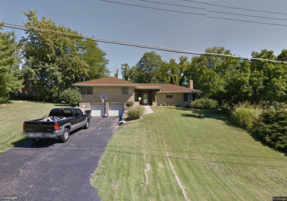
7357 Commonwealth Dr Cincinnati, OH 45224
Finneytown NeighborhoodEstimated Value: $301,670 - $355,000
4
Beds
3
Baths
1,912
Sq Ft
$173/Sq Ft
Est. Value
About This Home
This home is located at 7357 Commonwealth Dr, Cincinnati, OH 45224 and is currently estimated at $330,168, approximately $172 per square foot. 7357 Commonwealth Dr is a home located in Hamilton County with nearby schools including Finneytown Elementary School, Finneytown Secondary Campus, and St. Vivian School.
Ownership History
Date
Name
Owned For
Owner Type
Purchase Details
Closed on
Aug 30, 2002
Sold by
Kinnebrew Vada P
Bought by
Hunn Charles and Hunn Cheryl
Current Estimated Value
Home Financials for this Owner
Home Financials are based on the most recent Mortgage that was taken out on this home.
Original Mortgage
$195,000
Outstanding Balance
$77,339
Interest Rate
6.07%
Estimated Equity
$252,829
Purchase Details
Closed on
Sep 17, 1999
Sold by
Trevor Walker and Trevor Margaret Edwina
Bought by
Kinnebrew Vada P
Home Financials for this Owner
Home Financials are based on the most recent Mortgage that was taken out on this home.
Original Mortgage
$157,181
Interest Rate
6.75%
Create a Home Valuation Report for This Property
The Home Valuation Report is an in-depth analysis detailing your home's value as well as a comparison with similar homes in the area
Home Values in the Area
Average Home Value in this Area
Purchase History
| Date | Buyer | Sale Price | Title Company |
|---|---|---|---|
| Hunn Charles | $190,000 | -- | |
| Kinnebrew Vada P | $169,900 | -- |
Source: Public Records
Mortgage History
| Date | Status | Borrower | Loan Amount |
|---|---|---|---|
| Open | Hunn Charles | $195,000 | |
| Closed | Kinnebrew Vada P | $157,181 |
Source: Public Records
Tax History
| Year | Tax Paid | Tax Assessment Tax Assessment Total Assessment is a certain percentage of the fair market value that is determined by local assessors to be the total taxable value of land and additions on the property. | Land | Improvement |
|---|---|---|---|---|
| 2025 | $6,310 | $90,420 | $13,297 | $77,123 |
| 2024 | $6,167 | $90,420 | $13,297 | $77,123 |
| 2023 | $6,061 | $90,420 | $13,297 | $77,123 |
| 2022 | $5,409 | $58,517 | $13,038 | $45,479 |
| 2021 | $5,309 | $58,517 | $13,038 | $45,479 |
| 2020 | $5,393 | $58,517 | $13,038 | $45,479 |
| 2019 | $4,953 | $49,592 | $11,050 | $38,542 |
| 2018 | $4,573 | $49,592 | $11,050 | $38,542 |
| 2017 | $4,359 | $49,592 | $11,050 | $38,542 |
| 2016 | $4,476 | $50,103 | $12,492 | $37,611 |
| 2015 | $4,551 | $50,103 | $12,492 | $37,611 |
| 2014 | $4,507 | $50,103 | $12,492 | $37,611 |
| 2013 | $4,590 | $52,742 | $13,150 | $39,592 |
Source: Public Records
Map
Nearby Homes
- 332 Lux Ave
- 399 W Galbraith Rd
- 7809 View Place Dr
- 7790 Fancycab Ct Unit 14302
- 1117 W Seymour Ave
- 810 Southmeadow Cir
- 720 Castlegate Ln
- 712 W Galbraith Rd
- 704 W Galbraith Rd
- 741 W North Bend Rd
- 7946 Fairhope Ct
- 7929 Fairhope Ct
- 204 Brocdorf Dr
- 271 Poage Farm Rd
- 163 Compton Rd
- 8415 Mayfair St
- 833 W Galbraith Rd
- 6837 Warder Dr
- 852 Finney Trail
- 6848 Somerset Dr
- 7363 Commonwealth Dr
- 7349 Commonwealth Dr
- 461 Beechtree Dr
- 7343 Commonwealth Dr
- 7324 Commonwealth Dr
- 7360 Commonwealth Dr
- 7369 Commonwealth Dr
- 7364 Commonwealth Dr
- 459 Beechtree Dr
- 7335 Commonwealth Dr
- 7329 Commonwealth Dr
- 7368 Commonwealth Dr
- 463 Beechtree Dr
- 7374 Commonwealth Dr
- 7316 Commonwealth Dr
- 457 Beechtree Dr
- 7377 Commonwealth Dr
- 7377 Commonweatlh Dr
- 7321 Commonwealth Dr
- 467 Beechtree Dr
Your Personal Tour Guide
Ask me questions while you tour the home.