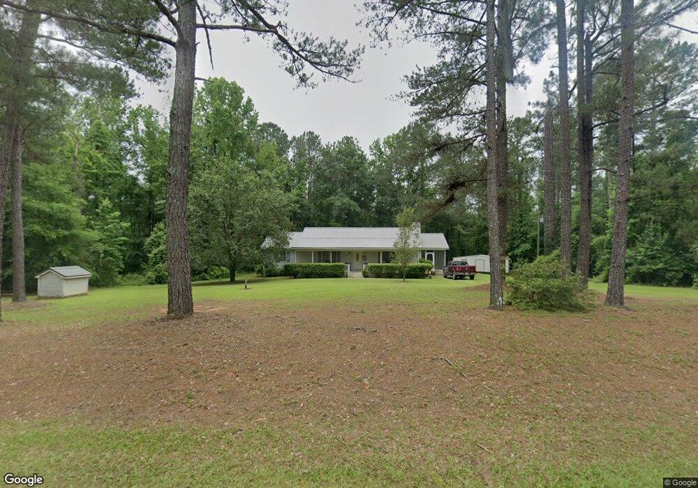
736 Tharpe Rd Musella, GA 31066
Estimated Value: $159,349
--
Bed
2
Baths
1,688
Sq Ft
$94/Sq Ft
Est. Value
About This Home
This home is located at 736 Tharpe Rd, Musella, GA 31066 and is currently estimated at $159,349, approximately $94 per square foot. 736 Tharpe Rd is a home located in Monroe County with nearby schools including Samuel E. Hubbard Elementary School and Mary Persons High School.
Ownership History
Date
Name
Owned For
Owner Type
Purchase Details
Closed on
Jun 6, 2002
Sold by
Windham Noel H
Bought by
Windham Noel H and Windham Donna S
Current Estimated Value
Purchase Details
Closed on
Apr 15, 1998
Sold by
Windham Donna S
Bought by
Windham Noel Hiram
Purchase Details
Closed on
Nov 6, 1997
Sold by
Letlow Donna S
Bought by
Windham Donna S and Noel Hiram
Purchase Details
Closed on
Jul 15, 1995
Sold by
Letlow Charles A
Bought by
Letlow Donna S
Purchase Details
Closed on
Jun 27, 1986
Sold by
Rice Ronnie W
Bought by
Letlow Charles A and Letlow Donna S
Create a Home Valuation Report for This Property
The Home Valuation Report is an in-depth analysis detailing your home's value as well as a comparison with similar homes in the area
Home Values in the Area
Average Home Value in this Area
Purchase History
| Date | Buyer | Sale Price | Title Company |
|---|---|---|---|
| Windham Noel H | -- | -- | |
| Windham Noel Hiram | -- | -- | |
| Windham Donna S | -- | -- | |
| Letlow Donna S | -- | -- | |
| Letlow Charles A | $80,900 | -- |
Source: Public Records
Tax History Compared to Growth
Tax History
| Year | Tax Paid | Tax Assessment Tax Assessment Total Assessment is a certain percentage of the fair market value that is determined by local assessors to be the total taxable value of land and additions on the property. | Land | Improvement |
|---|---|---|---|---|
| 2024 | $851 | $48,640 | $5,960 | $42,680 |
| 2023 | $795 | $41,640 | $5,960 | $35,680 |
| 2022 | $622 | $41,640 | $5,960 | $35,680 |
| 2021 | $648 | $41,640 | $5,960 | $35,680 |
| 2020 | $665 | $41,640 | $5,960 | $35,680 |
| 2019 | $670 | $41,640 | $5,960 | $35,680 |
| 2018 | $672 | $41,640 | $5,960 | $35,680 |
| 2017 | $1,210 | $41,640 | $5,960 | $35,680 |
| 2016 | $819 | $41,640 | $5,960 | $35,680 |
| 2015 | $777 | $41,640 | $5,960 | $35,680 |
| 2014 | $750 | $41,640 | $5,960 | $35,680 |
Source: Public Records
Map
Nearby Homes
- 375 Bagley Rd
- 2198 Dennis Rd
- 137 Shady Dale Dr
- 9390 Hopewell Rd
- 361 Allen Rd
- 13 Southern Waters Way
- 300 Slalom Pass
- 2550 Midway Rd
- 168 Kerr Way
- 140 Champions Dr
- 8294 Shelley Trail
- . Bentley Rd
- 0 Rogers Church Rd Unit 10643854
- Highway 42
- 0 Yellow Creek Rd Unit 24433636
- 0 Yellow Creek Rd Unit 24433638
- TRACT A Russellville Rd
- TRACT B Russellville Rd
- 519 Bluewater Bay Dr
- 402 Harbor Cove Dr