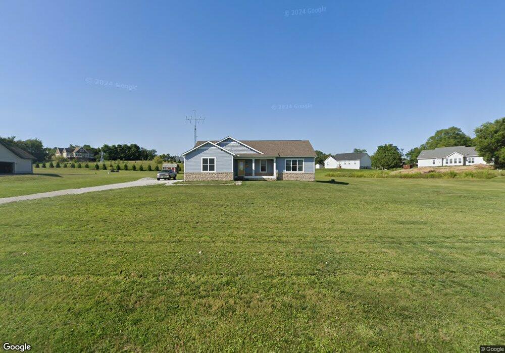
7363 Brandt Rd Carroll, OH 43112
Bloom NeighborhoodEstimated Value: $450,000 - $587,000
3
Beds
2
Baths
1,704
Sq Ft
$307/Sq Ft
Est. Value
About This Home
This home is located at 7363 Brandt Rd, Carroll, OH 43112 and is currently estimated at $523,580, approximately $307 per square foot. 7363 Brandt Rd is a home with nearby schools including Bloom Carroll Primary School, Bloom Carroll Intermediate School, and Bloom-Carroll Middle School.
Ownership History
Date
Name
Owned For
Owner Type
Purchase Details
Closed on
Jul 15, 2021
Sold by
Schouppe Anne E
Bought by
Callahan Walter F
Current Estimated Value
Purchase Details
Closed on
Jul 14, 2021
Sold by
Schouppe Anne E
Bought by
Callahan Walter F
Purchase Details
Closed on
Jun 25, 2021
Sold by
Callahan Walter F
Bought by
Schouppe Anne E
Purchase Details
Closed on
Mar 17, 2021
Sold by
5Are1 Llc and Stebelton Harold
Bought by
Callahan Walter F
Purchase Details
Closed on
Feb 19, 2018
Sold by
Stebelton Roger L and Stebelton Roger
Bought by
5Are1 Llc
Purchase Details
Closed on
Dec 29, 2017
Sold by
Stebelton Rodney L and Stebelton Rodney
Bought by
5Arei Llc
Purchase Details
Closed on
Nov 6, 2017
Sold by
Estate Of Robert L Stebelton
Bought by
Stebelton Rodney L and Stebelton Roger L
Create a Home Valuation Report for This Property
The Home Valuation Report is an in-depth analysis detailing your home's value as well as a comparison with similar homes in the area
Home Values in the Area
Average Home Value in this Area
Purchase History
| Date | Buyer | Sale Price | Title Company |
|---|---|---|---|
| Callahan Walter F | -- | None Available | |
| Schouppe Anne E | -- | None Available | |
| Callahan Walter F | -- | None Listed On Document | |
| Schouppe Anne E | -- | None Listed On Document | |
| Callahan Walter F | $120,000 | None Listed On Document | |
| 5Are1 Llc | -- | None Available | |
| 5Arei Llc | -- | None Available | |
| Stebelton Rodney L | -- | None Available |
Source: Public Records
Tax History Compared to Growth
Tax History
| Year | Tax Paid | Tax Assessment Tax Assessment Total Assessment is a certain percentage of the fair market value that is determined by local assessors to be the total taxable value of land and additions on the property. | Land | Improvement |
|---|---|---|---|---|
| 2024 | $11,290 | $137,010 | $25,630 | $111,380 |
| 2023 | $5,937 | $137,010 | $25,630 | $111,380 |
| 2022 | $3,053 | $69,930 | $25,630 | $44,300 |
| 2021 | $79 | $16,130 | $16,130 | $0 |
| 2020 | $47 | $2,240 | $2,240 | $0 |
| 2019 | $47 | $2,240 | $2,240 | $0 |
| 2018 | $59 | $11,530 | $11,530 | $0 |
| 2017 | $53 | $10,980 | $10,980 | $0 |
| 2016 | $46 | $14,030 | $14,030 | $0 |
| 2015 | $39 | $14,030 | $14,030 | $0 |
| 2014 | -- | $14,030 | $14,030 | $0 |
| 2013 | -- | $14,030 | $14,030 | $0 |
Source: Public Records
Map
Nearby Homes
- 4180 Stone Hill Drive East NW
- 6920 Winchester Rd NW
- 4900 Pickerington Rd NW
- 8322 Benson Rd
- 62 Oberle Ave
- 2155 Carroll-Southern Rd NW
- 52 W Canal St
- 7985 Lithopolis Rd NW
- 5560 Amanda Northern Rd NW
- 5341 Carnes Rd
- 5311 Mason Rd NW
- 1975 Lamb Rd NW
- 7234 Pickerington Rd
- 4656 Meadow Grove Dr NW
- 7190 Amanda Northern Rd NW
- 10385 Lithopolis Rd NW
- 7936 Allen Rd
- 5726 Bish Rd
- 7591 Heatherwood Dr NW
- 839 Rockmill Rd NW
- 7355 Brandt Rd
- 7347 Brandt Rd
- 7400 Brandt Rd
- 7445 Brandt Rd
- 7420 Brandt Rd
- 7331 Brandt Rd
- 4212 Pickerington Rd
- 4150 Pickerington Rd
- 4070 Pickerington Rd
- 7440 Brandt Rd NW
- 7440 Brandt Rd
- 4235 Pickerington Rd
- 7295 Brandt Rd
- 4195 Pickerington Rd
- 4094 Pickerington Rd
- 4386 Pickerington Rd
- 4386 Pickerington Rd
- 7277 Brandt Rd NW
- 4135 Pickerington Rd
- 4056 Pickerington Rd