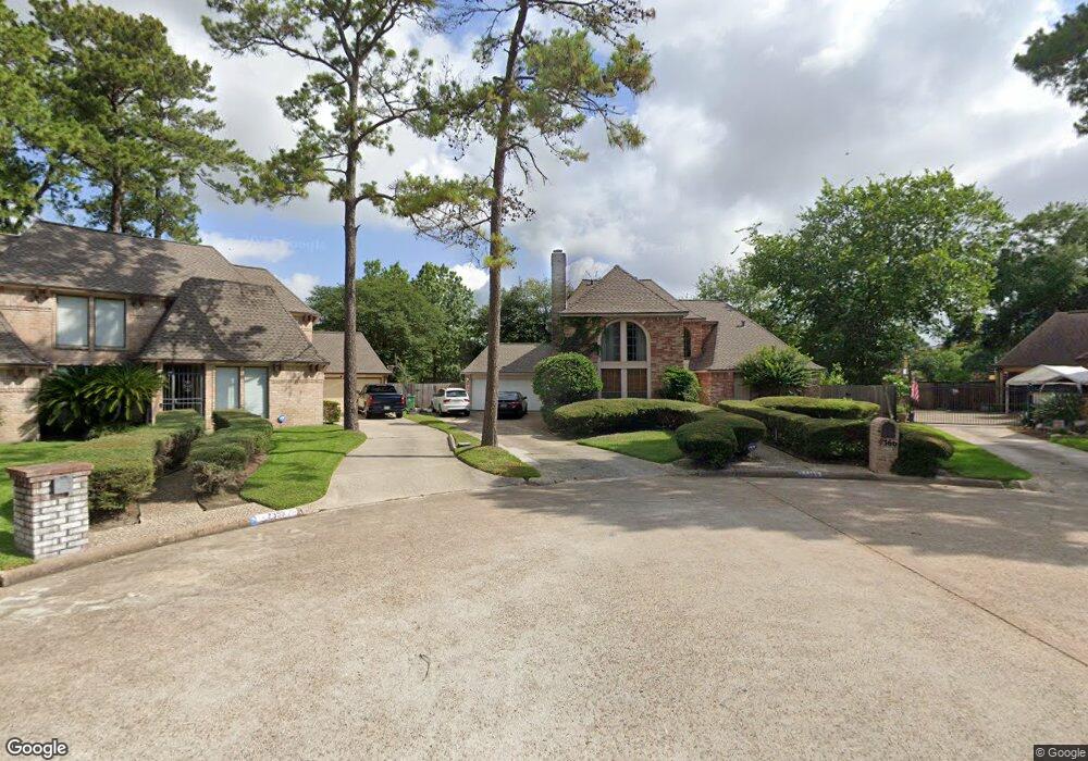
7366 Birchtree Forest Dr Houston, TX 77088
Greater Inwood NeighborhoodEstimated Value: $314,005 - $356,000
4
Beds
3
Baths
2,291
Sq Ft
$149/Sq Ft
Est. Value
About This Home
This home is located at 7366 Birchtree Forest Dr, Houston, TX 77088 and is currently estimated at $341,751, approximately $149 per square foot. 7366 Birchtree Forest Dr is a home located in Harris County with nearby schools including Edward a Vines EC/Pre-K/K School, Harris Elementary School, and Hoffman Middle School.
Ownership History
Date
Name
Owned For
Owner Type
Purchase Details
Closed on
Mar 22, 2024
Sold by
Wilson Fad
Bought by
Wilson Larita P
Current Estimated Value
Purchase Details
Closed on
Sep 15, 2000
Sold by
Alfano Mary Ann
Bought by
Wilson Fad
Home Financials for this Owner
Home Financials are based on the most recent Mortgage that was taken out on this home.
Original Mortgage
$147,084
Interest Rate
8.15%
Mortgage Type
VA
Create a Home Valuation Report for This Property
The Home Valuation Report is an in-depth analysis detailing your home's value as well as a comparison with similar homes in the area
Home Values in the Area
Average Home Value in this Area
Purchase History
| Date | Buyer | Sale Price | Title Company |
|---|---|---|---|
| Wilson Larita P | -- | None Listed On Document | |
| Wilson Fad | -- | Chicago Title |
Source: Public Records
Mortgage History
| Date | Status | Borrower | Loan Amount |
|---|---|---|---|
| Previous Owner | Wilson Fad | $147,084 |
Source: Public Records
Tax History Compared to Growth
Tax History
| Year | Tax Paid | Tax Assessment Tax Assessment Total Assessment is a certain percentage of the fair market value that is determined by local assessors to be the total taxable value of land and additions on the property. | Land | Improvement |
|---|---|---|---|---|
| 2025 | $101 | $339,306 | $82,283 | $257,023 |
| 2024 | $101 | $287,905 | $82,283 | $205,622 |
| 2023 | $101 | $279,700 | $82,283 | $197,417 |
| 2022 | $5,541 | $267,367 | $82,283 | $185,084 |
| 2021 | $5,275 | $210,000 | $51,427 | $158,573 |
| 2020 | $6,203 | $235,000 | $44,433 | $190,567 |
| 2019 | $6,412 | $231,700 | $44,433 | $187,267 |
| 2018 | $1,574 | $244,620 | $44,433 | $200,187 |
| 2017 | $5,414 | $272,157 | $44,433 | $227,724 |
| 2016 | $4,922 | $240,353 | $44,433 | $195,920 |
| 2015 | $1,870 | $202,102 | $44,433 | $157,669 |
| 2014 | $1,870 | $179,940 | $44,433 | $135,507 |
Source: Public Records
Map
Nearby Homes
- 3711 Black Locust Dr
- 3503 Cherry Forest Dr
- 4015 Black Locust Dr
- 3919 Badger Forest Dr
- 3414 Lemon Tree Ln
- 7331 Athlone Dr
- 7816 Inwood Grove Ln
- 7610 Alperton Dr
- 7200 T C Jester Blvd Unit 24
- DOVE Plan at Alaia Crossing
- CEDAR Plan at Alaia Crossing
- BOXWOOD Plan at Alaia Crossing
- 3306 Elmcrest Dr
- 7705 Inwood Grove Ln
- 3522 Almington Ln
- 7707 Inwood Grove Ln
- 7611 Athlone Dr
- 7702 Inwood Hills Ln
- 7709 Inwood Hills Ln
- 7712 Inwood Grove Ln
- 7362 Birchtree Forest Dr
- 7355 Birchtree Forest Dr
- 7354 Birchtree Forest Dr
- 7359 Birchtree Forest Dr
- 3814 Elmcrest Dr
- 7350 Birchtree Forest Dr
- 7347 Birchtree Forest Dr
- 3707 Black Locust Dr
- 3715 Black Locust Dr
- 3703 Black Locust Dr
- 3810 Elmcrest Dr
- 3719 Black Locust Dr
- 3818 Elmcrest Dr
- 3806 Elmcrest Dr
- 7355 Walkers Forest Dr
- 7342 Birchtree Forest Dr
- 7343 Birchtree Forest Dr
- 7351 Walkers Forest Dr
- 3803 Black Locust Dr
- 3618 Elmcrest Dr