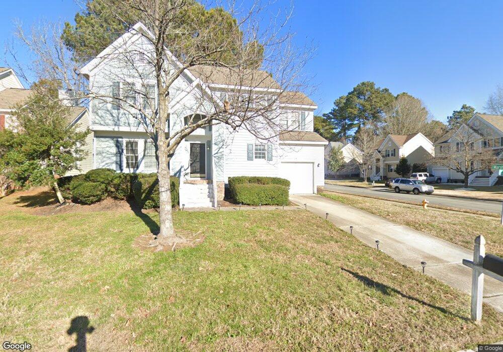
737 Cattail Cir Raleigh, NC 27610
Southeast Raleigh NeighborhoodEstimated Value: $311,739 - $344,000
3
Beds
3
Baths
1,662
Sq Ft
$197/Sq Ft
Est. Value
About This Home
This home is located at 737 Cattail Cir, Raleigh, NC 27610 and is currently estimated at $326,685, approximately $196 per square foot. 737 Cattail Cir is a home located in Wake County with nearby schools including Rogers Lane Elementary, River Bend Middle, and Southeast Raleigh Magnet High School.
Ownership History
Date
Name
Owned For
Owner Type
Purchase Details
Closed on
Oct 15, 2014
Sold by
Sp Srmof Ii 2012 A Trust
Bought by
American Residential Leasing Co Llc
Current Estimated Value
Purchase Details
Closed on
Feb 17, 2014
Sold by
Lowe Portia L
Bought by
Cp Srmof Ii 2012 A Trust Co
Purchase Details
Closed on
Jun 27, 2003
Sold by
Hud
Bought by
Lowe Portia L
Home Financials for this Owner
Home Financials are based on the most recent Mortgage that was taken out on this home.
Original Mortgage
$115,200
Interest Rate
8.25%
Mortgage Type
Purchase Money Mortgage
Purchase Details
Closed on
Mar 13, 2002
Sold by
Drake Ronald F and Drake Contrinia Mcarn
Bought by
Hud
Create a Home Valuation Report for This Property
The Home Valuation Report is an in-depth analysis detailing your home's value as well as a comparison with similar homes in the area
Home Values in the Area
Average Home Value in this Area
Purchase History
| Date | Buyer | Sale Price | Title Company |
|---|---|---|---|
| American Residential Leasing Co Llc | $147,500 | None Available | |
| Cp Srmof Ii 2012 A Trust Co | $115,000 | None Available | |
| Lowe Portia L | -- | -- | |
| Hud | $150,776 | -- |
Source: Public Records
Mortgage History
| Date | Status | Borrower | Loan Amount |
|---|---|---|---|
| Previous Owner | Lowe Portia L | $115,200 |
Source: Public Records
Tax History
| Year | Tax Paid | Tax Assessment Tax Assessment Total Assessment is a certain percentage of the fair market value that is determined by local assessors to be the total taxable value of land and additions on the property. | Land | Improvement |
|---|---|---|---|---|
| 2025 | $2,777 | $316,120 | $80,000 | $236,120 |
| 2024 | $2,766 | $316,120 | $80,000 | $236,120 |
Source: Public Records
Map
Nearby Homes
- 616 Hanska Way
- 640 Hanska Way
- 629 Hanska Way
- 504 Thistlegate Trail
- 5135 Primland Ln
- 5143 Primland Ln
- 5204 Bentgrass Dr
- 829 Penncross Dr
- 5308 Bentgrass Dr
- 5400 Thunderidge Dr
- 100 Penncross Dr
- 311 Gilman Ln Unit 107
- 300 Gilman Ln Unit 101
- 104 Boland Way
- 5011 Peachtree Town Ln
- 5345 Big Bass Dr
- 5335 Big Bass Dr
- 1004 Meridian View Ct
- 1004 Manderleigh Dr
- 1003 Azalea Cottage Ct
- 733 Cattail Cir
- 708 Marsh Grass Dr
- 729 Cattail Cir
- 704 Marsh Grass Dr
- 717 Marsh Grass Dr
- 712 Marsh Grass Dr
- 700 Marsh Grass Dr
- 725 Cattail Cir
- 716 Marsh Grass Dr
- 721 Marsh Grass Dr
- 721 Cattail Cir
- 512 Mountain Lake Dr
- 516 Mountain Lake Dr
- 709 Lake Brandon Trail
- 508 Mountain Lake Dr
- 801 Lake Brandon Trail
- 720 Marsh Grass Dr
- 705 Lake Brandon Trail
- 520 Mountain Lake Dr
- 805 Lake Brandon Trail
Your Personal Tour Guide
Ask me questions while you tour the home.