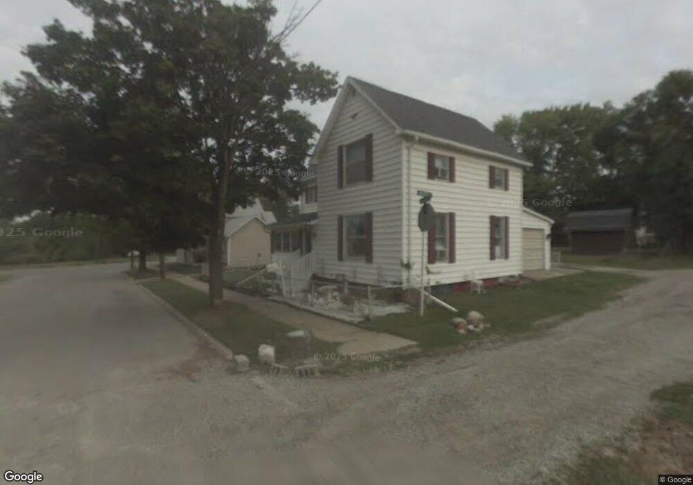
737 Fenton Rd Flint, MI 48503
Grand Traverse NeighborhoodEstimated Value: $63,000 - $202,000
3
Beds
3
Baths
2,011
Sq Ft
$51/Sq Ft
Est. Value
About This Home
This home is located at 737 Fenton Rd, Flint, MI 48503 and is currently estimated at $103,496, approximately $51 per square foot. 737 Fenton Rd is a home located in Genesee County with nearby schools including Eisenhower School, Flint Southwestern Classical Academy, and International Academy of Flint (K-12).
Ownership History
Date
Name
Owned For
Owner Type
Purchase Details
Closed on
Dec 4, 2019
Sold by
Genesee County Land Bank Authority
Bought by
Shinabarger Jay Lee
Current Estimated Value
Purchase Details
Closed on
Nov 14, 2016
Sold by
Genesee County Land Bank Authority
Bought by
Shinabarger Jay Lee
Purchase Details
Closed on
Dec 17, 2015
Sold by
Genesee County
Bought by
Genesee County Land Bank
Purchase Details
Closed on
Sep 15, 2004
Sold by
Mallard Paul W and Mallard Hazel M
Bought by
Haddix Everett and Coffman Doris P
Create a Home Valuation Report for This Property
The Home Valuation Report is an in-depth analysis detailing your home's value as well as a comparison with similar homes in the area
Home Values in the Area
Average Home Value in this Area
Purchase History
| Date | Buyer | Sale Price | Title Company |
|---|---|---|---|
| Shinabarger Jay Lee | $5,000 | None Available | |
| Shinabarger Jay Lee | $85,000 | None Available | |
| Genesee County Land Bank | -- | None Available | |
| Haddix Everett | $23,000 | First American Title Ins Co |
Source: Public Records
Mortgage History
| Date | Status | Borrower | Loan Amount |
|---|---|---|---|
| Closed | Shinabarger Jay Lee | $0 |
Source: Public Records
Tax History Compared to Growth
Tax History
| Year | Tax Paid | Tax Assessment Tax Assessment Total Assessment is a certain percentage of the fair market value that is determined by local assessors to be the total taxable value of land and additions on the property. | Land | Improvement |
|---|---|---|---|---|
| 2025 | $789 | $0 | $0 | $0 |
| 2024 | $777 | $5,500 | $0 | $0 |
| 2023 | $783 | $4,500 | $0 | $0 |
| 2022 | $0 | $3,800 | $0 | $0 |
| 2021 | $1,103 | $14,200 | $0 | $0 |
| 2020 | $1,049 | $13,100 | $0 | $0 |
| 2019 | $1,595 | $10,200 | $0 | $0 |
| 2018 | $677 | $9,100 | $0 | $0 |
| 2017 | $662 | $0 | $0 | $0 |
| 2016 | $0 | $0 | $0 | $0 |
| 2015 | -- | $0 | $0 | $0 |
| 2014 | -- | $0 | $0 | $0 |
| 2012 | -- | $6,400 | $0 | $0 |
Source: Public Records
Map
Nearby Homes
- 1708 Fenton Rd
- 1009 Oak St
- 1511 Tacoma St
- 1517 Tacoma St
- 2021 Brooks St
- 347 W 5th St Unit 2
- 343 W 5th St Unit 1
- 314 W 5th St
- 339 W 5th St Unit 3
- 335 W 5th St Unit 2
- 331 W 5th St Unit 1
- 327 W 5th St Unit 3
- 323 W 5th St Unit 2
- 319 W 5th St Unit 1
- 315 W 5th St Unit 3
- 311 W 5th St Unit 2
- 517 Morley Ave
- 307 W 5th St Unit 1
- 223 W 5th St Unit 2
- 219 W 5th Ave Unit 1