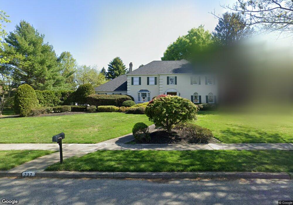
737 Mill St Moorestown, NJ 08057
Estimated Value: $1,108,352 - $1,246,000
--
Bed
--
Bath
3,250
Sq Ft
$364/Sq Ft
Est. Value
About This Home
This home is located at 737 Mill St, Moorestown, NJ 08057 and is currently estimated at $1,183,451, approximately $364 per square foot. 737 Mill St is a home located in Burlington County with nearby schools including George C. Baker Elementary School, Moorestown Upper Elementary School, and William Allen Middle School.
Ownership History
Date
Name
Owned For
Owner Type
Purchase Details
Closed on
Jan 17, 1999
Sold by
Lake Lawrence L and Lake Linda R
Bought by
Gagnon Brian J and Gagnon Ellen L
Current Estimated Value
Home Financials for this Owner
Home Financials are based on the most recent Mortgage that was taken out on this home.
Original Mortgage
$416,000
Interest Rate
7.91%
Purchase Details
Closed on
Aug 30, 1996
Sold by
Lake Linda R and Lake Lawrence L
Bought by
Lake Lawrence L and Lake Linda R
Create a Home Valuation Report for This Property
The Home Valuation Report is an in-depth analysis detailing your home's value as well as a comparison with similar homes in the area
Home Values in the Area
Average Home Value in this Area
Purchase History
| Date | Buyer | Sale Price | Title Company |
|---|---|---|---|
| Gagnon Brian J | $520,000 | Southern Counties Title Agen | |
| Lake Lawrence L | -- | -- |
Source: Public Records
Mortgage History
| Date | Status | Borrower | Loan Amount |
|---|---|---|---|
| Previous Owner | Gagnon Brian J | $416,000 |
Source: Public Records
Tax History Compared to Growth
Tax History
| Year | Tax Paid | Tax Assessment Tax Assessment Total Assessment is a certain percentage of the fair market value that is determined by local assessors to be the total taxable value of land and additions on the property. | Land | Improvement |
|---|---|---|---|---|
| 2025 | $16,630 | $586,200 | $175,000 | $411,200 |
| 2024 | $16,126 | $586,200 | $175,000 | $411,200 |
| 2023 | $16,126 | $586,200 | $175,000 | $411,200 |
| 2022 | $15,962 | $586,200 | $175,000 | $411,200 |
| 2021 | $15,751 | $586,200 | $175,000 | $411,200 |
| 2020 | $15,652 | $586,200 | $175,000 | $411,200 |
| 2019 | $15,376 | $586,200 | $175,000 | $411,200 |
| 2018 | $14,960 | $586,200 | $175,000 | $411,200 |
| 2017 | $15,089 | $586,200 | $175,000 | $411,200 |
| 2016 | $15,036 | $586,200 | $175,000 | $411,200 |
| 2015 | $14,854 | $586,200 | $175,000 | $411,200 |
| 2014 | $14,104 | $586,200 | $175,000 | $411,200 |
Source: Public Records
Map
Nearby Homes
- 543 Bethel Ave
- 25 Oriole Way
- 308 Farmdale Rd
- 316 Farmdale Rd
- 863 Golf View Rd
- 423 Park Blvd
- 2801 Riverton Rd
- 50 E 3rd St
- 205 E Central Ave
- 66 E 3rd St
- 82 E 3rd St
- 80 E 3rd St
- 313 Fairview Ave
- 15 E 2nd St
- 744 Signal Light Rd
- 133 Plum St Unit 6
- 316 W 3rd St
- 343 Tom Brown Rd
- 347 Tom Brown Rd
- 308 Elm St