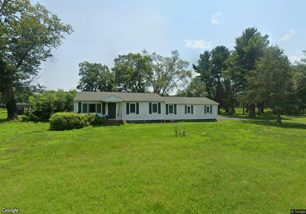
737 Money Rd Townsend, DE 19734
Estimated Value: $316,000 - $397,000
About This Home
This home is located at 737 Money Rd, Townsend, DE 19734 and is currently estimated at $360,438, approximately $294 per square foot. 737 Money Rd is a home located in New Castle County with nearby schools including Townsend Elementary School, Everett Meredith Middle School, and Odessa High School.
Ownership History
We collect this data history from publicly available records. To have your information removed, we recommend requesting removal directly through your county’s website.
Purchase Details
Home Financials for this Owner
Home Financials are based on the most recent Mortgage that was taken out on this home.Purchase Details
Home Values in the Area
Average Home Value in this Area
Purchase History
We collect this data history from publicly available records. To have your information removed, we recommend requesting removal directly through your county’s website.
| Date | Buyer | Sale Price | Title Company |
|---|---|---|---|
| $175,000 | None Listed On Document | ||
| -- | -- | ||
| -- | -- |
Mortgage History
We collect this data history from publicly available records. To have your information removed, we recommend requesting removal directly through your county’s website.
| Date | Status | Borrower | Loan Amount |
|---|---|---|---|
| Open | $171,830 |
Tax History
We collect this data history from publicly available records. To have your information removed, we recommend requesting removal directly through your county’s website.
| Year | Tax Paid | Tax Assessment Tax Assessment Total Assessment is a certain percentage of the fair market value that is determined by local assessors to be the total taxable value of land and additions on the property. | Land | Improvement |
|---|---|---|---|---|
| 2025 | $2,752 | $354,500 | $102,100 | $252,400 |
| 2024 | $459 | $55,300 | $8,800 | $46,500 |
| 2023 | $385 | $55,300 | $8,800 | $46,500 |
| 2022 | $385 | $55,300 | $8,800 | $46,500 |
| 2021 | $379 | $55,300 | $8,800 | $46,500 |
| 2020 | $375 | $55,300 | $8,800 | $46,500 |
| 2019 | $345 | $55,300 | $8,800 | $46,500 |
| 2018 | $333 | $55,300 | $8,800 | $46,500 |
| 2017 | $321 | $55,300 | $8,800 | $46,500 |
| 2016 | $290 | $55,300 | $8,800 | $46,500 |
| 2015 | $281 | $55,300 | $8,800 | $46,500 |
| 2014 | -- | $55,300 | $8,800 | $46,500 |
Map
- 3355 Harris Rd
- 1020 Robinson Rd
- 1019 Robinson Rd
- 1027 Robinson Rd
- 1003 Robinson Rd
- 1065 Robinson Rd Unit WHITFIELD RANCH PLAN
- 1063 Robinson Rd Unit WHITFIELD PLAN
- 1067 Robinson Rd Unit LAKELAND PLAN
- 1069 Robinson Rd Unit PEMBROOK PLAN
- 1071 Robinson Rd Unit DELRAY PLAN
- 1105 Kayla Ln
- 929 Robinson Rd
- 207 Olivine Cir
- 1509 Paige Place
- 413 Janets Way
- 195 Case Rd
- 199 Case Rd
- 203 Case Rd
- 206 Case Rd
- 469 Wyatt Dr
Ask me questions while you tour the home.