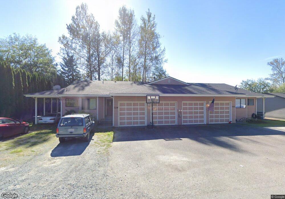
737 Sapp Rd Unit 739 Sedro Woolley, WA 98284
Estimated Value: $588,000 - $870,000
6
Beds
3
Baths
2,310
Sq Ft
$309/Sq Ft
Est. Value
About This Home
This home is located at 737 Sapp Rd Unit 739, Sedro Woolley, WA 98284 and is currently estimated at $713,085, approximately $308 per square foot. 737 Sapp Rd Unit 739 is a home located in Skagit County with nearby schools including Sedro-Woolley Senior High School.
Ownership History
Date
Name
Owned For
Owner Type
Purchase Details
Closed on
Feb 21, 2013
Sold by
Robinson Robert Lee and Robinson Jodee
Bought by
Story Stephen B and Story Corinne L
Current Estimated Value
Home Financials for this Owner
Home Financials are based on the most recent Mortgage that was taken out on this home.
Original Mortgage
$214,825
Outstanding Balance
$149,159
Interest Rate
3.34%
Mortgage Type
New Conventional
Estimated Equity
$563,926
Create a Home Valuation Report for This Property
The Home Valuation Report is an in-depth analysis detailing your home's value as well as a comparison with similar homes in the area
Home Values in the Area
Average Home Value in this Area
Purchase History
| Date | Buyer | Sale Price | Title Company |
|---|---|---|---|
| Story Stephen B | $286,716 | Guardian Northwest Title Co |
Source: Public Records
Mortgage History
| Date | Status | Borrower | Loan Amount |
|---|---|---|---|
| Open | Story Stephen B | $214,825 |
Source: Public Records
Tax History Compared to Growth
Tax History
| Year | Tax Paid | Tax Assessment Tax Assessment Total Assessment is a certain percentage of the fair market value that is determined by local assessors to be the total taxable value of land and additions on the property. | Land | Improvement |
|---|---|---|---|---|
| 2025 | $6,512 | $776,500 | $203,100 | $573,400 |
| 2024 | $6,660 | $705,300 | $199,800 | $505,500 |
| 2023 | $6,660 | $716,400 | $210,900 | $505,500 |
| 2022 | $5,739 | $679,000 | $182,000 | $497,000 |
| 2021 | $5,060 | $564,200 | $138,200 | $426,000 |
| 2020 | $4,892 | $464,200 | $0 | $0 |
| 2019 | $3,597 | $464,200 | $0 | $0 |
| 2018 | $4,005 | $418,600 | $0 | $0 |
| 2017 | $3,678 | $350,700 | $0 | $0 |
| 2016 | $3,725 | $326,600 | $79,800 | $246,800 |
| 2015 | $4,327 | $309,400 | $75,600 | $233,800 |
| 2013 | $3,916 | $304,800 | $0 | $0 |
Source: Public Records
Map
Nearby Homes
- 814 Sapp Rd
- 808 Sauk Mountain Dr
- 426 Longtime Ln
- 915 Presidio Place
- 500 Briza Ln
- 776 Parkland Loop
- 742 Parkland Loop
- 803 Parkland Loop
- 804 Parkland Loop
- 806 Parkland Loop
- 825 Parkland Loop
- 314 Birchwood Ln Unit 316
- 886 Carriage Ct
- 885 Carriage Ct
- 920 Carriage Ct Unit 59
- 1418 Moore St
- 1537 E Gateway Heights Loop
- 317 319 Township St
- 315 Shannon Ave
- 9392 Thresher Ave