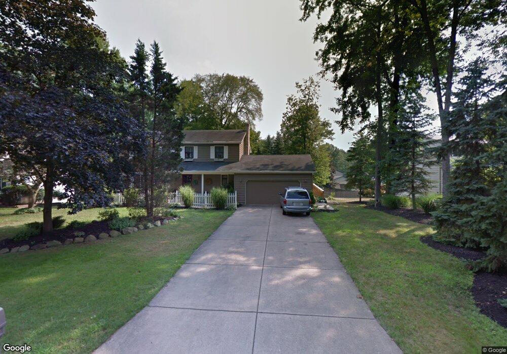
737 Squirrel Hill Dr Youngstown, OH 44512
Estimated Value: $335,595 - $375,000
5
Beds
4
Baths
2,542
Sq Ft
$139/Sq Ft
Est. Value
About This Home
This home is located at 737 Squirrel Hill Dr, Youngstown, OH 44512 and is currently estimated at $353,399, approximately $139 per square foot. 737 Squirrel Hill Dr is a home located in Mahoning County with nearby schools including Stadium Drive Elementary School, Boardman Center Middle School, and Boardman High School.
Ownership History
Date
Name
Owned For
Owner Type
Purchase Details
Closed on
Feb 24, 1998
Sold by
Mai Glen R and Mai Suzanne
Bought by
Ciavarella John J and Ciavarella Melissa K
Current Estimated Value
Home Financials for this Owner
Home Financials are based on the most recent Mortgage that was taken out on this home.
Original Mortgage
$111,350
Interest Rate
6.95%
Purchase Details
Closed on
Jun 17, 1993
Bought by
Phelan Edward and Phelan Linda
Create a Home Valuation Report for This Property
The Home Valuation Report is an in-depth analysis detailing your home's value as well as a comparison with similar homes in the area
Home Values in the Area
Average Home Value in this Area
Purchase History
| Date | Buyer | Sale Price | Title Company |
|---|---|---|---|
| Ciavarella John J | $131,000 | -- | |
| Phelan Edward | $125,000 | -- |
Source: Public Records
Mortgage History
| Date | Status | Borrower | Loan Amount |
|---|---|---|---|
| Previous Owner | Ciavarella John J | $111,350 |
Source: Public Records
Tax History Compared to Growth
Tax History
| Year | Tax Paid | Tax Assessment Tax Assessment Total Assessment is a certain percentage of the fair market value that is determined by local assessors to be the total taxable value of land and additions on the property. | Land | Improvement |
|---|---|---|---|---|
| 2024 | $4,328 | $85,810 | $12,390 | $73,420 |
| 2023 | $4,270 | $85,810 | $12,390 | $73,420 |
| 2022 | $4,082 | $62,760 | $12,540 | $50,220 |
| 2021 | $4,085 | $62,760 | $12,540 | $50,220 |
| 2020 | $4,106 | $62,760 | $12,540 | $50,220 |
| 2019 | $4,232 | $58,110 | $11,610 | $46,500 |
| 2018 | $3,680 | $58,110 | $11,610 | $46,500 |
| 2017 | $3,504 | $58,110 | $11,610 | $46,500 |
| 2016 | $3,331 | $52,120 | $11,610 | $40,510 |
| 2015 | $3,264 | $52,120 | $11,610 | $40,510 |
| 2014 | $3,274 | $52,120 | $11,610 | $40,510 |
| 2013 | $3,232 | $52,120 | $11,610 | $40,510 |
Source: Public Records
Map
Nearby Homes
- 7716 Silver Fox Dr
- 7511 E Parkside Dr
- 7556 Jaguar Dr
- 7544 Jaguar Dr
- 7603 Red Fox Dr
- 7784 Hitchcock Rd
- 7553 Glenwood Ave
- 179 Southwoods Ave
- 7387 Oregon Trail
- 7367 Oregon Trail
- 0 Pinewood Dr Unit 5140025
- 2319 Hunters Ridge
- 6938 Ron Park Place
- 1193 Red Tail Hawk Ct Unit 1
- 8121 Hitchcock Rd Unit 10
- 7851 Huntington Cir
- 1133 Red Tail Hawk Ct Unit 6
- 6632 Harrington Ave
- 7005 Paxton Rd
- 6892 Glenwood Ave
- 749 Squirrel Hill Dr
- 7705 Silver Fox Dr
- 769 Squirrel Hill Dr
- 7709 Silver Fox Dr
- 721 Squirrel Hill Dr
- 732 Squirrel Hill Dr
- 785 Squirrel Hill Dr
- 724 Squirrel Hill Dr
- 740 Squirrel Hill Dr
- 795 Squirrel Hill Dr
- 716 Squirrel Hill Dr
- 748 Squirrel Hill Dr
- 7717 Silver Fox Dr
- 717 Squirrel Hill Dr
- 764 Squirrel Hill Dr
- 756 Squirrel Hill Dr
- 708 Squirrel Hill Dr
- 733 Squirrel Hill Ct
- 725 Squirrel Hill Ct
- 725 Squirrel Hill Ct