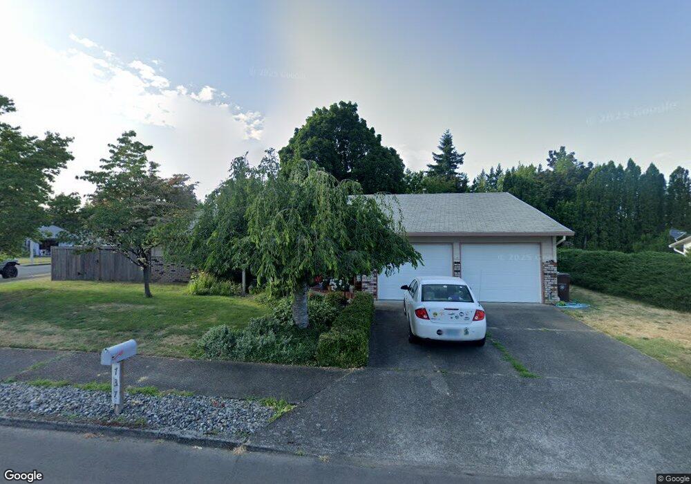
737 SW 20th Cir Troutdale, OR 97060
Sunrise NeighborhoodEstimated Value: $427,000 - $495,000
3
Beds
2
Baths
1,462
Sq Ft
$318/Sq Ft
Est. Value
About This Home
This home is located at 737 SW 20th Cir, Troutdale, OR 97060 and is currently estimated at $464,707, approximately $317 per square foot. 737 SW 20th Cir is a home located in Multnomah County with nearby schools including Troutdale Elementary School, Walt Morey Middle School, and Reynolds High School.
Ownership History
Date
Name
Owned For
Owner Type
Purchase Details
Closed on
Dec 31, 2013
Sold by
Lalonde Janice Rae
Bought by
Stone Allyson G D
Current Estimated Value
Home Financials for this Owner
Home Financials are based on the most recent Mortgage that was taken out on this home.
Original Mortgage
$198,500
Outstanding Balance
$140,939
Interest Rate
2.99%
Mortgage Type
Adjustable Rate Mortgage/ARM
Estimated Equity
$323,768
Purchase Details
Closed on
Mar 19, 1998
Sold by
Johnson Lillian R
Bought by
Johnson Lillian R and Lalonde Janice Rae
Create a Home Valuation Report for This Property
The Home Valuation Report is an in-depth analysis detailing your home's value as well as a comparison with similar homes in the area
Home Values in the Area
Average Home Value in this Area
Purchase History
| Date | Buyer | Sale Price | Title Company |
|---|---|---|---|
| Stone Allyson G D | $209,000 | First American | |
| Johnson Lillian R | -- | -- |
Source: Public Records
Mortgage History
| Date | Status | Borrower | Loan Amount |
|---|---|---|---|
| Open | Stone Allyson G D | $198,500 |
Source: Public Records
Tax History Compared to Growth
Tax History
| Year | Tax Paid | Tax Assessment Tax Assessment Total Assessment is a certain percentage of the fair market value that is determined by local assessors to be the total taxable value of land and additions on the property. | Land | Improvement |
|---|---|---|---|---|
| 2025 | $4,344 | $234,850 | -- | -- |
| 2024 | $4,106 | $228,010 | -- | -- |
| 2023 | $3,998 | $221,370 | $0 | $0 |
| 2022 | $3,903 | $214,930 | $0 | $0 |
| 2021 | $3,811 | $208,670 | $0 | $0 |
| 2020 | $3,564 | $202,600 | $0 | $0 |
| 2019 | $3,421 | $196,700 | $0 | $0 |
| 2018 | $3,398 | $190,980 | $0 | $0 |
| 2017 | $3,391 | $185,420 | $0 | $0 |
| 2016 | $3,278 | $180,020 | $0 | $0 |
| 2015 | $3,196 | $174,780 | $0 | $0 |
| 2014 | $3,107 | $169,690 | $0 | $0 |
Source: Public Records
Map
Nearby Homes
- 2020 SW Laura Ct
- 839 SW Grant Way
- 665 SW 24th St
- 1021 SW 24th St
- 821 SW 14th St
- 1427 SW 24th St
- 1226 SW Hensley Rd
- 2326 SW Mcginnis Ave
- 1212 SW Edgefield Ave
- 2846 SW Faith Ct
- 724 SW 28th St
- 809 SW Crestview Way
- 735 SW Sunset Way
- 2511 S Troutdale Rd
- 1330 SW 28th St Unit 1332
- 2154 SE Sandy Ct
- 1106 SW Dottie Ct
- 1953 SW Northstar Way
- 1392 SW Berryessa Place
- 2701 SW Latourell Place
- 715 SW 20th Cir
- 1959 SW Laura Ct
- 730 SW 20th Cir
- 2009 SW Laura Ct
- 1945 SW Laura Ct
- 701 SW 20th Cir
- 1930 SW Laura Ct
- 726 SW 20th Cir
- 1933 SW Laura Ct
- 2023 SW Laura Ct
- 628 SW 19th Cir
- 722 SW 20th Cir
- 1927 SW Laura Ct
- 1922 SW Laura Ct
- 1964 SW Elise Place
- 1992 SW Elise Place
- 1948 SW Elise Place
- 2006 SW Elise Place
- 614 SW 19th Cir
- 685 SW 20th Cir