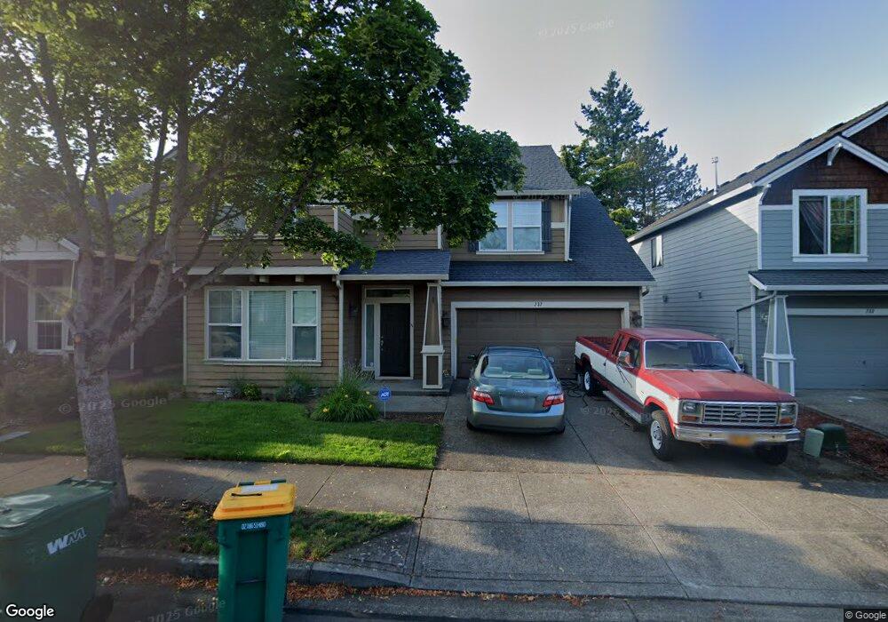
737 SW Grant Way Troutdale, OR 97060
Sunrise NeighborhoodEstimated Value: $543,000 - $588,000
--
Bed
3
Baths
2,492
Sq Ft
$227/Sq Ft
Est. Value
About This Home
This home is located at 737 SW Grant Way, Troutdale, OR 97060 and is currently estimated at $565,448, approximately $226 per square foot. 737 SW Grant Way is a home located in Multnomah County with nearby schools including Troutdale Elementary School, Walt Morey Middle School, and Reynolds High School.
Ownership History
Date
Name
Owned For
Owner Type
Purchase Details
Closed on
Jul 29, 2025
Sold by
Menon Santosh
Bought by
Panicker-Menon Living Trust and Menon
Current Estimated Value
Purchase Details
Closed on
Nov 15, 2006
Sold by
D R Horton Inc Portland
Bought by
Menon Santosh
Home Financials for this Owner
Home Financials are based on the most recent Mortgage that was taken out on this home.
Original Mortgage
$257,520
Interest Rate
6.36%
Mortgage Type
Purchase Money Mortgage
Create a Home Valuation Report for This Property
The Home Valuation Report is an in-depth analysis detailing your home's value as well as a comparison with similar homes in the area
Home Values in the Area
Average Home Value in this Area
Purchase History
| Date | Buyer | Sale Price | Title Company |
|---|---|---|---|
| Panicker-Menon Living Trust | -- | None Listed On Document | |
| Menon Santosh | $321,900 | First American Title Insuran |
Source: Public Records
Mortgage History
| Date | Status | Borrower | Loan Amount |
|---|---|---|---|
| Previous Owner | Menon Santosh | $257,520 |
Source: Public Records
Tax History Compared to Growth
Tax History
| Year | Tax Paid | Tax Assessment Tax Assessment Total Assessment is a certain percentage of the fair market value that is determined by local assessors to be the total taxable value of land and additions on the property. | Land | Improvement |
|---|---|---|---|---|
| 2025 | $5,764 | $312,920 | -- | -- |
| 2024 | $5,446 | $303,810 | -- | -- |
| 2023 | $5,303 | $294,970 | $0 | $0 |
| 2022 | $5,175 | $286,380 | $0 | $0 |
| 2021 | $5,055 | $278,040 | $0 | $0 |
| 2020 | $4,729 | $269,950 | $0 | $0 |
| 2019 | $4,539 | $262,090 | $0 | $0 |
| 2018 | $4,508 | $254,460 | $0 | $0 |
| 2017 | $4,498 | $247,050 | $0 | $0 |
| 2016 | $4,347 | $239,860 | $0 | $0 |
| 2015 | $4,238 | $232,880 | $0 | $0 |
| 2014 | $4,121 | $226,100 | $0 | $0 |
Source: Public Records
Map
Nearby Homes
- 839 SW Grant Way
- 821 SW 14th St
- 1226 SW Hensley Rd
- 2020 SW Laura Ct
- 809 SW Crestview Way
- 1212 SW Edgefield Ave
- 735 SW Sunset Way
- 665 SW 24th St
- 1021 SW 24th St
- 1106 SW Dottie Ct
- 1427 SW 24th St
- 2326 SW Mcginnis Ave
- 2154 SE Sandy Ct
- 1392 SW Berryessa Place
- 1953 SW Northstar Way
- 2511 S Troutdale Rd
- 1018 SW Halsey St
- 2846 SW Faith Ct
- 724 SW 28th St
- 1330 SW 28th St Unit 1332
- 733 SW Grant Way
- 745 SW Grant Way
- 809 SW Grant Way
- 722 SW 15th St
- 732 SW 15th St
- 740 SW Grant Way
- 744 SW Grant Way
- 734 SW Grant Way
- 817 SW Grant Way
- 703 SW Grant Way
- 804 SW Grant Way
- 804 SW Grant Way
- 804 SW Grant Way Unit 3%
- 704 SW 15th St
- 722 SW Grant Way
- 802 SW 15th St
- 812 SW Grant Way
- 708 SW Grant Way
- 818 SW Grant Way
- 741 SW Morgan Way