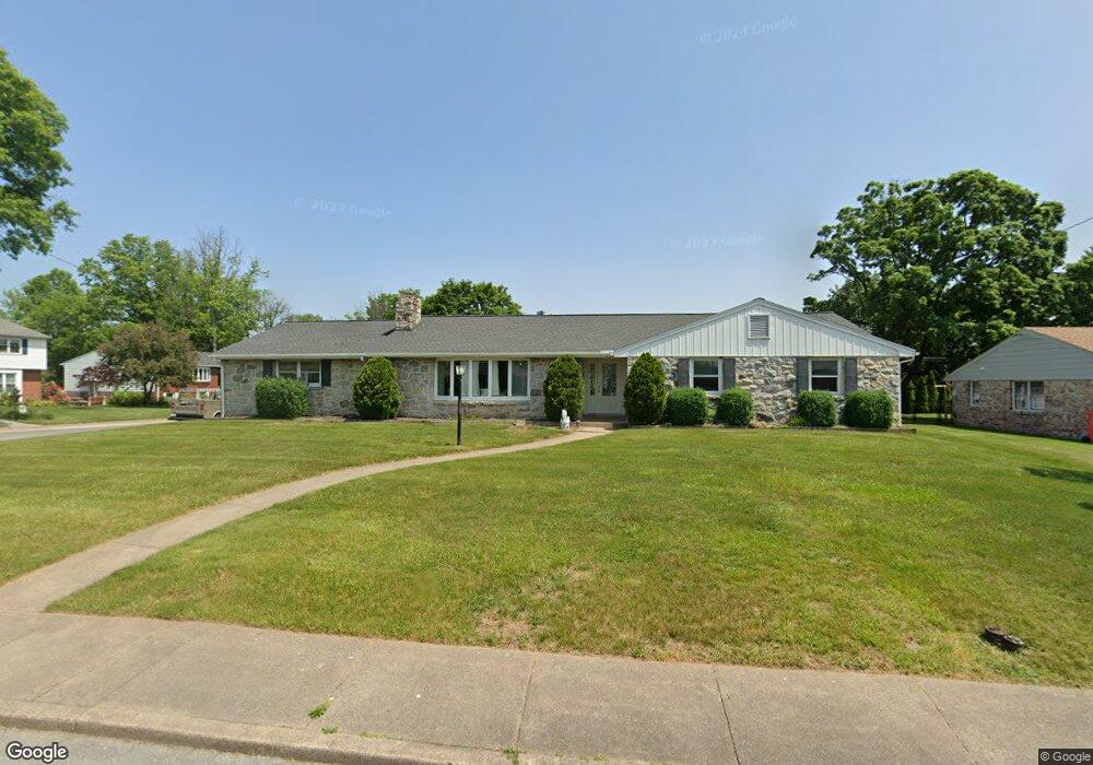
737 Sylvan Dr Pottstown, PA 19464
Estimated Value: $362,000 - $418,000
4
Beds
2
Baths
2,239
Sq Ft
$170/Sq Ft
Est. Value
About This Home
This home is located at 737 Sylvan Dr, Pottstown, PA 19464 and is currently estimated at $381,042, approximately $170 per square foot. 737 Sylvan Dr is a home located in Montgomery County with nearby schools including Lower Pottsgrove Elementary School, Pottsgrove Middle School, and Pottsgrove Senior High School.
Ownership History
Date
Name
Owned For
Owner Type
Purchase Details
Closed on
Mar 16, 2023
Sold by
Weaver Betty B
Bought by
Gitney Darlene and Carroll Cynthia Ann
Current Estimated Value
Purchase Details
Closed on
Jan 1, 1963
Bought by
Weaver George and Weaver Betty
Create a Home Valuation Report for This Property
The Home Valuation Report is an in-depth analysis detailing your home's value as well as a comparison with similar homes in the area
Home Values in the Area
Average Home Value in this Area
Purchase History
| Date | Buyer | Sale Price | Title Company |
|---|---|---|---|
| Gitney Darlene | $325,000 | None Listed On Document | |
| Weaver George | -- | -- |
Source: Public Records
Tax History Compared to Growth
Tax History
| Year | Tax Paid | Tax Assessment Tax Assessment Total Assessment is a certain percentage of the fair market value that is determined by local assessors to be the total taxable value of land and additions on the property. | Land | Improvement |
|---|---|---|---|---|
| 2025 | $7,012 | $145,970 | $41,780 | $104,190 |
| 2024 | $7,012 | $145,970 | $41,780 | $104,190 |
| 2023 | $6,789 | $145,970 | $41,780 | $104,190 |
| 2022 | $6,685 | $145,970 | $41,780 | $104,190 |
| 2021 | $6,587 | $145,970 | $41,780 | $104,190 |
| 2020 | $6,489 | $145,970 | $41,780 | $104,190 |
| 2019 | $6,454 | $145,970 | $41,780 | $104,190 |
| 2018 | $6,454 | $145,970 | $41,780 | $104,190 |
| 2017 | $6,432 | $145,970 | $41,780 | $104,190 |
| 2016 | $6,375 | $145,970 | $41,780 | $104,190 |
| 2015 | $6,154 | $145,970 | $41,780 | $104,190 |
| 2014 | $6,154 | $145,970 | $41,780 | $104,190 |
Source: Public Records
Map
Nearby Homes
- 303 Grosstown Rd
- 425 Center St
- 530 E Howard St
- 226 School Ln
- 624 E Howard St
- 501 and 507 E Race St
- 516 Ash St Unit 52
- 3 W Race St
- 0 Ash St Unit PAMC2144590
- 94 Random Rd
- 81 Random Rd
- 25 Random Rd
- 74 Middlemarch Rd
- 32 E Race St
- 326 E Vine St
- 160 Linden St Unit 69
- 7 E Vine St
- 536 & 538 W Vine St
- 132 Westin Rd
- 601 W High St