Estimated Value: $224,744 - $331,000
--
Bed
2
Baths
1,075
Sq Ft
$258/Sq Ft
Est. Value
About This Home
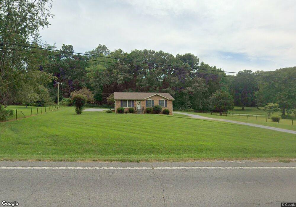
This home is located at 7378 Highway 41 N, Adams, TN 37010 and is currently estimated at $277,186, approximately $257 per square foot. 7378 Highway 41 N is a home located in Robertson County with nearby schools including Jo Byrns Elementary School and Jo Byrns High School.
Ownership History
Date
Name
Owned For
Owner Type
Purchase Details
Closed on
Apr 11, 2019
Sold by
Holt James R and Estate Of Barbara Holt
Bought by
Yeargain Catherine Ann and Heatherly Linda H
Current Estimated Value
Purchase Details
Closed on
Aug 24, 2001
Sold by
Etal Mason Linda A
Bought by
Alan Holman
Purchase Details
Closed on
Sep 3, 1993
Bought by
Holt Baarbara R
Purchase Details
Closed on
Sep 18, 1986
Bought by
Holt Clifford and Holt Barbara
Purchase Details
Closed on
Mar 3, 1977
Purchase Details
Closed on
Jan 1, 1977
Create a Home Valuation Report for This Property
The Home Valuation Report is an in-depth analysis detailing your home's value as well as a comparison with similar homes in the area
Home Values in the Area
Average Home Value in this Area
Purchase History
| Date | Buyer | Sale Price | Title Company |
|---|---|---|---|
| Yeargain Catherine Ann | -- | None Available | |
| Alan Holman | $69,500 | -- | |
| Holt Baarbara R | -- | -- | |
| Holt Clifford | -- | -- | |
| -- | -- | -- | |
| -- | $2,000 | -- |
Source: Public Records
Tax History Compared to Growth
Tax History
| Year | Tax Paid | Tax Assessment Tax Assessment Total Assessment is a certain percentage of the fair market value that is determined by local assessors to be the total taxable value of land and additions on the property. | Land | Improvement |
|---|---|---|---|---|
| 2025 | -- | $54,625 | $0 | $0 |
| 2024 | -- | $54,625 | $14,600 | $40,025 |
| 2023 | $827 | $54,625 | $14,600 | $40,025 |
| 2022 | $818 | $31,700 | $10,325 | $21,375 |
| 2021 | $928 | $31,700 | $10,325 | $21,375 |
| 2020 | $805 | $31,700 | $10,325 | $21,375 |
| 2019 | $805 | $31,700 | $10,325 | $21,375 |
| 2018 | $805 | $31,700 | $10,325 | $21,375 |
| 2017 | $797 | $24,575 | $5,700 | $18,875 |
| 2016 | $774 | $24,575 | $5,700 | $18,875 |
| 2015 | $807 | $24,575 | $5,700 | $18,875 |
| 2014 | $807 | $24,575 | $5,700 | $18,875 |
Source: Public Records
Map
Nearby Homes
- 1986 Route 76
- 205 Maple St
- 104 E Pond St
- 1015 Landing Lane Lot 1
- 1035 Landing Lane Lot 2
- 1047 Landing Lane Lot 3
- 7898 Highway 41 N
- 4945 Bill Baggett Rd
- 4941 Bill Baggett Rd
- 9 Sturgeon Creek Rd
- 9b Sturgeon Creek Rd
- 6841 Highway 41 N
- 6 Sturgeon Creek Rd
- 1 J Bourne Rd
- 5016 Caney Sink Rd
- 6695 Highway 41 N
- 234 Railroad St
- 0 Chester Rd
- 0 Us Highway 41
- 0 U S 41
- 7368 Highway 41 N
- 7414 Highway 41 N
- 7428 Highway 41 N
- 5157 Johnson Springs Rd
- 7433 U S 41
- 7433 Highway 41 N
- 7433 Highway 41 N
- 7454 Highway 41 N
- 2386 R Porter Rd
- 2387 R Porter Rd
- 7460 Highway 41 N
- 2371 R Porter Rd
- 7474 Highway 41 N
- 2460 R Porter Rd
- 7272 U S 41
- 2385 R Porter Rd
- 7272 Hwy 41n
- 7254 Highway 41 N
- 5165 S Bell Cross Rd
- 5257 S Bell Cross Rd