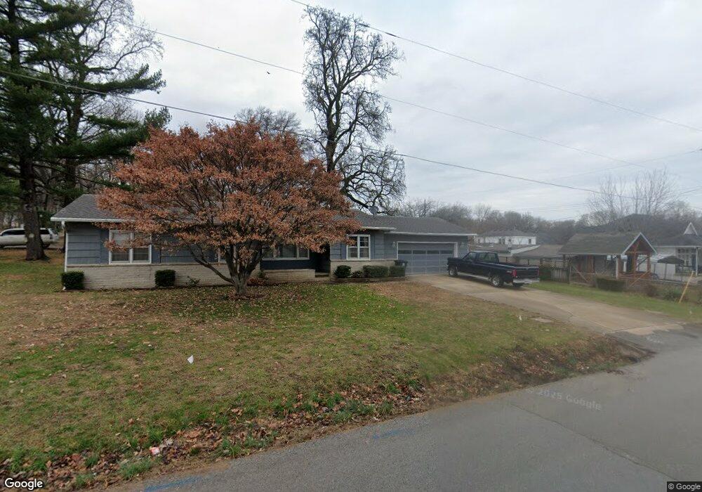
738 E Devon St Independence, MO 64055
Hanthorn NeighborhoodEstimated Value: $184,000 - $228,799
3
Beds
1
Bath
1,302
Sq Ft
$158/Sq Ft
Est. Value
About This Home
This home is located at 738 E Devon St, Independence, MO 64055 and is currently estimated at $205,200, approximately $157 per square foot. 738 E Devon St is a home located in Jackson County with nearby schools including Sycamore Hills Elementary School, Bridger Middle School, and Pioneer Ridge Middle School.
Create a Home Valuation Report for This Property
The Home Valuation Report is an in-depth analysis detailing your home's value as well as a comparison with similar homes in the area
Home Values in the Area
Average Home Value in this Area
Tax History
| Year | Tax Paid | Tax Assessment Tax Assessment Total Assessment is a certain percentage of the fair market value that is determined by local assessors to be the total taxable value of land and additions on the property. | Land | Improvement |
|---|---|---|---|---|
| 2025 | $2,052 | $30,906 | $4,963 | $25,943 |
| 2024 | $2,052 | $29,613 | $3,842 | $25,771 |
| 2023 | $2,005 | $29,614 | $2,569 | $27,045 |
| 2022 | $1,726 | $23,370 | $5,345 | $18,025 |
| 2021 | $1,726 | $23,370 | $5,345 | $18,025 |
| 2020 | $1,654 | $21,759 | $5,345 | $16,414 |
| 2019 | $1,627 | $21,759 | $5,345 | $16,414 |
| 2018 | $1,483 | $18,937 | $4,652 | $14,285 |
| 2017 | $1,483 | $18,937 | $4,652 | $14,285 |
| 2016 | $1,314 | $16,614 | $2,936 | $13,678 |
Source: Public Records
Map
Nearby Homes
- 735 E Devon St
- 718 E Gudgell Ave
- 921 E Manor Rd
- 603 E Myrtle St
- 421 E Angus St
- 1340 S Emery Ave
- 660 E Red Rd
- 1339 S Hocker Ave
- 1312 S Pearl St
- 1402 S Dodgion Ave
- 1120 S Leslie St
- 2705 S Haden Ct
- 912 E Stone St
- 2800 S Woodbury Dr
- 2724 S Woodbury Dr
- 1040 E Stone St
- 1954 S Lake Terrace
- 15804 E 27th St S
- 914 E South Ave
- 220 E Hansen Ct
- 833 E Hereford Ave
- 736 E Devon St
- 800 E Devon St
- 745 E Devon St
- 831 E Hereford Ave
- 801 E Devon St
- 741 E Devon St
- 1603 S Crane St
- 804 E Devon St
- 823 E Hereford Ave
- 734 E Devon St
- 1608 S Crane St
- 803 E Devon St
- 805 E Hereford Ave
- 908 E Hereford Ave
- 813 E Devon St
- 801 E Hereford Ave
- 726 E Gudgell Ave
- 806 E Devon St
- 806 E Devon St
Your Personal Tour Guide
Ask me questions while you tour the home.