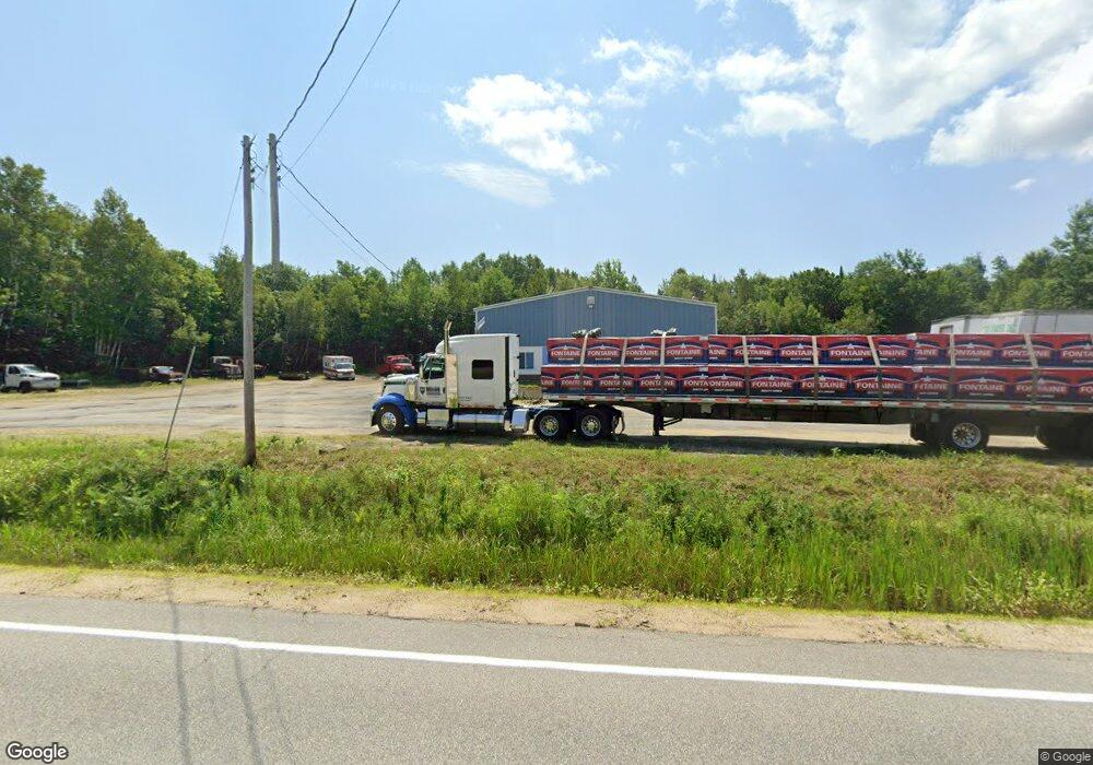
738 Main St Sumner, ME 04292
Estimated Value: $150,270
Studio
--
Bath
4,080
Sq Ft
$37/Sq Ft
Est. Value
About This Home
This home is located at 738 Main St, Sumner, ME 04292 and is currently estimated at $150,270, approximately $36 per square foot. 738 Main St is a home located in Oxford County with nearby schools including Hartford-Sumner Elementary School, Buckfield Junior/Senior High School, and West Sumner Christian School.
Ownership History
Date
Name
Owned For
Owner Type
Purchase Details
Closed on
Nov 10, 2025
Sold by
W A Lucas Enterprises Llc
Bought by
Lucas Weldon R and Lucas Rhonda H
Current Estimated Value
Purchase Details
Closed on
Aug 31, 2016
Sold by
Farrar Pamela M
Bought by
Wa Lucas Enterprises L
Home Financials for this Owner
Home Financials are based on the most recent Mortgage that was taken out on this home.
Original Mortgage
$120,000
Interest Rate
3.45%
Mortgage Type
New Conventional
Create a Home Valuation Report for This Property
The Home Valuation Report is an in-depth analysis detailing your home's value as well as a comparison with similar homes in the area
Purchase History
| Date | Buyer | Sale Price | Title Company |
|---|---|---|---|
| Lucas Weldon R | $150,000 | -- | |
| Wa Lucas Enterprises L | -- | -- |
Source: Public Records
Mortgage History
| Date | Status | Borrower | Loan Amount |
|---|---|---|---|
| Previous Owner | Wa Lucas Enterprises L | $120,000 |
Source: Public Records
Tax History
| Year | Tax Paid | Tax Assessment Tax Assessment Total Assessment is a certain percentage of the fair market value that is determined by local assessors to be the total taxable value of land and additions on the property. | Land | Improvement |
|---|---|---|---|---|
| 2025 | $3,306 | $211,916 | $51,480 | $160,436 |
| 2024 | $2,755 | $211,916 | $51,480 | $160,436 |
| 2023 | $2,700 | $127,950 | $34,600 | $93,350 |
| 2022 | $2,642 | $127,950 | $34,600 | $93,350 |
| 2021 | $2,642 | $127,950 | $34,600 | $93,350 |
| 2020 | $1,587 | $127,950 | $34,600 | $93,350 |
| 2019 | $2,604 | $127,950 | $34,600 | $93,350 |
| 2018 | $1,584 | $127,950 | $34,600 | $93,350 |
| 2017 | $2,341 | $127,950 | $34,600 | $93,350 |
| 2016 | $1,357 | $127,950 | $34,600 | $93,350 |
| 2015 | $2,098 | $127,950 | $34,600 | $93,350 |
| 2014 | $2,047 | $127,950 | $34,600 | $93,350 |
| 2013 | $2,009 | $127,950 | $34,600 | $93,350 |
Source: Public Records
Map
Nearby Homes
- 729 Main St
- 585 Main St
- 42 Front St
- 20 Front St
- 15 Front St
- 67 Fields Hill Rd
- 66 Ridge Rd
- 409 Gammon Rd
- M19 L6-6 Tuell Hill Rd
- 1443 Main St
- 105 Arthur Allen Rd
- 14 Butterfield Rd
- Lots 10&11 Davenport Rd
- 289 Tucker Rd
- 20 Kittridge Brook Rd
- 14 Mcneil Rd
- Lot#32 Beech Ridge Ln
- 71 Mountain View Dr
- 216 Brock School Rd
- Lot A Blackberry Ln
- 740 Main St
- 615 Main St
- 753 Main St
- 719 Main St
- 755 Main St
- 759 Main St
- 767 Main St
- 782 Main St
- 707 Main St
- 0 Sumner Hill Rd Unit 1068042
- 24 Lower Sumner Hill Rd
- 10 Upper Sumner Hill Rd
- 801 Main St
- 27 Lower Sumner Hill Rd
- 21 Lower Sumner Hill Rd
- 47 Upper Sumner Hill Rd
- 57 Upper Sumner Hill Rd
- 814 Main (Route 219)
- 814 Main Street Route 219
- 25 Lower Sumner Hill Rd
Your Personal Tour Guide
Ask me questions while you tour the home.
