Estimated Value: $124,607 - $409,000
2
Beds
2
Baths
1,392
Sq Ft
$188/Sq Ft
Est. Value
About This Home
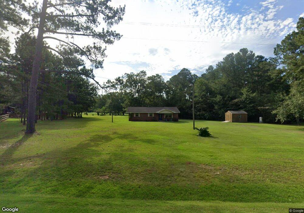
This home is located at 7387 Ga Highway 111 S, Cairo, GA 39828 and is currently estimated at $261,902, approximately $188 per square foot. 7387 Ga Highway 111 S is a home.
Ownership History
Date
Name
Owned For
Owner Type
Purchase Details
Closed on
Jul 18, 2023
Sold by
Nelson Vicki Lynn
Bought by
Nelson Andrea B
Current Estimated Value
Purchase Details
Closed on
Mar 31, 2023
Sold by
Nelson Tony Wayne Estate
Bought by
Nelson Vicki Lynn
Purchase Details
Closed on
Jan 8, 2020
Sold by
Nelson Andrea B
Bought by
Nelson Tony Wayne
Purchase Details
Closed on
Mar 25, 2011
Sold by
The Nelson Family Trust
Bought by
Nelson Andrea B
Purchase Details
Closed on
Nov 5, 2007
Sold by
Nelson Tony Wayne
Bought by
The Nelson Family Trust
Purchase Details
Closed on
Nov 13, 1998
Sold by
Nelson K Leroy
Bought by
Nelson Tony Wayne
Purchase Details
Closed on
Sep 3, 1976
Bought by
Nelson K Leroy
Create a Home Valuation Report for This Property
The Home Valuation Report is an in-depth analysis detailing your home's value as well as a comparison with similar homes in the area
Home Values in the Area
Average Home Value in this Area
Purchase History
| Date | Buyer | Sale Price | Title Company |
|---|---|---|---|
| Nelson Andrea B | -- | -- | |
| Nelson Vicki Lynn | -- | -- | |
| Nelson Tony Wayne | -- | -- | |
| Nelson Andrea B | -- | -- | |
| The Nelson Family Trust | -- | -- | |
| Nelson Tony Wayne | $12,000 | -- | |
| Nelson K Leroy | -- | -- |
Source: Public Records
Tax History Compared to Growth
Tax History
| Year | Tax Paid | Tax Assessment Tax Assessment Total Assessment is a certain percentage of the fair market value that is determined by local assessors to be the total taxable value of land and additions on the property. | Land | Improvement |
|---|---|---|---|---|
| 2024 | $1,202 | $39,072 | $1,854 | $37,218 |
| 2023 | $944 | $30,679 | $3,510 | $27,169 |
| 2022 | $944 | $30,679 | $3,510 | $27,169 |
| 2021 | $947 | $30,679 | $3,510 | $27,169 |
| 2020 | $951 | $30,679 | $3,510 | $27,169 |
| 2019 | $951 | $30,679 | $3,510 | $27,169 |
| 2018 | $892 | $30,679 | $3,510 | $27,169 |
| 2017 | $850 | $30,679 | $3,510 | $27,169 |
| 2016 | $737 | $26,467 | $3,510 | $22,957 |
| 2015 | $728 | $26,467 | $3,510 | $22,957 |
| 2014 | -- | $26,467 | $3,510 | $22,957 |
| 2013 | -- | $24,092 | $3,600 | $20,492 |
Source: Public Records
Map
Nearby Homes
- 114 Emily Ln
- 115 Isabelle Ln
- 48 Blue Bird Ct
- 7667 Tallahassee Hwy
- 0 Fla-Ga Hwy Unit 355337
- 4258 Lower Hawthorne Trail
- 235 2nd Ave
- 198 2nd Ave
- 9778 Florida Georgia Hwy
- 170 Pine Top Trail
- 185 Maggies Dr
- 151 Mcnair Rd
- 3621 Concord Rd
- 2525 Fairbanks Ferry Rd
- 1447 Deer Run Rd
- 226 My St
- XXXX Fairbanks Ferry Ct
- 2065 Wayside Farm Rd
- 13 Raven Run
- 205/225 Still Water Ln
- 116 Darsey Rd
- 116 Darsey Rd
- 7411 Ga Highway 111 S
- 134 Darsey Rd
- 152 Darsey Rd
- 107 Darsey Rd
- 123 Darsey Rd
- 157 Darsey Rd
- 188 Darsey Rd
- 250 Tobacco Cir
- 242 Tobacco Cir
- 165 Tobacco Cir Unit 1
- 165 Tobacco Cir
- 240 Darsey Rd
- 242 Darsey Rd
- 158 Tobacco Cir
- 2 States Ln
- 221 Limmer Ln
- 211 Limmer Ln
- 111 Emily Ln