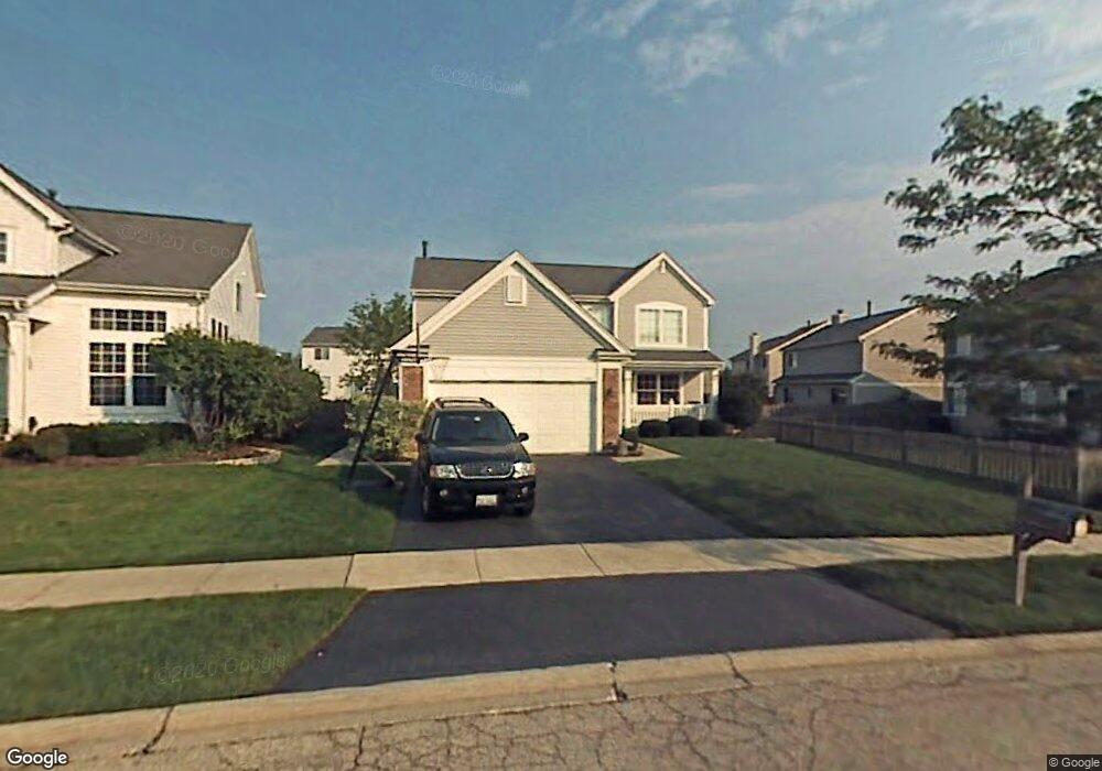
7387 Lenox Ct Gurnee, IL 60031
Estimated Value: $410,287 - $435,000
3
Beds
3
Baths
2,072
Sq Ft
$202/Sq Ft
Est. Value
About This Home
This home is located at 7387 Lenox Ct, Gurnee, IL 60031 and is currently estimated at $419,572, approximately $202 per square foot. 7387 Lenox Ct is a home located in Lake County with nearby schools including Woodland Primary School, Woodland Intermediate School, and Woodland Elementary School.
Ownership History
Date
Name
Owned For
Owner Type
Purchase Details
Closed on
May 29, 1996
Sold by
American National Bk & Tr Co Of Chicago
Bought by
Hennigan Robert and Hennigan Cathy
Current Estimated Value
Home Financials for this Owner
Home Financials are based on the most recent Mortgage that was taken out on this home.
Original Mortgage
$164,350
Interest Rate
8.33%
Create a Home Valuation Report for This Property
The Home Valuation Report is an in-depth analysis detailing your home's value as well as a comparison with similar homes in the area
Home Values in the Area
Average Home Value in this Area
Purchase History
| Date | Buyer | Sale Price | Title Company |
|---|---|---|---|
| Hennigan Robert | $183,000 | Ticor Title Insurance Compan |
Source: Public Records
Mortgage History
| Date | Status | Borrower | Loan Amount |
|---|---|---|---|
| Previous Owner | Hennigan Robert | $164,350 |
Source: Public Records
Tax History Compared to Growth
Tax History
| Year | Tax Paid | Tax Assessment Tax Assessment Total Assessment is a certain percentage of the fair market value that is determined by local assessors to be the total taxable value of land and additions on the property. | Land | Improvement |
|---|---|---|---|---|
| 2024 | $9,672 | $114,631 | $14,144 | $100,487 |
| 2023 | $8,731 | $106,426 | $13,132 | $93,294 |
| 2022 | $8,731 | $95,569 | $13,690 | $81,879 |
| 2021 | $7,887 | $91,735 | $13,141 | $78,594 |
| 2020 | $7,630 | $89,480 | $12,818 | $76,662 |
| 2019 | $7,411 | $86,882 | $12,446 | $74,436 |
| 2018 | $7,481 | $88,708 | $16,203 | $72,505 |
| 2017 | $7,400 | $86,166 | $15,739 | $70,427 |
| 2016 | $7,337 | $82,329 | $15,038 | $67,291 |
| 2015 | $7,140 | $78,081 | $14,262 | $63,819 |
| 2014 | $6,109 | $68,092 | $13,998 | $54,094 |
| 2012 | $5,794 | $68,613 | $14,105 | $54,508 |
Source: Public Records
Map
Nearby Homes
- 1601 Newgate Ct
- 1603 Napa Dr
- 7623 Beringer Ct
- 1593 Vineyard Dr
- 36077 N Bridlewood Ave
- 17876 W Braewick Rd
- 17775 W Braewick Rd
- 7390 Bittersweet Dr
- 1075 Suffolk Ct
- 17820 W Braewick Rd
- 1094 Vista Dr
- 6877 W Mount Vernon Ct Unit 4A
- 36253 N Bridlewood Ave
- 17781 W Elsbury St
- 7493 Bittersweet Dr
- 18325 W Lakeview Terrace
- 6797 Roanoake Ct
- 6771 E Wellsley Ct
- 36259 N Field View Dr
- 18229 W Banbury Dr
- 7381 Lenox Ct
- 1501 Woodbury Cir
- 1495 Woodbury Cir
- 1320 Almaden Ln
- 7375 Lenox Ct
- 1318 Almaden Ln
- 1489 Woodbury Cir
- 1316 Almaden Ln
- 7386 Lenox Ct Unit 3
- 7378 Lenox Ct
- 7367 Lenox Ct Unit 3
- 7394 Lenox Ct
- 1312 Almaden Ln
- 7370 Lenox Ct
- 7361 Lenox Ct
- 1527 Woodbury Cir
- 1494 Woodbury Cir
- 1480 Woodbury Cir
- 1500 Woodbury Cir
- 1310 Almaden Ln