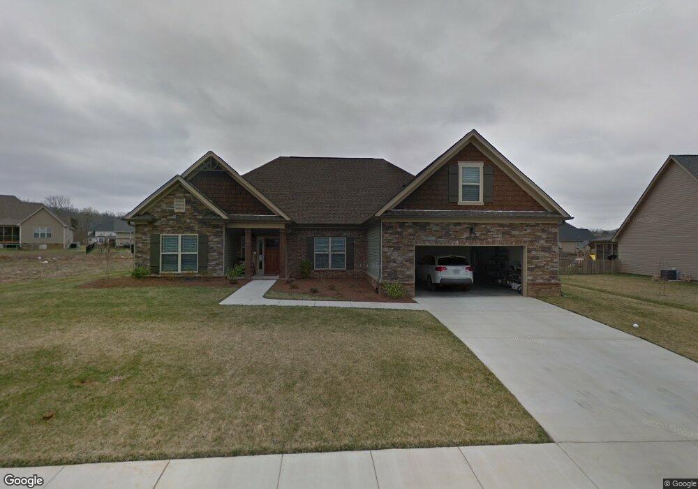
7388 Red Poppy Dr Unit 57 Ooltewah, TN 37363
Estimated Value: $535,000 - $562,000
3
Beds
3
Baths
2,794
Sq Ft
$196/Sq Ft
Est. Value
About This Home
This home is located at 7388 Red Poppy Dr Unit 57, Ooltewah, TN 37363 and is currently estimated at $548,182, approximately $196 per square foot. 7388 Red Poppy Dr Unit 57 is a home located in Hamilton County with nearby schools including Ooltewah Elementary School, Hunter Middle School, and Ooltewah High School.
Ownership History
Date
Name
Owned For
Owner Type
Purchase Details
Closed on
Aug 30, 2024
Sold by
Wallace David L and Kim Anne
Bought by
Ratajski Michael
Current Estimated Value
Purchase Details
Closed on
Jun 1, 2020
Sold by
Guajardo Lisa R
Bought by
Wallace David L and Wallace Kim Anne
Home Financials for this Owner
Home Financials are based on the most recent Mortgage that was taken out on this home.
Original Mortgage
$206,000
Interest Rate
3.3%
Mortgage Type
New Conventional
Purchase Details
Closed on
Dec 12, 2012
Sold by
Rogers Family Farm Inc
Bought by
Pratt Homebuilders Llc
Home Financials for this Owner
Home Financials are based on the most recent Mortgage that was taken out on this home.
Original Mortgage
$242,400
Interest Rate
3.43%
Mortgage Type
Construction
Create a Home Valuation Report for This Property
The Home Valuation Report is an in-depth analysis detailing your home's value as well as a comparison with similar homes in the area
Home Values in the Area
Average Home Value in this Area
Purchase History
| Date | Buyer | Sale Price | Title Company |
|---|---|---|---|
| Ratajski Michael | $535,000 | Jones Title | |
| Wallace David L | $356,000 | First Choice Title Inc | |
| Pratt Homebuilders Llc | $49,000 | Pioneer Title Agency Inc |
Source: Public Records
Mortgage History
| Date | Status | Borrower | Loan Amount |
|---|---|---|---|
| Previous Owner | Wallace David L | $206,000 | |
| Previous Owner | Pratt Homebuilders Llc | $242,400 |
Source: Public Records
Tax History Compared to Growth
Tax History
| Year | Tax Paid | Tax Assessment Tax Assessment Total Assessment is a certain percentage of the fair market value that is determined by local assessors to be the total taxable value of land and additions on the property. | Land | Improvement |
|---|---|---|---|---|
| 2024 | $1,971 | $88,075 | $0 | $0 |
| 2023 | $1,980 | $88,075 | $0 | $0 |
| 2022 | $1,980 | $88,075 | $0 | $0 |
| 2021 | $1,980 | $88,075 | $0 | $0 |
| 2020 | $2,146 | $77,275 | $0 | $0 |
| 2019 | $2,146 | $77,275 | $0 | $0 |
| 2018 | $2,146 | $77,275 | $0 | $0 |
| 2017 | $2,146 | $77,275 | $0 | $0 |
| 2016 | $2,064 | $0 | $0 | $0 |
| 2015 | $2,064 | $74,300 | $0 | $0 |
| 2014 | $2,064 | $0 | $0 | $0 |
Source: Public Records
Map
Nearby Homes
- 7470 Blazing Star Ct
- 7432 Hollyhock Ln
- 7990 Trout Lily Dr
- 8245 Shrewsbury Ln
- 8233 Shrewsbury Ln
- 8257 Shrewsbury Ln
- 8263 Shrewsbury Ln
- 8271 Shrewsbury Ln
- 8279 Shrewsbury Ln
- 7574 Catchfly Dr
- 8272 Shrewsbury Ln
- 8284 Shrewsbury Ln
- 8305 Shrewsbury Ln
- 8298 Shrewsbury Ln
- 8306 Shrewsbury Ln
- 8320 Shrewsbury Ln
- 7413 Mcdaniel Ln
- 7960 Vervena Dr
- 8502 Blanche Rd
- 8600 Wading Branch Ct
- 7388 Red Poppy Dr
- 7400 Red Poppy Dr
- 7400 Red Poppy Dr Unit Lt 369
- 7376 Red Poppy Dr Unit 367
- 7376 Red Poppy Dr
- 7399 Red Poppy Dr
- 7399 Red Poppy Dr Unit 355
- 7387 Red Poppy Dr
- 8045 Fox Glove Dr
- 8059 Fox Glove Dr
- 7364 Red Poppy Dr
- 7412 Red Poppy Dr
- 8073 Fox Glove Dr
- 7411 Red Poppy Dr
- 7998 Tranquility Dr
- 7375 Red Poppy Lt 357 Dr
- 7375 Red Poppy Dr
- 7974 Tranquility Dr
- 8031 Fox Glove Dr
- 7352 Red Poppy Dr