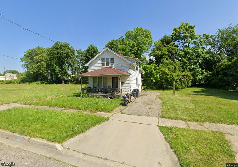
739 Addison St Flint, MI 48505
King Avenue Plus NeighborhoodEstimated Value: $36,000 - $83,000
4
Beds
2
Baths
960
Sq Ft
$62/Sq Ft
Est. Value
About This Home
This home is located at 739 Addison St, Flint, MI 48505 and is currently estimated at $59,632, approximately $62 per square foot. 739 Addison St is a home located in Genesee County with nearby schools including Brownell STEM Academy, Flint Cultural Center Academy, and Greater Heights Academy.
Ownership History
Date
Name
Owned For
Owner Type
Purchase Details
Closed on
Dec 6, 2017
Sold by
Asited Properties
Bought by
Twin Peaks 28 Inc
Current Estimated Value
Purchase Details
Closed on
Apr 25, 2008
Sold by
Trott & Trott Pc
Bought by
Asiled Properties Llc
Purchase Details
Closed on
Nov 14, 2007
Sold by
Mortgage Electronic Registration Systems
Bought by
Federal National Mortgage Association
Purchase Details
Closed on
Oct 19, 2007
Sold by
Verkennes Jason
Bought by
Mortgage Electronic Registration Systems
Purchase Details
Closed on
Dec 12, 2006
Sold by
Keels Larry G and Keels Sharon B
Bought by
Verkennes Jason
Create a Home Valuation Report for This Property
The Home Valuation Report is an in-depth analysis detailing your home's value as well as a comparison with similar homes in the area
Home Values in the Area
Average Home Value in this Area
Purchase History
| Date | Buyer | Sale Price | Title Company |
|---|---|---|---|
| Twin Peaks 28 Inc | -- | Cislo Title Co | |
| Asiled Properties Llc | $1,500 | Warranty Title Agency Llc | |
| Federal National Mortgage Association | -- | None Available | |
| Mortgage Electronic Registration Systems | $44,787 | None Available | |
| Verkennes Jason | $54,000 | Metropol |
Source: Public Records
Tax History Compared to Growth
Tax History
| Year | Tax Paid | Tax Assessment Tax Assessment Total Assessment is a certain percentage of the fair market value that is determined by local assessors to be the total taxable value of land and additions on the property. | Land | Improvement |
|---|---|---|---|---|
| 2025 | $62 | $0 | $0 | $0 |
| 2024 | $62 | $0 | $0 | $0 |
| 2023 | $72 | $0 | $0 | $0 |
| 2022 | $0 | $0 | $0 | $0 |
| 2021 | $268 | $0 | $0 | $0 |
| 2020 | $268 | $0 | $0 | $0 |
| 2019 | $277 | $0 | $0 | $0 |
| 2018 | $473 | $3,600 | $0 | $0 |
| 2017 | $434 | $0 | $0 | $0 |
| 2016 | $432 | $0 | $0 | $0 |
| 2015 | -- | $0 | $0 | $0 |
| 2014 | -- | $0 | $0 | $0 |
| 2012 | -- | $4,100 | $0 | $0 |
Source: Public Records
Map
Nearby Homes
- 613 E van Wagoner Ave
- 4028 North St
- 638 E Pasadena Ave
- 606 Damon St
- 418 Damon St
- 3810 Marvin St
- 3312 Buick St
- 370 E Moore St
- 733 Black Ave
- 313 Edwin Ave
- 3506 Esther St
- 0 E Marengo Ave Unit 50166417
- 218 E Jackson Ave
- 618 E Pulaski Ave
- 680 E Pierson Rd
- 2913 Martin Luther King Ave
- 2913
- 200 W Mcclellan St
- 124 W Flint Park Blvd
- 726 E Parkway Ave