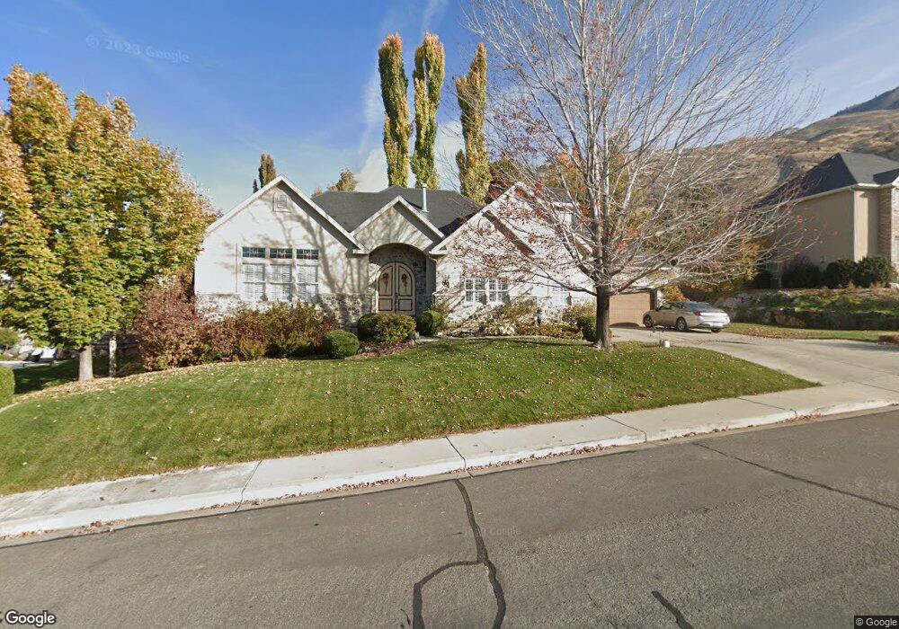
739 E 600 N Unit 10 Lindon, UT 84042
Estimated Value: $808,029 - $955,000
4
Beds
4
Baths
2,163
Sq Ft
$415/Sq Ft
Est. Value
About This Home
This home is located at 739 E 600 N Unit 10, Lindon, UT 84042 and is currently estimated at $897,010, approximately $414 per square foot. 739 E 600 N Unit 10 is a home located in Utah County with nearby schools including Lindon Elementary School, Oak Canyon Junior High School, and Pleasant Grove High School.
Ownership History
Date
Name
Owned For
Owner Type
Purchase Details
Closed on
Dec 11, 2006
Sold by
Galland Matthew C and Galland Erica V
Bought by
Walker Kurt and Walker Susan
Current Estimated Value
Purchase Details
Closed on
Apr 8, 2004
Sold by
Casper Brion J and Casper Kim
Bought by
Galland Matthew C and Galland Erica
Create a Home Valuation Report for This Property
The Home Valuation Report is an in-depth analysis detailing your home's value as well as a comparison with similar homes in the area
Home Values in the Area
Average Home Value in this Area
Purchase History
| Date | Buyer | Sale Price | Title Company |
|---|---|---|---|
| Walker Kurt | -- | First American Title Agency | |
| Galland Matthew C | -- | Horizon Title Insurance |
Source: Public Records
Tax History
| Year | Tax Paid | Tax Assessment Tax Assessment Total Assessment is a certain percentage of the fair market value that is determined by local assessors to be the total taxable value of land and additions on the property. | Land | Improvement |
|---|---|---|---|---|
| 2025 | $3,085 | $411,455 | -- | -- |
| 2024 | $3,085 | $380,325 | $0 | $0 |
| 2023 | $2,966 | $392,700 | $0 | $0 |
| 2022 | $3,458 | $442,365 | $0 | $0 |
| 2021 | $3,346 | $645,400 | $211,200 | $434,200 |
| 2020 | $3,210 | $609,500 | $192,000 | $417,500 |
| 2019 | $3,001 | $594,400 | $176,900 | $417,500 |
| 2018 | $2,959 | $552,600 | $161,800 | $390,800 |
| 2017 | $2,735 | $273,845 | $0 | $0 |
| 2016 | $2,669 | $247,170 | $0 | $0 |
| 2015 | $2,622 | $229,570 | $0 | $0 |
| 2014 | $2,354 | $204,160 | $0 | $0 |
Source: Public Records
Map
Nearby Homes
- 739 E 600 N
- 734 E 640 N
- 734 E 640 N Unit 19
- 717 E 600 N
- 717 E 600 N Unit 11
- 763 E 600 N
- 763 E 600 N Unit 9
- 718 E 640 N
- 718 E 640 N Unit 18
- 726 E 600 N
- 758 E 600 N
- 758 E 600 N Unit 3
- 774 E 640 N
- 683 E 600 N
- 683 E 600 N Unit 12
- 743 E 640 N
- 743 E 640 N Unit 27
- 684 E 640 N
- 684 E 640 N Unit 17
- 692 E 600 N
Your Personal Tour Guide
Ask me questions while you tour the home.