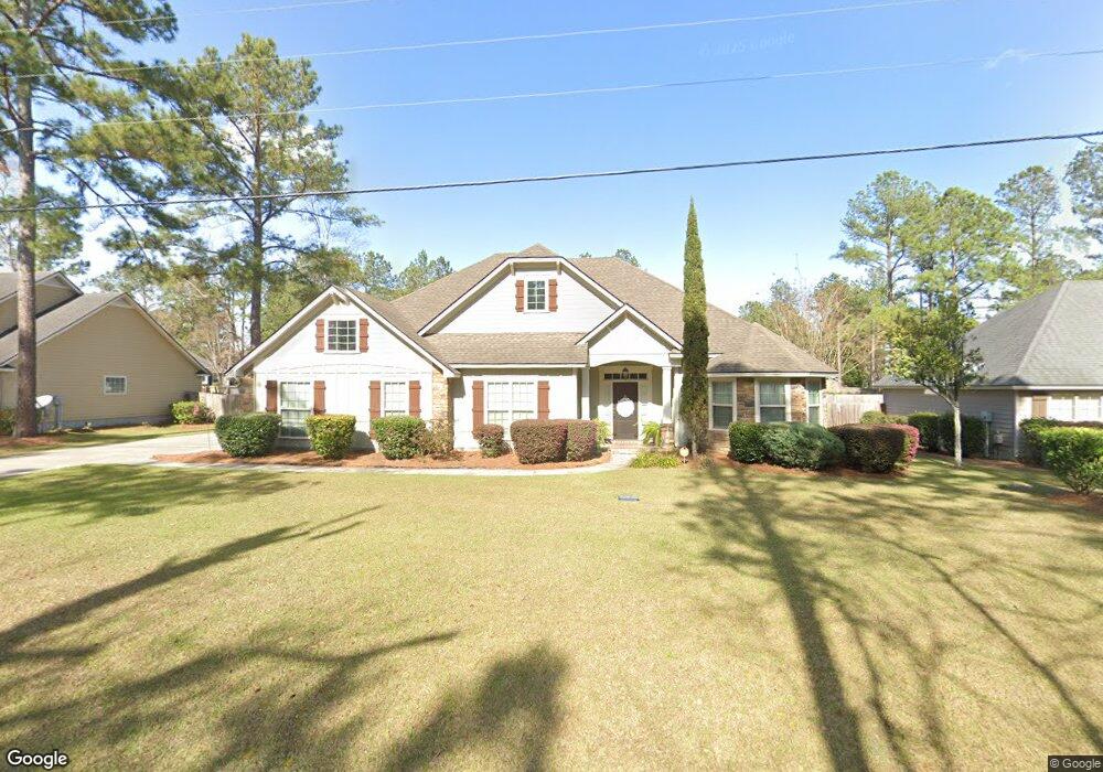
739 Fry Rd Hahira, GA 31632
Estimated Value: $317,496
3
Beds
3
Baths
1,835
Sq Ft
$173/Sq Ft
Est. Value
About This Home
This home is located at 739 Fry Rd, Hahira, GA 31632 and is currently estimated at $317,496, approximately $173 per square foot. 739 Fry Rd is a home located in Lowndes County with nearby schools including Hahira Elementary School, Hahira Middle School, and Lowndes High School.
Ownership History
Date
Name
Owned For
Owner Type
Purchase Details
Closed on
May 6, 2022
Sold by
Register Isaac A
Bought by
Cain Maribrook and Cain Ty
Current Estimated Value
Home Financials for this Owner
Home Financials are based on the most recent Mortgage that was taken out on this home.
Original Mortgage
$273,505
Outstanding Balance
$258,424
Interest Rate
4.67%
Mortgage Type
New Conventional
Estimated Equity
$59,072
Purchase Details
Closed on
Dec 12, 2012
Sold by
Blake Taylor Developments
Bought by
Register Isaac A
Home Financials for this Owner
Home Financials are based on the most recent Mortgage that was taken out on this home.
Original Mortgage
$203,200
Interest Rate
3.38%
Mortgage Type
New Conventional
Purchase Details
Closed on
Feb 7, 2012
Purchase Details
Closed on
Mar 30, 2004
Bought by
Foxborough Development Corporation
Create a Home Valuation Report for This Property
The Home Valuation Report is an in-depth analysis detailing your home's value as well as a comparison with similar homes in the area
Home Values in the Area
Average Home Value in this Area
Purchase History
| Date | Buyer | Sale Price | Title Company |
|---|---|---|---|
| Cain Maribrook | $287,900 | -- | |
| Register Isaac A | $213,900 | -- | |
| -- | $24,000 | -- | |
| Blake Taylor Developments Inc | $24,000 | -- | |
| Foxborough Development Corporation | -- | -- |
Source: Public Records
Mortgage History
| Date | Status | Borrower | Loan Amount |
|---|---|---|---|
| Open | Cain Maribrook | $273,505 | |
| Previous Owner | Register Isaac A | $203,200 |
Source: Public Records
Tax History Compared to Growth
Tax History
| Year | Tax Paid | Tax Assessment Tax Assessment Total Assessment is a certain percentage of the fair market value that is determined by local assessors to be the total taxable value of land and additions on the property. | Land | Improvement |
|---|---|---|---|---|
| 2024 | $3,094 | $118,702 | $16,000 | $102,702 |
| 2023 | $2,997 | $111,366 | $16,000 | $95,366 |
| 2022 | $2,923 | $98,792 | $16,000 | $82,792 |
| 2021 | $2,251 | $76,869 | $9,600 | $67,269 |
| 2020 | $2,282 | $76,869 | $9,600 | $67,269 |
| 2019 | $2,301 | $76,869 | $9,600 | $67,269 |
| 2018 | $2,240 | $74,365 | $9,600 | $64,765 |
| 2017 | $2,272 | $74,365 | $9,600 | $64,765 |
| 2016 | $2,055 | $67,618 | $9,600 | $58,018 |
| 2015 | $1,982 | $67,618 | $9,600 | $58,018 |
| 2014 | $2,017 | $67,618 | $9,600 | $58,018 |
Source: Public Records
Map
Nearby Homes
- The Walker Plan at Reynolda Place
- The Belfort Plan at Reynolda Place
- The Ozark Plan at Reynolda Place
- The Beau Plan at Reynolda Place
- 605 S Nelson St
- 627 Stagecoach Trail
- 1055 Angie Ln
- 1063 Angie Ln
- 1105 Hannah Dr
- 1109 Hannah Dr
- 1130 Hannah Dr
- 1131 Hannah Dr
- 1135 Hannah Dr
- 1139 Hannah Dr
- 1159 Hannah Dr
- 3001 Houser Way
- 497 Bryson Cir
- 489 Bryson Cir
- 601 Katherine Ln
- 824 Danielle Way
- 739 Fry Rd
- 0 Honeycomb Dr Unit 21243
- 0 Honeycomb Dr Unit 10241351
- 0 Honeycomb Dr Unit 20863
- 0 Honeycomb Dr Unit 10182741
- 743 Fry Rd
- 737 Fry Rd
- 534 Cottonwood Cove
- 747 Fry Rd
- 747 Fry Rd
- 540 Cottonwood Cove
- 724 Lawson Farms Rd
- 523 Cottonwood Cove
- 531 Cottonwood Cove
- 751 Fry Rd
- 535 Cottonwood Cove
- 535 Cottonwood Cove
- 751 Fry Rd
- 527 Cottonwood Cove
- 730 Lawson Farms Rd