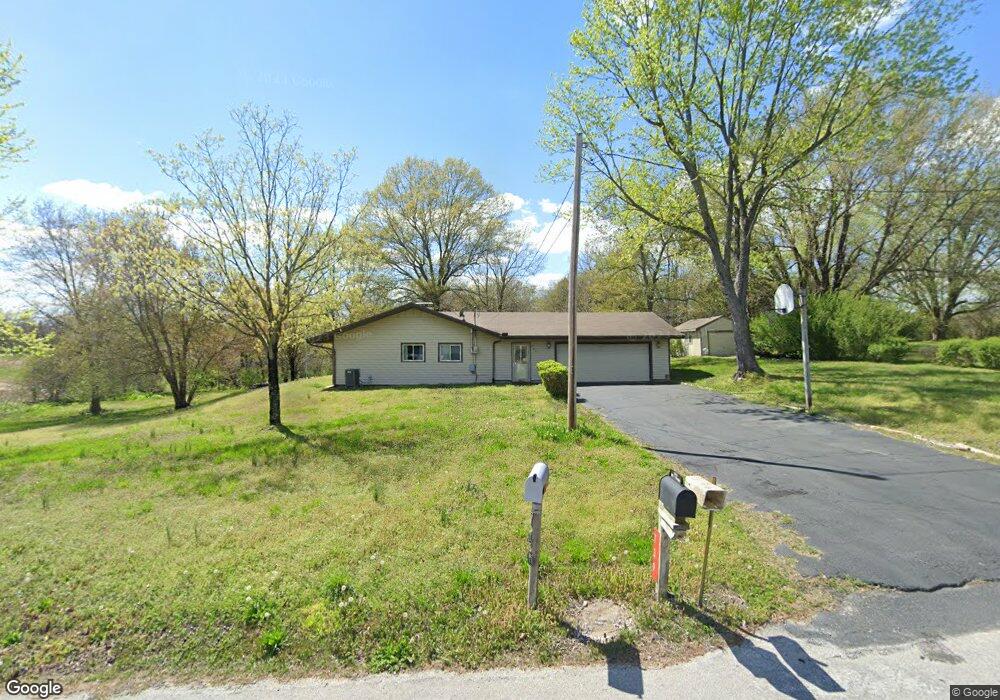
739 S McCrite Ave Springfield, MO 65802
Southeast Springfield NeighborhoodEstimated Value: $335,225 - $500,000
3
Beds
1
Bath
2,128
Sq Ft
$190/Sq Ft
Est. Value
About This Home
This home is located at 739 S McCrite Ave, Springfield, MO 65802 and is currently estimated at $403,556, approximately $189 per square foot. 739 S McCrite Ave is a home located in Greene County with nearby schools including Strafford Elementary School, Strafford Middle School, and Strafford High School.
Ownership History
Date
Name
Owned For
Owner Type
Purchase Details
Closed on
Aug 7, 2021
Sold by
Weeks Diane Kay
Bought by
Weeks Diane Kay and Weeks Brian Lane
Current Estimated Value
Purchase Details
Closed on
Dec 27, 2011
Sold by
Waterman Ginnette M
Bought by
Weeks Diane Kay
Purchase Details
Closed on
Dec 19, 2011
Sold by
Jacobs Danette M
Bought by
Weeks Diane Kay
Purchase Details
Closed on
Dec 16, 2011
Sold by
Weeks Jerry L
Bought by
Weeks Diane Kay
Purchase Details
Closed on
Jul 30, 2009
Sold by
Shuman Shay
Bought by
Weeks Diane Kay
Purchase Details
Closed on
Feb 9, 2008
Sold by
Weeks Brian
Bought by
Weeks Diane Kay
Purchase Details
Closed on
Feb 8, 2008
Sold by
Weeks Daryl
Bought by
Weeks Diane Kay
Create a Home Valuation Report for This Property
The Home Valuation Report is an in-depth analysis detailing your home's value as well as a comparison with similar homes in the area
Home Values in the Area
Average Home Value in this Area
Purchase History
| Date | Buyer | Sale Price | Title Company |
|---|---|---|---|
| Weeks Diane Kay | -- | None Available | |
| Weeks Diane Kay | -- | None Available | |
| Weeks Diane Kay | -- | None Available | |
| Weeks Diane Kay | -- | None Available | |
| Weeks Diane Kay | -- | None Available | |
| Weeks Diane Kay | -- | None Available | |
| Weeks Diane Kay | -- | None Available | |
| Weeks Diane Kay | -- | None Available | |
| Weeks Diane Kay | -- | None Available |
Source: Public Records
Tax History Compared to Growth
Tax History
| Year | Tax Paid | Tax Assessment Tax Assessment Total Assessment is a certain percentage of the fair market value that is determined by local assessors to be the total taxable value of land and additions on the property. | Land | Improvement |
|---|---|---|---|---|
| 2025 | $1,595 | $32,760 | $7,830 | $24,930 |
| 2024 | $1,595 | $29,220 | $5,870 | $23,350 |
| 2023 | $1,606 | $29,220 | $5,870 | $23,350 |
| 2022 | $1,351 | $25,930 | $5,870 | $20,060 |
| 2021 | $1,271 | $25,930 | $5,870 | $20,060 |
| 2020 | $1,226 | $24,600 | $5,870 | $18,730 |
| 2019 | $1,221 | $24,600 | $5,870 | $18,730 |
| 2018 | $1,070 | $21,390 | $5,870 | $15,520 |
| 2017 | $1,061 | $21,370 | $5,870 | $15,500 |
| 2016 | $1,056 | $21,370 | $5,870 | $15,500 |
| 2015 | $1,054 | $21,370 | $5,870 | $15,500 |
| 2014 | $1,052 | $21,150 | $5,870 | $15,280 |
Source: Public Records
Map
Nearby Homes
- Lot 10 Farm Road 134
- Lot 7 Farm Road 134
- Lot 11 Farm Road 134
- Lot 12 Farm Road 134
- Lot 8 Farm Road 134
- Lot 6 Farm Road 134
- Lot 13 Farm Road 134
- Lot 3 Farm Road 134
- Lot 2 Farm Road 134
- 5854 E Sumac Ln
- 1318 S Farm Road 205
- 5757 E Meadowmere St
- 5724 E Farm Road 132
- 5724 E Mill St
- Lot 14 E Farm Road 132
- 5295 E Farm Road 138
- 1410 S Briar Ave
- 5159 E Cherry Hills Blvd
- 608 S Yellowwood Dr
- 5055 E Cherry Place
- 695 S McCrite Ave
- 746 S McCrite Ave
- 6107 E Farm Road 138
- 883 S Auberry Ln
- 749 S Roberts Dr
- 694 S McCrite Ave
- 697 S Roberts Dr
- Tbd S River Hills
- 633 S McCrite Ave
- 805 S Auberry Ln
- 0 S Roberts Dr Unit 60039798
- 702 S Roberts Dr
- 826 S Farm Road 207
- 826 S Farm Rd 207
- 6325 E Farm Road 138
- 6157 E Roberts Ln
- 6093 E Farm Road 138
- 6173 E Roberts Ln
- 000 E Roberts Ln
- 440 S Farm Road 205