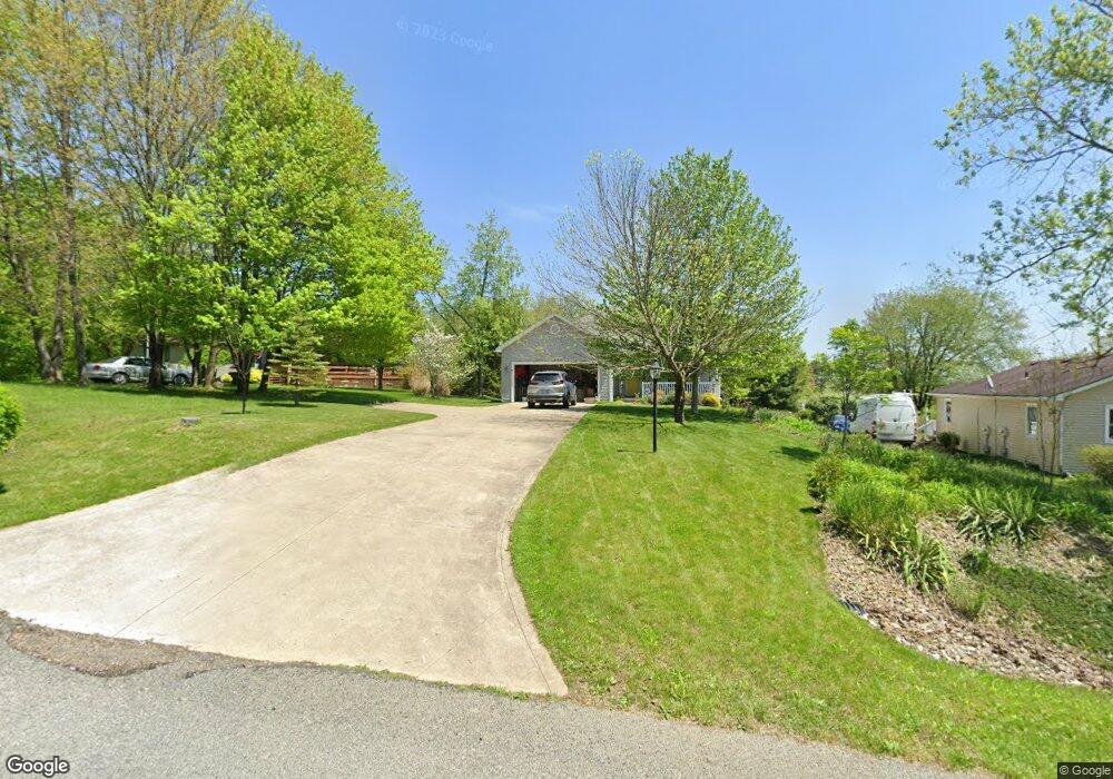
739 Winesap Cir Howard, OH 43028
Apple Valley NeighborhoodEstimated Value: $330,000 - $457,000
3
Beds
2
Baths
1,993
Sq Ft
$200/Sq Ft
Est. Value
About This Home
This home is located at 739 Winesap Cir, Howard, OH 43028 and is currently estimated at $399,557, approximately $200 per square foot. 739 Winesap Cir is a home located in Knox County with nearby schools including East Knox Elementary School and East Knox High School.
Ownership History
Date
Name
Owned For
Owner Type
Purchase Details
Closed on
Jul 28, 2006
Sold by
Stewart Laird D and Stewart Erika
Bought by
Stewart Jana L
Current Estimated Value
Purchase Details
Closed on
Dec 28, 2005
Sold by
Elliott George J and Elliott Tracy L
Bought by
Stewart Laird D
Purchase Details
Closed on
Feb 10, 2000
Sold by
Wagner Phillip
Bought by
Elliott George J and Elliott Tracy
Purchase Details
Closed on
Jan 28, 1988
Sold by
Masseria John P and Masseria Allison
Bought by
Wagner Phillip
Create a Home Valuation Report for This Property
The Home Valuation Report is an in-depth analysis detailing your home's value as well as a comparison with similar homes in the area
Home Values in the Area
Average Home Value in this Area
Purchase History
| Date | Buyer | Sale Price | Title Company |
|---|---|---|---|
| Stewart Jana L | -- | None Available | |
| Stewart Laird D | $5,625 | None Available | |
| Elliott George J | $4,000 | -- | |
| Wagner Phillip | $1,000 | -- |
Source: Public Records
Tax History Compared to Growth
Tax History
| Year | Tax Paid | Tax Assessment Tax Assessment Total Assessment is a certain percentage of the fair market value that is determined by local assessors to be the total taxable value of land and additions on the property. | Land | Improvement |
|---|---|---|---|---|
| 2024 | $3,916 | $107,510 | $4,540 | $102,970 |
| 2023 | $3,916 | $107,510 | $4,540 | $102,970 |
| 2022 | $3,053 | $74,150 | $3,130 | $71,020 |
| 2021 | $3,053 | $74,150 | $3,130 | $71,020 |
| 2020 | $2,907 | $74,150 | $3,130 | $71,020 |
| 2019 | $2,428 | $58,820 | $3,080 | $55,740 |
| 2018 | $2,274 | $58,820 | $3,080 | $55,740 |
| 2017 | $2,253 | $58,820 | $3,080 | $55,740 |
| 2016 | $2,089 | $54,460 | $2,850 | $51,610 |
| 2015 | $1,901 | $54,460 | $2,850 | $51,610 |
| 2014 | $1,904 | $54,460 | $2,850 | $51,610 |
| 2013 | $2,027 | $54,970 | $3,480 | $51,490 |
Source: Public Records
Map
Nearby Homes
- 719 Winesap Cir
- 406 Crabapple Dr
- 318 Crabapple Dr
- 770 Winesap Cir
- 214 Crabapple Dr
- 667 Winesap Cir
- 558 Crabapple Dr
- 531 Crabapple Dr
- 610 Crabapple Dr
- 265 Lakeview Heights Dr
- 1257 Apple Valley Dr
- 177 Lakeview Heights Dr
- 1176 Apple Valley Dr
- 882 Winesap Dr
- 882 Winesap Dr Unit 197
- 93 Crabapple Ct
- 232 Northern Spy Dr
- 890 Winesap Dr
- 360 Baldwin Dr
- 43 Hawkeye Ct
- 743 Winesap Cir
- 471 Winesap Cir
- 37 Jonathon Ct
- 751 Winesap Cir
- 750 Winesap Cir
- 28 Jonathon Ct
- 754 Winesap Cir
- 0 Jonathon Ct Unit 531/532 211005758
- 0 Jonathon Ct Unit Lot 531/532
- 0 Jonathon Ct Unit Lot 531 / 532
- 135 Jonathon Dr
- 29 Jonathon Ct
- 758 Winesap Cir
- 163 Jonathon Dr
- 123 Jonathon Dr
- 763 Winesap Cir
- 155 Jonathon Dr
- 398 Crabapple Dr
- 714 Winesap Cir
- 119 Jonathon Dr