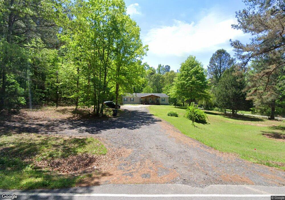
7390 Westbrook Rd Gainesville, GA 30506
Estimated Value: $290,000 - $358,000
3
Beds
2
Baths
2,040
Sq Ft
$154/Sq Ft
Est. Value
About This Home
This home is located at 7390 Westbrook Rd, Gainesville, GA 30506 and is currently estimated at $313,454, approximately $153 per square foot. 7390 Westbrook Rd is a home located in Forsyth County with nearby schools including Chestatee Elementary School, Little Mill Middle School, and War Hill Christian Academy.
Ownership History
Date
Name
Owned For
Owner Type
Purchase Details
Closed on
Aug 12, 2021
Sold by
Delay Colton Dale
Bought by
Burruss Loraine W and Burruss William D
Current Estimated Value
Home Financials for this Owner
Home Financials are based on the most recent Mortgage that was taken out on this home.
Original Mortgage
$138,000
Outstanding Balance
$125,296
Interest Rate
2.8%
Mortgage Type
New Conventional
Estimated Equity
$188,158
Purchase Details
Closed on
Nov 20, 2018
Sold by
Delay Rocky Lee
Bought by
Delay Colton Dale
Purchase Details
Closed on
Jan 15, 1997
Sold by
Hillsman J F
Bought by
Delay Rocky Kendra
Create a Home Valuation Report for This Property
The Home Valuation Report is an in-depth analysis detailing your home's value as well as a comparison with similar homes in the area
Home Values in the Area
Average Home Value in this Area
Purchase History
| Date | Buyer | Sale Price | Title Company |
|---|---|---|---|
| Burruss Loraine W | -- | -- | |
| Burruss Loraine W | $238,000 | -- | |
| Delay Colton Dale | -- | -- | |
| Delay Rocky Kendra | $21,600 | -- |
Source: Public Records
Mortgage History
| Date | Status | Borrower | Loan Amount |
|---|---|---|---|
| Open | Burruss Loraine W | $138,000 |
Source: Public Records
Tax History Compared to Growth
Tax History
| Year | Tax Paid | Tax Assessment Tax Assessment Total Assessment is a certain percentage of the fair market value that is determined by local assessors to be the total taxable value of land and additions on the property. | Land | Improvement |
|---|---|---|---|---|
| 2025 | $324 | $89,396 | $77,396 | $12,000 |
| 2024 | $324 | $64,612 | $52,092 | $12,520 |
| 2023 | $208 | $66,172 | $52,092 | $14,080 |
| 2022 | $327 | $46,632 | $32,952 | $13,680 |
| 2021 | $1,156 | $46,632 | $32,952 | $13,680 |
| 2020 | $1,166 | $47,112 | $32,952 | $14,160 |
| 2019 | $1,056 | $42,184 | $25,464 | $16,720 |
| 2018 | $1,039 | $40,736 | $24,016 | $16,720 |
| 2017 | $965 | $37,908 | $21,188 | $16,720 |
| 2016 | $847 | $33,672 | $16,952 | $16,720 |
| 2015 | $849 | $33,672 | $16,952 | $16,720 |
| 2014 | $831 | $34,672 | $16,952 | $17,720 |
Source: Public Records
Map
Nearby Homes
- 00 Dawsonville Hwy
- 0 Dawsonville Hwy (Tract 1; 112 66 Acres)
- 0 Pea Ridge
- 7270 Wits End Dr
- 7120 Creek Ridge Dr
- 6965 Timberbrooke Dr
- 6540 Grindle Rd
- 6155 Old Still Run Rd
- 6545 Westbrook Rd
- 01 Dawsonville Hwy
- 6280 Dawsonville Hwy
- 0 Pea Ridge Rd Unit 10433447
- 7770 Old Keith Bridge Rd
- 6180 Sammy Dr
- 6230 Carlys Way
- 6325 Crestline Dr
- 7240 Anderson Lake Rd
- 0 Anderson Lake Rd Unit 7676151
- 6415 Tranquillity Manor Rd
- 7175 Anderson Lake Rd
- 7380 Westbrook Rd
- 7385 Westbrook Rd
- 7375 Westbrook Rd
- 7330 Westbrook Rd
- 7445 Westbrook Rd
- 7310 Westbrook Rd
- 7465 Westbrook Rd
- 7590 Westbrook Rd
- 5715 Dawsonville Hwy
- 5635 Dawsonville Hwy
- 7210 Westbrook Rd
- 7206 Westbrook Rd
- 7225 Westbrook Rd
- 5905 Nobb Hill Dr
- 7175 Westbrook Rd
- 5610 Dawsonville Hwy
- 7605 Westbrook Rd
- 7605 Westbrook Rd
- 5875 Nobb Hill Dr
- 5730 Dawsonville Hwy