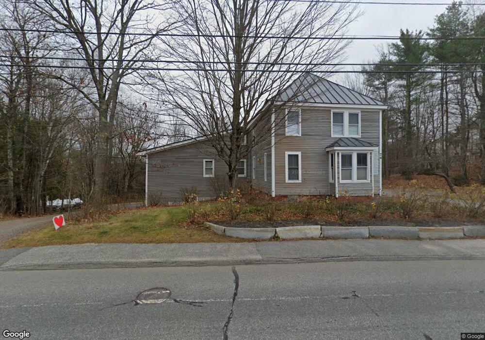
74 Bow St Freeport, ME 04032
Estimated Value: $585,000 - $943,593
5
Beds
3
Baths
2,933
Sq Ft
$271/Sq Ft
Est. Value
About This Home
This home is located at 74 Bow St, Freeport, ME 04032 and is currently estimated at $795,148, approximately $271 per square foot. 74 Bow St is a home located in Cumberland County with nearby schools including Morse Street School, Mast Landing School, and Freeport Middle School.
Ownership History
Date
Name
Owned For
Owner Type
Purchase Details
Closed on
Oct 20, 2020
Sold by
Maine State Hsng Auth
Bought by
Creighton William P
Current Estimated Value
Purchase Details
Closed on
Aug 30, 2018
Sold by
Creighton William P
Bought by
Quarry Ridge Housing
Purchase Details
Closed on
Jun 29, 2007
Sold by
Fortier Stephen P and Fortier Kristen L
Bought by
Creighton William P
Home Financials for this Owner
Home Financials are based on the most recent Mortgage that was taken out on this home.
Original Mortgage
$200,000
Interest Rate
6.38%
Mortgage Type
Unknown
Create a Home Valuation Report for This Property
The Home Valuation Report is an in-depth analysis detailing your home's value as well as a comparison with similar homes in the area
Home Values in the Area
Average Home Value in this Area
Purchase History
| Date | Buyer | Sale Price | Title Company |
|---|---|---|---|
| Creighton William P | -- | None Available | |
| Quarry Ridge Housing | -- | -- | |
| Creighton William P | -- | -- |
Source: Public Records
Mortgage History
| Date | Status | Borrower | Loan Amount |
|---|---|---|---|
| Previous Owner | Creighton William P | $200,000 |
Source: Public Records
Tax History
| Year | Tax Paid | Tax Assessment Tax Assessment Total Assessment is a certain percentage of the fair market value that is determined by local assessors to be the total taxable value of land and additions on the property. | Land | Improvement |
|---|---|---|---|---|
| 2024 | $9,209 | $689,800 | $141,900 | $547,900 |
| 2023 | $8,485 | $617,100 | $129,000 | $488,100 |
| 2022 | $8,234 | $603,200 | $115,100 | $488,100 |
| 2021 | $8,106 | $607,200 | $115,100 | $492,100 |
| 2020 | $7,664 | $547,400 | $106,600 | $440,800 |
| 2019 | $7,304 | $510,800 | $100,600 | $410,200 |
| 2018 | $7,149 | $475,000 | $94,000 | $381,000 |
| 2017 | $5,853 | $391,500 | $91,800 | $299,700 |
| 2016 | $5,735 | $363,000 | $85,000 | $278,000 |
| 2015 | $5,766 | $343,200 | $80,800 | $262,400 |
| 2014 | $5,423 | $343,200 | $80,800 | $262,400 |
| 2013 | $5,335 | $336,600 | $80,800 | $255,800 |
Source: Public Records
Map
Nearby Homes
- 11 Orchard Hill Rd
- 212 Main St
- 10 Durham Rd
- 67 Farmview Ln
- 42 Durham Rd
- 15 Linwood Rd Unit 15
- 26 Harvest Ridge Rd Unit 24
- 20 Harvest Ridge Rd Unit 23
- 15 Tinkers Way
- 1260 Us Route 1
- 1 Wardtown Rd
- 8 Statler Ln
- 45 Beech Hill Rd
- 304 Pownal Rd
- 18 Circle Dr
- 0 Prout Rd
- 5 Arrowhead Ridge Rd
- 143 Bragdon Rd
- 34 Newfield Rd
- 21 Renee Rd
Your Personal Tour Guide
Ask me questions while you tour the home.