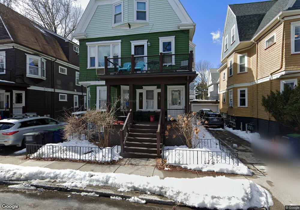
74 Bromfield Rd Somerville, MA 02144
Estimated Value: $1,371,000 - $1,690,564
6
Beds
2
Baths
9,999
Sq Ft
$149/Sq Ft
Est. Value
About This Home
***CALL TODAY FOR SHOWINGS, HIGHLY COMPETITIVE MARKET!
Pictures are of a similar unit in the building - currently under reno
Ownership History
Date
Name
Owned For
Owner Type
Purchase Details
Closed on
Oct 10, 2006
Sold by
Bettencourt Brian D and Jenkins Leland H
Bought by
74 Bromfield Street Rt and Bettencourt Brian D
Current Estimated Value
Home Financials for this Owner
Home Financials are based on the most recent Mortgage that was taken out on this home.
Original Mortgage
$400,000
Outstanding Balance
$239,742
Interest Rate
6.54%
Mortgage Type
Purchase Money Mortgage
Estimated Equity
$1,253,149
Create a Home Valuation Report for This Property
The Home Valuation Report is an in-depth analysis detailing your home's value as well as a comparison with similar homes in the area
Purchase History
| Date | Buyer | Sale Price | Title Company |
|---|---|---|---|
| 74 Bromfield Street Rt | -- | -- | |
| Bettencourt Brian D | $645,000 | -- |
Source: Public Records
Mortgage History
| Date | Status | Borrower | Loan Amount |
|---|---|---|---|
| Open | Bettencourt Brian D | $400,000 |
Source: Public Records
Property History
| Date | Event | Price | List to Sale | Price per Sq Ft |
|---|---|---|---|---|
| 06/01/2025 06/01/25 | For Rent | $7,800 | 0.0% | -- |
| 06/01/2025 06/01/25 | For Rent | $7,800 | 0.0% | -- |
| 10/08/2024 10/08/24 | Off Market | $7,800 | -- | -- |
Tax History
| Year | Tax Paid | Tax Assessment Tax Assessment Total Assessment is a certain percentage of the fair market value that is determined by local assessors to be the total taxable value of land and additions on the property. | Land | Improvement |
|---|---|---|---|---|
| 2025 | $14,396 | $1,319,500 | $702,700 | $616,800 |
| 2024 | $13,765 | $1,308,500 | $702,700 | $605,800 |
| 2023 | $13,101 | $1,267,000 | $702,700 | $564,300 |
| 2022 | $12,336 | $1,211,800 | $669,300 | $542,500 |
| 2021 | $11,992 | $1,176,800 | $664,400 | $512,400 |
| 2020 | $11,574 | $1,147,100 | $664,800 | $482,300 |
| 2019 | $11,057 | $1,027,600 | $605,200 | $422,400 |
| 2018 | $10,203 | $902,100 | $550,200 | $351,900 |
| 2017 | $10,005 | $857,300 | $519,000 | $338,300 |
| 2016 | $9,668 | $771,600 | $463,500 | $308,100 |
| 2015 | $9,249 | $733,500 | $428,100 | $305,400 |
Source: Public Records
Map
Nearby Homes
- 111 Pearson Rd
- 15 Colby St
- 228 Harvard St
- 55 Packard Ave Unit 1
- 1004 Broadway Unit 3
- 42 Packard Ave Unit 42
- 69 Electric Ave Unit 3
- 26 Chandler St Unit 26
- 297 Main St Unit 3
- 106 Electric Ave Unit 3
- 68 Winslow Ave
- 74 Pearson Ave
- 12 Upland Rd
- 43 Grove St
- 595 Broadway Unit 302
- 595 Broadway Unit 102
- 595 Broadway Unit 202
- 595 Broadway Unit 101
- 595 Broadway Unit 301
- 16 Rogers Ave
- 74 Bromfield Rd Unit 2
- 74 Bromfield Rd Unit 1
- 78 Bromfield Rd
- 78 Bromfield Rd Unit 2
- 70 Bromfield Rd
- 187 College Ave
- 82 Bromfield Rd
- 82 Bromfield Rd Unit 1
- 82 Bromfield Rd Unit 2
- 185 College Ave
- 66 Bromfield Rd
- 66 Bromfield Rd Unit 1
- 191 College Ave
- 183 College Ave Unit 2
- 183 College Ave Unit 1
- 183 College Ave
- 69 Bromfield Rd
- 69 Bromfield Rd Unit 6
- 69 Bromfield Rd Unit 69 Bromfield Rd.
- 69 Bromfield Rd Unit bromfield rd
Your Personal Tour Guide
Ask me questions while you tour the home.