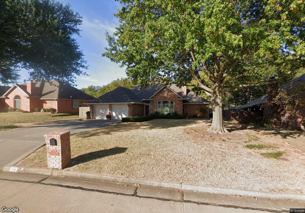
74 Crown Point Shawnee, OK 74804
Estimated Value: $232,000 - $266,000
3
Beds
2
Baths
1,901
Sq Ft
$128/Sq Ft
Est. Value
About This Home
This home is located at 74 Crown Point, Shawnee, OK 74804 and is currently estimated at $243,367, approximately $128 per square foot. 74 Crown Point is a home located in Pottawatomie County.
Ownership History
Date
Name
Owned For
Owner Type
Purchase Details
Closed on
Nov 29, 2018
Sold by
Hicks Steven L and Hicks Cynthia B
Bought by
Steven L and Steven Cynthia B Hicks 2018 Revoca
Current Estimated Value
Purchase Details
Closed on
Jul 24, 2003
Sold by
Middleton Ladonna
Bought by
Hicks Steven and Hicks Cynthia
Purchase Details
Closed on
Feb 5, 1993
Sold by
Middleton Gerald W
Bought by
Middleton Ladonna M
Purchase Details
Closed on
Sep 22, 1992
Sold by
Bryant Frank Duke
Bought by
Bryant Tamara
Purchase Details
Closed on
Jun 19, 1992
Sold by
Bryant Frankie and Bryant Tamara
Bought by
Bryant Frankie
Purchase Details
Closed on
Jun 17, 1992
Sold by
Landmark Land Co Oklahom
Bought by
Bryant Frank
Create a Home Valuation Report for This Property
The Home Valuation Report is an in-depth analysis detailing your home's value as well as a comparison with similar homes in the area
Purchase History
| Date | Buyer | Sale Price | Title Company |
|---|---|---|---|
| Steven L | -- | None Available | |
| Hicks Steven | $150,000 | -- | |
| Middleton Ladonna M | -- | -- | |
| Bryant Tamara | -- | -- | |
| Bryant Frankie | -- | -- | |
| Bryant Frank | -- | -- |
Source: Public Records
Tax History
| Year | Tax Paid | Tax Assessment Tax Assessment Total Assessment is a certain percentage of the fair market value that is determined by local assessors to be the total taxable value of land and additions on the property. | Land | Improvement |
|---|---|---|---|---|
| 2025 | $1,735 | $20,081 | $1,257 | $18,824 |
| 2024 | $1,704 | $19,496 | $1,221 | $18,275 |
| 2023 | $1,704 | $18,928 | $1,200 | $17,728 |
| 2022 | $1,672 | $18,928 | $1,200 | $17,728 |
| 2021 | $1,687 | $18,928 | $1,200 | $17,728 |
| 2020 | $1,706 | $19,160 | $1,200 | $17,960 |
| 2019 | $1,769 | $19,623 | $1,200 | $18,423 |
| 2018 | $1,783 | $19,668 | $1,200 | $18,468 |
| 2017 | $1,790 | $19,897 | $1,200 | $18,697 |
| 2016 | $1,788 | $19,669 | $1,159 | $18,510 |
| 2015 | $1,530 | $19,096 | $1,132 | $17,964 |
| 2014 | $1,483 | $18,540 | $1,089 | $17,451 |
Source: Public Records
Map
Nearby Homes
- 2 Lancet Cir
- 5 Norwich Ct
- 14 Janeway Place
- 2024 Lantana Cir
- 23 Crown Point
- 40 Northridge Rd
- 9 Castle Creek Place
- 1305 Castle Creek St
- 17 Beckley St
- 3904 Northridge Rd
- 3906 Northridge Rd
- 2 Turkey Knob St
- 2704 Woodlawn Ct
- 1301 Manchester
- 1204 Cambridge Dr
- 31 E Oak Hill
- 2205 Copper Creek Ln
- 1406 E Bradley St
- 5005 Chauncey Ln
- 1104 Adeline
Your Personal Tour Guide
Ask me questions while you tour the home.