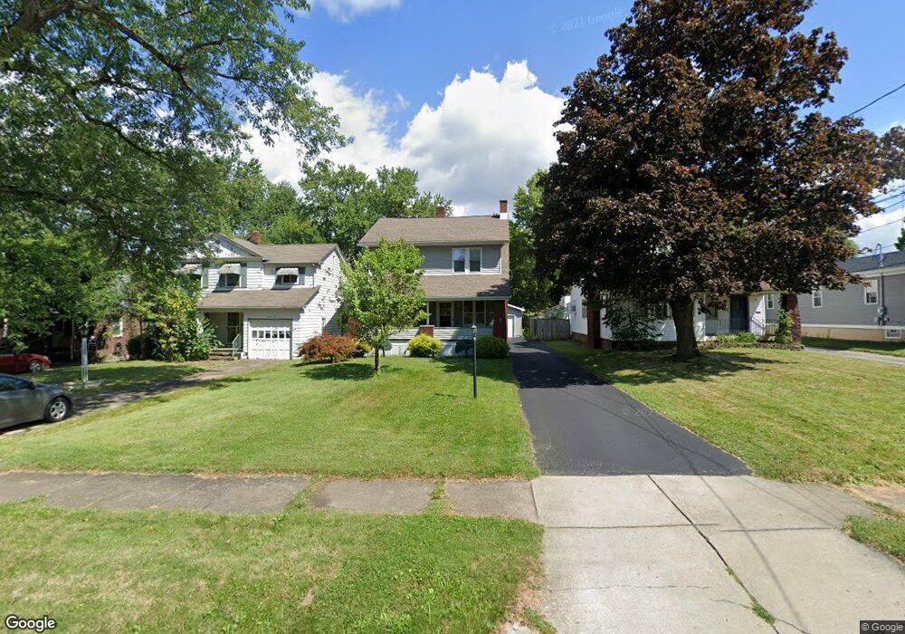
74 Erskine Ave Youngstown, OH 44512
Estimated Value: $133,000 - $152,000
3
Beds
1
Bath
1,255
Sq Ft
$113/Sq Ft
Est. Value
About This Home
This home is located at 74 Erskine Ave, Youngstown, OH 44512 and is currently estimated at $141,308, approximately $112 per square foot. 74 Erskine Ave is a home located in Mahoning County with nearby schools including Boardman Glenwood Junior High School, Boardman High School, and Horizon Science Academy - Youngstown.
Ownership History
Date
Name
Owned For
Owner Type
Purchase Details
Closed on
Feb 2, 2004
Sold by
Centofanti Anthony R and Centofanti Karen J
Bought by
Larsen Todd M
Current Estimated Value
Home Financials for this Owner
Home Financials are based on the most recent Mortgage that was taken out on this home.
Original Mortgage
$72,281
Outstanding Balance
$32,768
Interest Rate
5.91%
Mortgage Type
FHA
Estimated Equity
$108,540
Purchase Details
Closed on
Mar 1, 1990
Bought by
Centofanti Anthony R
Create a Home Valuation Report for This Property
The Home Valuation Report is an in-depth analysis detailing your home's value as well as a comparison with similar homes in the area
Home Values in the Area
Average Home Value in this Area
Purchase History
| Date | Buyer | Sale Price | Title Company |
|---|---|---|---|
| Larsen Todd M | $72,900 | -- | |
| Centofanti Anthony R | $38,500 | -- |
Source: Public Records
Mortgage History
| Date | Status | Borrower | Loan Amount |
|---|---|---|---|
| Open | Larsen Todd M | $72,281 |
Source: Public Records
Tax History
| Year | Tax Paid | Tax Assessment Tax Assessment Total Assessment is a certain percentage of the fair market value that is determined by local assessors to be the total taxable value of land and additions on the property. | Land | Improvement |
|---|---|---|---|---|
| 2025 | $1,781 | $34,860 | $3,110 | $31,750 |
| 2024 | $1,823 | $34,860 | $3,110 | $31,750 |
| 2023 | $1,799 | $34,860 | $3,110 | $31,750 |
| 2022 | $1,469 | $21,680 | $3,070 | $18,610 |
| 2021 | $1,470 | $21,680 | $3,070 | $18,610 |
| 2020 | $1,478 | $21,680 | $3,070 | $18,610 |
| 2019 | $1,483 | $19,190 | $2,720 | $16,470 |
| 2018 | $1,252 | $19,190 | $2,720 | $16,470 |
| 2017 | $1,324 | $19,190 | $2,720 | $16,470 |
| 2016 | $1,399 | $21,290 | $2,950 | $18,340 |
| 2015 | $1,335 | $21,290 | $2,950 | $18,340 |
| 2014 | $1,339 | $21,290 | $2,950 | $18,340 |
| 2013 | $1,322 | $21,290 | $2,950 | $18,340 |
Source: Public Records
Map
Nearby Homes
- 27 Erskine Ave
- 123 Melrose Ave
- 5503 Southern Blvd
- 162 Erskine Ave
- 190 Melrose Ave
- 86 Terrace Dr
- 4941 Market St
- 28 Terrace Dr
- 63 Clifton Dr
- 4833 Oak Knoll Dr
- 4717 Market St
- 165 Mathews Rd Unit A
- 191 Mathews Rd Unit A
- 189 Beechwood Dr
- 0 Indianola Rd
- 227 Shields Rd
- 0 Mathews Rd Unit 5038026
- 237 Shields Rd
- 321 Meadowbrook Ave Unit 323
- 244 Shields Rd
Your Personal Tour Guide
Ask me questions while you tour the home.