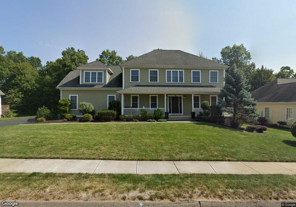
74 Knoll Ridge Ct Middletown, CT 06457
Westfield NeighborhoodEstimated Value: $631,000 - $641,499
4
Beds
4
Baths
2,739
Sq Ft
$232/Sq Ft
Est. Value
About This Home
This home is located at 74 Knoll Ridge Ct, Middletown, CT 06457 and is currently estimated at $636,375, approximately $232 per square foot. 74 Knoll Ridge Ct is a home located in Middlesex County with nearby schools including St John Paul II School.
Ownership History
Date
Name
Owned For
Owner Type
Purchase Details
Closed on
Jun 20, 2023
Sold by
Erazmus Donald T
Bought by
Erazmus Donald T and Napolitano Kayleigh R
Current Estimated Value
Purchase Details
Closed on
Jan 12, 2012
Sold by
Erazmus Jeanne
Bought by
Erazmus Donald T
Home Financials for this Owner
Home Financials are based on the most recent Mortgage that was taken out on this home.
Original Mortgage
$80,500
Interest Rate
4%
Mortgage Type
New Conventional
Purchase Details
Closed on
May 19, 2006
Sold by
F & O Realty Dev Llc
Bought by
Erazmus Donald T and Erazmus Jeanne
Create a Home Valuation Report for This Property
The Home Valuation Report is an in-depth analysis detailing your home's value as well as a comparison with similar homes in the area
Home Values in the Area
Average Home Value in this Area
Purchase History
| Date | Buyer | Sale Price | Title Company |
|---|---|---|---|
| Erazmus Donald T | -- | None Available | |
| Erazmus Donald T | -- | -- | |
| Erazmus Donald T | $524,616 | -- |
Source: Public Records
Mortgage History
| Date | Status | Borrower | Loan Amount |
|---|---|---|---|
| Previous Owner | Erazmus Donald T | $80,500 | |
| Previous Owner | Erazmus Donald T | $277,200 | |
| Previous Owner | Erazmus Donald T | $308,000 | |
| Previous Owner | Erazmus Donald T | $351,000 | |
| Previous Owner | Erazmus Donald T | $358,000 |
Source: Public Records
Tax History Compared to Growth
Tax History
| Year | Tax Paid | Tax Assessment Tax Assessment Total Assessment is a certain percentage of the fair market value that is determined by local assessors to be the total taxable value of land and additions on the property. | Land | Improvement |
|---|---|---|---|---|
| 2025 | $13,574 | $348,950 | $84,060 | $264,890 |
| 2024 | $12,841 | $348,950 | $84,060 | $264,890 |
| 2023 | $12,248 | $348,950 | $84,060 | $264,890 |
| 2022 | $11,888 | $270,180 | $56,040 | $214,140 |
| 2021 | $11,888 | $270,180 | $56,040 | $214,140 |
| 2020 | $11,942 | $270,180 | $56,040 | $214,140 |
| 2019 | $11,996 | $270,180 | $56,040 | $214,140 |
| 2018 | $11,807 | $270,180 | $56,040 | $214,140 |
| 2017 | $11,186 | $263,820 | $65,160 | $198,660 |
| 2016 | $10,869 | $263,820 | $65,160 | $198,660 |
| 2015 | $10,447 | $263,820 | $65,160 | $198,660 |
| 2014 | $10,553 | $263,820 | $65,160 | $198,660 |
Source: Public Records
Map
Nearby Homes
- 36 Brookview Ln
- 27 Valley Dr
- 180 Bailey Rd
- 94 Cynthia Ln Unit D-5
- 122 Nejako Dr
- 85 Aspen Dr
- 404 Newfield St
- 136 Westfield St
- 59 Willow Bee Ln
- 59 Westfield Terrace
- 82 Westfield Terrace
- 3 Nathan Hale Rd
- 4 Nathan Hale Rd
- 1 Nathan Hale Rd
- 2 Nathan Hale Rd
- 18 Phedon Pkwy
- 31 Broadview Pkwy
- 30 Hemlock Place
- 137 Webster Ln Unit 2-42
- 145 Webster Ln Unit 2-41
- 86 Knoll Ridge Ct
- 66 Knoll Ridge Ct
- 54 Knoll Ridge Ct
- 94 Knoll Ridge Ct
- 69 Ledgebrook Ln
- 73 Knoll Ridge Ct
- 74 Ledgebrook Ln
- 59 Knoll Ridge Ct
- 87 Knoll Ridge Ct
- 35 Spring Brook Dr
- 46 Knoll Ridge Ct
- 63 Ledgebrook Ln
- Lot B Knoll Ridge Ct
- Lot A Knoll Ridge Ct
- 27 Spring Brook Dr
- 30 Knoll Ridge Ct
- 45 Knoll Ridge Ct
- 70 Ledgebrook Ln
- 198 Mccormick Ln
- 208 Mccormick Ln