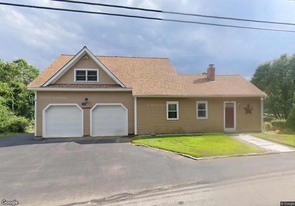
74 Lyndeborough Rd Amherst, NH 03031
Estimated Value: $603,627 - $735,000
2
Beds
1
Bath
1,158
Sq Ft
$556/Sq Ft
Est. Value
About This Home
This home is located at 74 Lyndeborough Rd, Amherst, NH 03031 and is currently estimated at $643,657, approximately $555 per square foot. 74 Lyndeborough Rd is a home with nearby schools including Wilkins Elementary School, Amherst Middle School, and Souhegan Cooperative High School.
Ownership History
Date
Name
Owned For
Owner Type
Purchase Details
Closed on
Sep 1, 2016
Sold by
Thomas Cameron D and Thomas Loni R
Bought by
Thomas Ft
Current Estimated Value
Purchase Details
Closed on
May 28, 2004
Sold by
Mulholland Shaun P
Bought by
Thomas Cameron D and Thomas Loni P
Home Financials for this Owner
Home Financials are based on the most recent Mortgage that was taken out on this home.
Original Mortgage
$178,800
Interest Rate
5.88%
Mortgage Type
Purchase Money Mortgage
Purchase Details
Closed on
May 17, 2002
Sold by
Paul Kelly M
Bought by
Mulholland Shaun P
Home Financials for this Owner
Home Financials are based on the most recent Mortgage that was taken out on this home.
Original Mortgage
$135,920
Interest Rate
7.15%
Purchase Details
Closed on
Dec 21, 1998
Sold by
Gaspar Stephen and Gaspar Lisa M
Bought by
Paul Kelley M
Create a Home Valuation Report for This Property
The Home Valuation Report is an in-depth analysis detailing your home's value as well as a comparison with similar homes in the area
Home Values in the Area
Average Home Value in this Area
Purchase History
| Date | Buyer | Sale Price | Title Company |
|---|---|---|---|
| Thomas Ft | -- | -- | |
| Thomas Cameron D | $223,500 | -- | |
| Mulholland Shaun P | $169,900 | -- | |
| Paul Kelley M | $98,000 | -- |
Source: Public Records
Mortgage History
| Date | Status | Borrower | Loan Amount |
|---|---|---|---|
| Previous Owner | Paul Kelley M | $173,700 | |
| Previous Owner | Paul Kelley M | $188,616 | |
| Previous Owner | Paul Kelley M | $178,800 | |
| Previous Owner | Paul Kelley M | $135,920 |
Source: Public Records
Tax History Compared to Growth
Tax History
| Year | Tax Paid | Tax Assessment Tax Assessment Total Assessment is a certain percentage of the fair market value that is determined by local assessors to be the total taxable value of land and additions on the property. | Land | Improvement |
|---|---|---|---|---|
| 2024 | $9,697 | $422,900 | $158,100 | $264,800 |
| 2023 | $9,253 | $422,900 | $158,100 | $264,800 |
| 2022 | $8,936 | $422,900 | $158,100 | $264,800 |
| 2021 | $9,012 | $422,900 | $158,100 | $264,800 |
| 2020 | $8,866 | $311,300 | $126,500 | $184,800 |
| 2019 | $8,393 | $311,300 | $126,500 | $184,800 |
| 2018 | $8,477 | $311,300 | $126,500 | $184,800 |
| 2017 | $8,097 | $311,300 | $126,500 | $184,800 |
| 2016 | $7,814 | $311,300 | $126,500 | $184,800 |
| 2015 | $7,203 | $272,000 | $143,300 | $128,700 |
| 2014 | $7,252 | $272,000 | $143,300 | $128,700 |
| 2013 | $5,771 | $218,200 | $143,300 | $74,900 |
Source: Public Records
Map
Nearby Homes
- 64 Lyndeborough Rd
- 80 Christian Hill Rd
- 229 Mont Vernon Rd
- 57 Patch Hill Ln
- 51 Singer Brook Rd
- 67 Christian Hill Rd
- 131 Homestead Cir
- 3 Abby Ln Unit 2
- 18 Adams St
- 30 Perkins St Unit 1
- 4 Bloody Brook Rd
- 344 Elm St Unit 16
- 23 Bloody Brook Rd
- 40 North St
- 0 Briar Cliff Dr
- 7 Miles Rd
- 32 Larch Rd
- 135 Amherst St Unit 28
- 24 Spaulding St
- 145 Westchester Dr
- 75 Lyndeborough Rd
- 72 Lyndeborough Rd
- 73 Lyndeborough Rd
- 2 Joslin Rd
- 8 State Route 13
- 8 Hartshorn Mill Rd
- 70 Lyndeborough Rd
- 11 Route 13
- 11 Route 13
- 105 Christian Hill Rd
- 112 Christian Hill Rd
- 114 Christian Hill Rd
- 108 Christian Hill Rd
- 16 Hartshorn Mill Rd
- 12 Joslin Rd
- 16 Joslin Rd
- 68 Lyndeborough Rd
- 106 Christian Hill Rd
- 103 Christian Hill Rd
- 2 Route 13