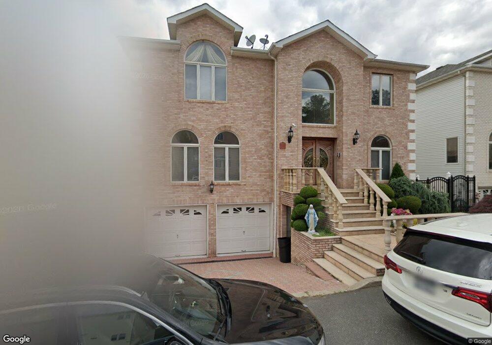
74 Michael Loop Staten Island, NY 10301
Emerson Hill NeighborhoodEstimated Value: $1,138,756 - $1,498,000
About This Home
This home is located at 74 Michael Loop, Staten Island, NY 10301 and is currently estimated at $1,315,939, approximately $541 per square foot. 74 Michael Loop is a home located in Richmond County with nearby schools including P.S. 48 - William C. Wilcox, I.S. 49 Berta A Dreyfus, and New Dorp High School.
Ownership History
We collect this data history from publicly available records. To have your information removed, we recommend requesting removal directly through your county’s website.
Purchase Details
Purchase Details
Home Financials for this Owner
Home Financials are based on the most recent Mortgage that was taken out on this home.Home Values in the Area
Average Home Value in this Area
Purchase History
We collect this data history from publicly available records. To have your information removed, we recommend requesting removal directly through your county’s website.
| Date | Buyer | Sale Price | Title Company |
|---|---|---|---|
| -- | First American Title Insurance | ||
| $591,000 | -- |
Mortgage History
We collect this data history from publicly available records. To have your information removed, we recommend requesting removal directly through your county’s website.
| Date | Status | Borrower | Loan Amount |
|---|---|---|---|
| Previous Owner | $435,000 |
Tax History
We collect this data history from publicly available records. To have your information removed, we recommend requesting removal directly through your county’s website.
| Year | Tax Paid | Tax Assessment Tax Assessment Total Assessment is a certain percentage of the fair market value that is determined by local assessors to be the total taxable value of land and additions on the property. | Land | Improvement |
|---|---|---|---|---|
| 2026 | $13,437 | $79,200 | $12,761 | $66,439 |
| 2025 | $13,160 | $66,900 | $14,825 | $52,075 |
| 2024 | $13,160 | $65,520 | $14,443 | $51,077 |
| 2023 | $12,697 | $62,519 | $13,262 | $49,257 |
| 2022 | $11,774 | $58,980 | $14,280 | $44,700 |
| 2021 | $12,692 | $62,160 | $14,280 | $47,880 |
| 2020 | $12,649 | $59,760 | $14,280 | $45,480 |
| 2019 | $12,466 | $64,860 | $14,280 | $50,580 |
| 2018 | $11,460 | $56,220 | $14,280 | $41,940 |
| 2017 | $10,859 | $53,270 | $12,393 | $40,877 |
| 2016 | $10,047 | $50,256 | $12,459 | $37,797 |
| 2015 | $9,572 | $50,256 | $10,552 | $39,704 |
| 2014 | $9,572 | $49,878 | $10,473 | $39,405 |
Map
- 58 Michael Loop
- 16 Diana Trail
- 79 Endor Ave
- 8 Diana Trail
- 239 Douglas Rd
- 35 Milden Ave
- 27 Witteman Place
- 260 Douglas Rd
- 231 Douglas Rd
- 74 Longfellow Ave
- 149 Douglas Rd
- 174 Douglas Rd
- 1430 Clove Rd
- 25 Beebe St
- 159 Seneca Ave
- 830 Howard Ave Unit 4H
- 755 Narrows Rd N Unit 1001
- 755 Narrows Rd N Unit 602
- 755 Narrows Rd N Unit 513A
- 755 Narrows Rd N Unit 1014
Ask me questions while you tour the home.