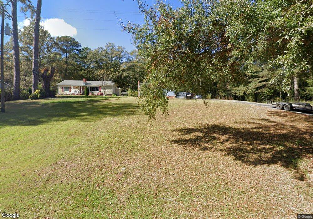
74 New Airport Rd Lagrange, GA 30240
Estimated Value: $112,000 - $152,000
2
Beds
1
Bath
936
Sq Ft
$137/Sq Ft
Est. Value
About This Home
This home is located at 74 New Airport Rd, Lagrange, GA 30240 and is currently estimated at $128,405, approximately $137 per square foot. 74 New Airport Rd is a home located in Troup County with nearby schools including Ethel W. Kight Elementary School, Hollis Hand Elementary School, and Franklin Forest Elementary School.
Ownership History
Date
Name
Owned For
Owner Type
Purchase Details
Closed on
Sep 20, 2019
Sold by
Stelzer Dustin C
Bought by
Shelnutt Roger Bruce and Shelnutt Connie Lee
Current Estimated Value
Purchase Details
Closed on
Jun 7, 2001
Sold by
Charles Gamble
Bought by
Breland David and Breland Meredith J
Purchase Details
Closed on
May 22, 2000
Sold by
Jim L Moore
Bought by
Charles Gamble
Purchase Details
Closed on
Mar 29, 2000
Sold by
Sec Of Housing & Urban Dev
Bought by
Jim L Moore
Purchase Details
Closed on
Aug 24, 1999
Sold by
Regions Mort
Bought by
Sec Of Housing & Urban Dev
Purchase Details
Closed on
Jun 15, 1999
Sold by
Anthony C Ivey
Bought by
Regions Mort
Purchase Details
Closed on
Dec 5, 1996
Sold by
Assoc Fin Ser Of America
Bought by
Anthony C Ivey
Purchase Details
Closed on
Dec 4, 1996
Sold by
Emmett Thompson
Bought by
Assoc Fin Ser Of America
Purchase Details
Closed on
Nov 15, 1990
Bought by
Emmett Thompson
Purchase Details
Closed on
Oct 28, 1978
Purchase Details
Closed on
Aug 16, 1975
Purchase Details
Closed on
Jan 1, 1974
Purchase Details
Closed on
Jan 1, 1971
Purchase Details
Closed on
Jan 1, 1970
Create a Home Valuation Report for This Property
The Home Valuation Report is an in-depth analysis detailing your home's value as well as a comparison with similar homes in the area
Home Values in the Area
Average Home Value in this Area
Purchase History
| Date | Buyer | Sale Price | Title Company |
|---|---|---|---|
| Shelnutt Roger Bruce | $72,500 | -- | |
| Breland David | $68,000 | -- | |
| Charles Gamble | $36,000 | -- | |
| Jim L Moore | -- | -- | |
| Sec Of Housing & Urban Dev | $52,000 | -- | |
| Regions Mort | $52,000 | -- | |
| Anthony C Ivey | $49,900 | -- | |
| Assoc Fin Ser Of America | -- | -- | |
| Emmett Thompson | $48,300 | -- | |
| -- | -- | -- | |
| -- | -- | -- | |
| -- | -- | -- | |
| -- | -- | -- | |
| -- | -- | -- |
Source: Public Records
Tax History Compared to Growth
Tax History
| Year | Tax Paid | Tax Assessment Tax Assessment Total Assessment is a certain percentage of the fair market value that is determined by local assessors to be the total taxable value of land and additions on the property. | Land | Improvement |
|---|---|---|---|---|
| 2024 | $909 | $35,320 | $9,360 | $25,960 |
| 2023 | $853 | $33,280 | $9,360 | $23,920 |
| 2022 | $842 | $32,160 | $9,360 | $22,800 |
| 2021 | $800 | $28,520 | $9,360 | $19,160 |
| 2020 | $800 | $28,520 | $9,360 | $19,160 |
| 2019 | $630 | $20,880 | $9,360 | $11,520 |
| 2018 | $600 | $19,892 | $9,452 | $10,440 |
| 2017 | $600 | $19,892 | $9,452 | $10,440 |
| 2016 | $602 | $19,945 | $9,452 | $10,493 |
| 2015 | $603 | $19,945 | $9,452 | $10,493 |
| 2014 | $551 | $18,216 | $9,452 | $8,764 |
| 2013 | -- | $18,800 | $9,452 | $9,348 |
Source: Public Records
Map
Nearby Homes
- 141 Avery Dr
- 0 Unit 10514554
- 167 S Kight Dr
- 101 Crown St Unit LOT 5
- 102 Crown St Unit LOT 1
- The Rhodes Plan at Crown Street Cottages
- The Truitt Plan at Crown Street Cottages
- The Callaway Plan at Crown Street Cottages
- 802 Monroe St
- 212 Aster Way
- 205 Grady St
- 608 Wilburn Ave
- 610 Wilburn Ave
- 119 Jones St
- 107 Clark St
- 211 Moores Hill
- 0 Moores Hill
- 202 Parker Ln
- 0 Bradfield Dr Unit 10568803
- 102 Parker St
- 84 New Airport Rd
- 92 New Airport Rd
- 52 New Airport Rd
- 106 New Airport Rd
- 46 New Airport Rd
- 53 New Airport Rd
- 65 New Airport Rd
- 118 New Airport Rd
- 41 New Airport Rd
- 128 New Airport Rd
- 18 New Airport Rd
- 2005 West Point Rd
- 2053 West Point Rd
- 27 New Airport Rd
- 142 New Airport Rd
- 106 Old Airport Rd
- 104 Old Airport Rd
- 2063 W Point Rd
- 102 Old Airport Rd
- 9 Terrace Dr