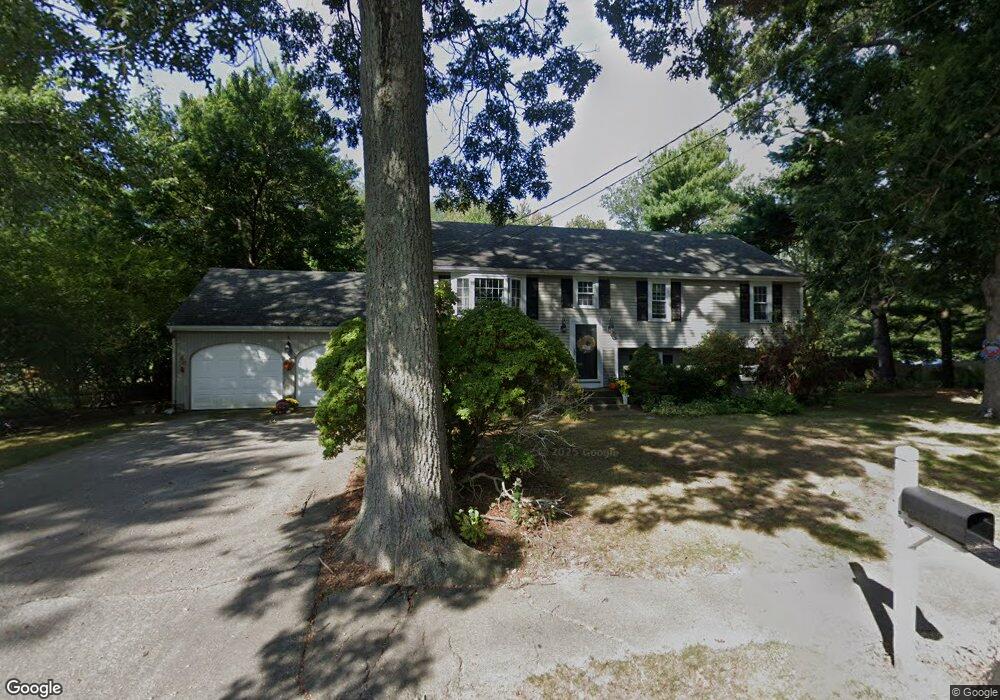
74 Pratt Rd Scituate, MA 02066
Estimated Value: $832,497 - $909,000
3
Beds
2
Baths
1,196
Sq Ft
$742/Sq Ft
Est. Value
About This Home
This home is located at 74 Pratt Rd, Scituate, MA 02066 and is currently estimated at $887,624, approximately $742 per square foot. 74 Pratt Rd is a home located in Plymouth County with nearby schools including Cushing Elementary School, Lester J. Gates Middle School, and Scituate High School.
Ownership History
Date
Name
Owned For
Owner Type
Purchase Details
Closed on
Jun 29, 2007
Sold by
Anacleto John R and Anacleto Jeniffer L M
Bought by
Purcell Terry Bridget
Current Estimated Value
Purchase Details
Closed on
Aug 31, 2001
Sold by
Marshalka Andrew S and Marshalka Elise
Bought by
Anacletoa Jeniffer Lm and Anacleto John R
Purchase Details
Closed on
Aug 11, 1993
Sold by
Field Charles F and Field Judith B
Bought by
Marshalka Andrew S and Marshalka Elise
Create a Home Valuation Report for This Property
The Home Valuation Report is an in-depth analysis detailing your home's value as well as a comparison with similar homes in the area
Home Values in the Area
Average Home Value in this Area
Purchase History
We collect this data history from publicly available records. To have your information removed, we recommend requesting removal directly through your county’s website.
| Date | Buyer | Sale Price | Title Company |
|---|---|---|---|
| Purcell Terry Bridget | $500,000 | -- | |
| Anacletoa Jeniffer Lm | $353,500 | -- | |
| Marshalka Andrew S | $197,000 | -- |
Source: Public Records
Mortgage History
We collect this data history from publicly available records. To have your information removed, we recommend requesting removal directly through your county’s website.
| Date | Status | Borrower | Loan Amount |
|---|---|---|---|
| Open | Marshalka Andrew S | $100,000 | |
| Closed | Marshalka Andrew S | $25,000 |
Source: Public Records
Tax History
| Year | Tax Paid | Tax Assessment Tax Assessment Total Assessment is a certain percentage of the fair market value that is determined by local assessors to be the total taxable value of land and additions on the property. | Land | Improvement |
|---|---|---|---|---|
| 2025 | $7,208 | $721,500 | $415,500 | $306,000 |
| 2024 | $7,022 | $677,800 | $377,700 | $300,100 |
| 2023 | $6,774 | $614,100 | $343,400 | $270,700 |
| 2022 | $6,774 | $536,800 | $309,600 | $227,200 |
| 2021 | $6,690 | $501,900 | $308,900 | $193,000 |
| 2020 | $6,527 | $483,500 | $297,000 | $186,500 |
| 2019 | $6,419 | $467,200 | $291,200 | $176,000 |
| 2018 | $6,212 | $445,300 | $287,000 | $158,300 |
| 2017 | $6,119 | $434,300 | $276,000 | $158,300 |
| 2016 | $5,829 | $412,200 | $253,900 | $158,300 |
| 2015 | $5,254 | $401,100 | $242,800 | $158,300 |
Source: Public Records
Map
Nearby Homes
- 23 Acorn St
- 485 Country Way
- 684 Country Way
- 701 Country Way
- 105 Ann Vinal Rd
- 47 Tanglewood Dr
- 41 Utility Rd
- 38 Booth Hill Rd
- 26 Mordecai Lincoln Rd
- 14 Christopher Ln
- 74 Branch St Unit 15
- 74 Branch St Unit 5
- 799 Country Way
- 817 Country Way
- 67 Border St
- 430 Hatherly Rd Unit Exhibit “A”
- 430 Hatherly Rd Unit Exhibit “B”
- 392 S Main St
- 49 Jackson Rd
- 23 Grace Way
- 68 Pratt Rd
- 23 Puritan Dr
- 79 Pratt Rd
- 13 Puritan Dr
- 73 Pratt Rd
- 5 Puritan Dr
- 85 Pratt Rd
- Lot 4B & 6 Hood Rd
- 000 Great Rock & Little Rock Isle
- 12&14 Stanton Ln
- Lot 2 Ingrid Ln
- 7 Silver Road- Humarock
- Lot 13 Tilden Farm
- 62 Pratt Rd
- 24 Puritan Dr
- 29 Creelman Dr
- 20 Puritan Dr
- 89 Pratt Rd
- 204 Captain Peirce Rd
- 14 Puritan Dr
Your Personal Tour Guide
Ask me questions while you tour the home.