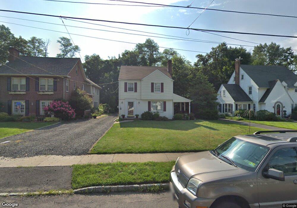
740 Hawthorne Ave Bound Brook, NJ 08805
Estimated Value: $466,808 - $601,000
3
Beds
1
Bath
1,358
Sq Ft
$390/Sq Ft
Est. Value
About This Home
This home is located at 740 Hawthorne Ave, Bound Brook, NJ 08805 and is currently estimated at $528,952, approximately $389 per square foot. 740 Hawthorne Ave is a home located in Somerset County with nearby schools including Adamsville Primary School, Bridgewater-Raritan Middle School, and Hillside Intermediate School.
Ownership History
Date
Name
Owned For
Owner Type
Purchase Details
Closed on
Jul 26, 2010
Sold by
Stryker Robert H
Bought by
Rosener Jennifer
Current Estimated Value
Home Financials for this Owner
Home Financials are based on the most recent Mortgage that was taken out on this home.
Original Mortgage
$252,000
Outstanding Balance
$168,606
Interest Rate
4.78%
Mortgage Type
New Conventional
Estimated Equity
$360,346
Create a Home Valuation Report for This Property
The Home Valuation Report is an in-depth analysis detailing your home's value as well as a comparison with similar homes in the area
Home Values in the Area
Average Home Value in this Area
Purchase History
| Date | Buyer | Sale Price | Title Company |
|---|---|---|---|
| Rosener Jennifer | $315,000 | Nrt Title Agency Llc |
Source: Public Records
Mortgage History
| Date | Status | Borrower | Loan Amount |
|---|---|---|---|
| Open | Rosener Jennifer | $252,000 |
Source: Public Records
Tax History
| Year | Tax Paid | Tax Assessment Tax Assessment Total Assessment is a certain percentage of the fair market value that is determined by local assessors to be the total taxable value of land and additions on the property. | Land | Improvement |
|---|---|---|---|---|
| 2025 | $7,259 | $372,100 | $208,600 | $163,500 |
| 2024 | $7,259 | $368,300 | $208,600 | $159,700 |
| 2023 | $6,950 | $346,300 | $208,600 | $137,700 |
| 2022 | $6,725 | $322,400 | $203,600 | $118,800 |
| 2021 | $6,701 | $315,600 | $203,600 | $112,000 |
| 2020 | $6,684 | $314,100 | $203,600 | $110,500 |
| 2019 | $6,701 | $311,800 | $203,600 | $108,200 |
| 2018 | $6,638 | $309,600 | $203,600 | $106,000 |
| 2017 | $6,610 | $308,000 | $203,600 | $104,400 |
| 2016 | $6,191 | $292,700 | $188,600 | $104,100 |
| 2015 | $6,145 | $290,800 | $188,600 | $102,200 |
| 2014 | $5,993 | $279,400 | $188,600 | $90,800 |
Source: Public Records
Map
Nearby Homes
- 744 Hawthorne Ave
- 736 Hawthorne Ave
- 750 Hawthorne Ave
- 734 Hawthorne Ave
- 730 Hawthorne Ave
- 756 Hawthorne Ave
- 737 Hawthorne Ave
- 733 Hawthorne Ave
- 731 Hawthorne Ave
- 724 Hawthorne Ave
- 747 Hawthorne Ave
- 762 Hawthorne Ave
- 729 Hawthorne Ave
- 759 Hawthorne Ave
- 727 Hawthorne Ave
- 768 Hawthorne Ave
- 720 Hawthorne Ave
- 734 Park Ave
- 736 Park Ave
- 732 Park Ave
Your Personal Tour Guide
Ask me questions while you tour the home.