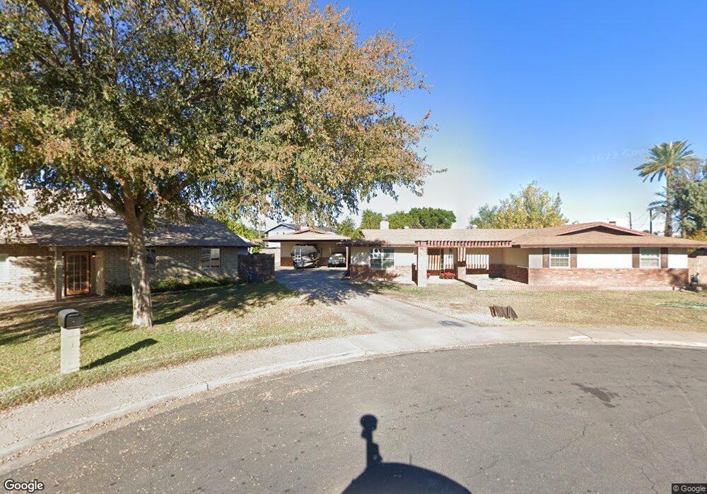
740 N Orange Cir Mesa, AZ 85201
Riverview NeighborhoodEstimated Value: $528,897 - $660,000
--
Bed
3
Baths
2,682
Sq Ft
$221/Sq Ft
Est. Value
About This Home
This home is located at 740 N Orange Cir, Mesa, AZ 85201 and is currently estimated at $592,474, approximately $220 per square foot. 740 N Orange Cir is a home located in Maricopa County with nearby schools including Franklin at Brimhall Elementary School, Emerson Elementary School, and Franklin West Elementary School.
Ownership History
Date
Name
Owned For
Owner Type
Purchase Details
Closed on
Dec 11, 2013
Sold by
Willis Lance T and Willis Margie A
Bought by
Willis Scott M and Willis Kellie L
Current Estimated Value
Purchase Details
Closed on
Jun 8, 1999
Sold by
Willis Lance T and Willis Margie
Bought by
Willis Lance T and Willis Margie A
Create a Home Valuation Report for This Property
The Home Valuation Report is an in-depth analysis detailing your home's value as well as a comparison with similar homes in the area
Home Values in the Area
Average Home Value in this Area
Purchase History
| Date | Buyer | Sale Price | Title Company |
|---|---|---|---|
| Willis Scott M | -- | None Available | |
| Willis Lance T | -- | -- |
Source: Public Records
Tax History Compared to Growth
Tax History
| Year | Tax Paid | Tax Assessment Tax Assessment Total Assessment is a certain percentage of the fair market value that is determined by local assessors to be the total taxable value of land and additions on the property. | Land | Improvement |
|---|---|---|---|---|
| 2025 | $1,768 | $21,653 | -- | -- |
| 2024 | $1,818 | $20,622 | -- | -- |
| 2023 | $1,818 | $43,080 | $8,610 | $34,470 |
| 2022 | $1,778 | $25,960 | $5,190 | $20,770 |
| 2021 | $1,827 | $25,460 | $5,090 | $20,370 |
| 2020 | $1,890 | $25,060 | $5,010 | $20,050 |
| 2019 | $1,670 | $20,170 | $4,030 | $16,140 |
| 2018 | $1,594 | $21,510 | $4,300 | $17,210 |
| 2017 | $1,544 | $20,600 | $4,120 | $16,480 |
| 2016 | $1,516 | $19,150 | $3,830 | $15,320 |
| 2015 | $1,431 | $16,720 | $3,340 | $13,380 |
Source: Public Records
Map
Nearby Homes
- 719 N Cherry
- 619 N Date
- 345 W 9th St
- 923 N Country Club Dr
- 948 N Cherry
- 949 N Revere
- 455 W 5th Place
- 453 W University Dr
- 340 W University Dr Unit 1
- 437 N Robson
- 222 W Brown Rd Unit 66
- 222 W Brown Rd Unit 57
- 222 W Brown Rd Unit 36
- 222 W Brown Rd Unit 117
- 929 W 10th Place
- 749 N Beverly
- 315 N Cherry
- 140 W University Dr
- 1042 W 9th Place
- 745 W 3rd St
- 736 N Orange Cir
- 545 W 8th St
- 519 W Rio Salado Pkwy
- 519 W 8th St
- 730 N Orange Cir
- 730 N Orange Cir
- 735 N Date
- 737 N Orange Cir
- 731 N Orange Cir
- 729 N Date
- 555 W Rio Salado Pkwy Unit C
- 722 N Orange Cir
- 723 N Orange Cir
- 744 N Vineyard
- 740 N Date
- 752 N Vineyard
- 721 N Date
- 738 N Vineyard
- 760 N Vineyard
- 546 W 8th St